File:070727 New Washington ADIZ-FRZ.jpg
ナビゲーションに移動
検索に移動
このプレビューのサイズ: 780 × 600 ピクセル。 その他の解像度: 312 × 240 ピクセル | 624 × 480 ピクセル | 900 × 692 ピクセル。
元のファイル (900 × 692 ピクセル、ファイルサイズ: 220キロバイト、MIME タイプ: image/jpeg)
キャプション
キャプション
このファイルの内容を1行で記述してください
概要
[編集]
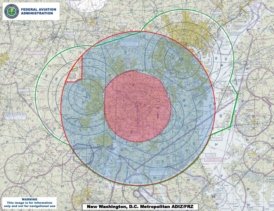
| 解説 | This map compares the new Air Defense Identification Zone (ADIZ) surrounding Washington, D.C. (red line) with the old ADIZ (green line). The new zone is effective as of 0500 UTC, 30 Aug 2007. The shaded red circle in the middle is the restricted airspace surrounding the capital. |
| 日付 | |
| 原典 | U.S. Federal Aviation Administration (http://www.faa.gov) - http://www.faa.gov/news/updates/adiz_frz/media/070727_New_ADIZ-FRZ.jpg |
| 作者 | U.S. Federal Aviation Administration |
ライセンス
[編集]
This image or file is a work of a Federal Aviation Administration employee, taken or made as part of that person's official duties. As a work of the U.S. federal government, the image is in the public domain in the United States.
|
 |
ファイルの履歴
過去の版のファイルを表示するには、その版の日時をクリックしてください。
| 日付と時刻 | サムネイル | 寸法 | 利用者 | コメント | |
|---|---|---|---|---|---|
| 現在の版 | 2007年7月31日 (火) 00:09 | | 900 × 692 (220キロバイト) | Sarfa~commonswiki (トーク | 投稿記録) | This map compares the new Air Defense Identification Zone (ADIZ) surrounding Washington, D.C. (red line) with the old ADIZ (green line). The new zone is effective as of 0500 UTC, 30 Aug 2007. |
このファイルは上書きできません。
ファイルの使用状況
このファイルを使用しているページはありません。
グローバルなファイル使用状況
以下に挙げる他のウィキがこの画像を使っています:
- de.wikipedia.org での使用状況
- en.wikipedia.org での使用状況
- fi.wikipedia.org での使用状況
- it.wikipedia.org での使用状況
- ja.wikipedia.org での使用状況
- ko.wikipedia.org での使用状況
- www.wikidata.org での使用状況
- zh.wikipedia.org での使用状況