File:070727 New Washington ADIZ-FRZ.jpg
跳转到导航
跳转到搜索
本预览的尺寸:780 × 600像素。 其他分辨率:312 × 240像素 | 624 × 480像素 | 900 × 692像素。
原始文件 (900 × 692像素,文件大小:220 KB,MIME类型:image/jpeg)
说明
说明
添加一行文字以描述该文件所表现的内容
摘要
[编辑]
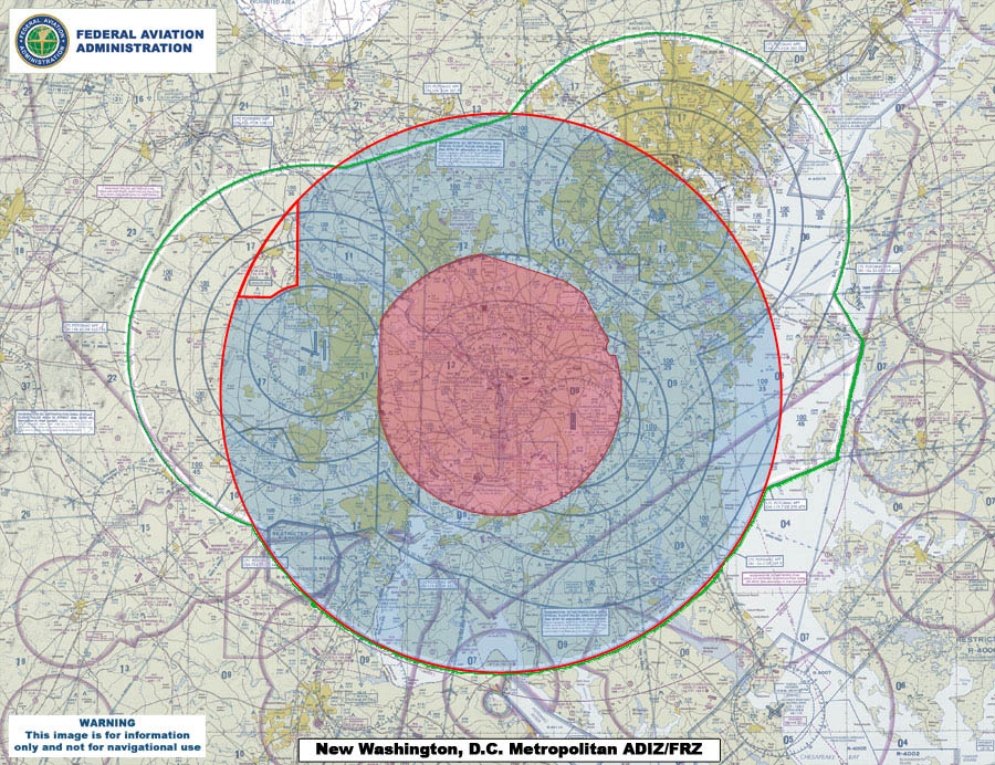
| 描述 | This map compares the new Air Defense Identification Zone (ADIZ) surrounding Washington, D.C. (red line) with the old ADIZ (green line). The new zone is effective as of 0500 UTC, 30 Aug 2007. The shaded red circle in the middle is the restricted airspace surrounding the capital. |
| 日期 | |
| 来源 | U.S. Federal Aviation Administration (http://www.faa.gov) - http://www.faa.gov/news/updates/adiz_frz/media/070727_New_ADIZ-FRZ.jpg |
| 作者 | U.S. Federal Aviation Administration |
许可协议
[编辑]
|
|
 |
文件历史
点击某个日期/时间查看对应时刻的文件。
| 日期/时间 | 缩略图 | 大小 | 用户 | 备注 | |
|---|---|---|---|---|---|
| 当前 | 2007年7月31日 (二) 00:09 | | 900 × 692(220 KB) | Sarfa~commonswiki(留言 | 贡献) | This map compares the new Air Defense Identification Zone (ADIZ) surrounding Washington, D.C. (red line) with the old ADIZ (green line). The new zone is effective as of 0500 UTC, 30 Aug 2007. |
您不可以覆盖此文件。
文件用途
没有页面使用本文件。
全域文件用途
以下其他wiki使用此文件:
- de.wikipedia.org上的用途
- en.wikipedia.org上的用途
- fi.wikipedia.org上的用途
- it.wikipedia.org上的用途
- ja.wikipedia.org上的用途
- ko.wikipedia.org上的用途
- www.wikidata.org上的用途
- zh.wikipedia.org上的用途