File:070727 New Washington ADIZ-FRZ.jpg
跳至導覽
跳至搜尋
預覽大小:780 × 600 像素。 其他解析度:312 × 240 像素 | 624 × 480 像素 | 900 × 692 像素。
原始檔案 (900 × 692 像素,檔案大小:220 KB,MIME 類型:image/jpeg)
說明
說明
添加單行說明來描述出檔案所代表的內容
摘要
[編輯]
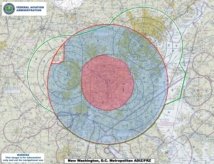
| 描述 | This map compares the new Air Defense Identification Zone (ADIZ) surrounding Washington, D.C. (red line) with the old ADIZ (green line). The new zone is effective as of 0500 UTC, 30 Aug 2007. The shaded red circle in the middle is the restricted airspace surrounding the capital. |
| 日期 | |
| 來源 | U.S. Federal Aviation Administration (http://www.faa.gov) - http://www.faa.gov/news/updates/adiz_frz/media/070727_New_ADIZ-FRZ.jpg |
| 作者 | U.S. Federal Aviation Administration |
授權條款
[編輯]
|
|
 |
檔案歷史
點選日期/時間以檢視該時間的檔案版本。
| 日期/時間 | 縮圖 | 尺寸 | 用戶 | 備註 | |
|---|---|---|---|---|---|
| 目前 | 2007年7月31日 (二) 00:09 | | 900 × 692(220 KB) | Sarfa~commonswiki(對話 | 貢獻) | This map compares the new Air Defense Identification Zone (ADIZ) surrounding Washington, D.C. (red line) with the old ADIZ (green line). The new zone is effective as of 0500 UTC, 30 Aug 2007. |
無法覆蓋此檔案。
檔案用途
沒有使用此檔案的頁面。
全域檔案使用狀況
以下其他 wiki 使用了這個檔案:
- de.wikipedia.org 的使用狀況
- en.wikipedia.org 的使用狀況
- fi.wikipedia.org 的使用狀況
- it.wikipedia.org 的使用狀況
- ja.wikipedia.org 的使用狀況
- ko.wikipedia.org 的使用狀況
- www.wikidata.org 的使用狀況
- zh.wikipedia.org 的使用狀況