File:100MilesSign.jpg
Aller à la navigation
Aller à la recherche
Pas de plus haute résolution disponible.
100MilesSign.jpg (500 × 517 pixels, taille du fichier : 145 kio, type MIME : image/jpeg)
Légendes
Légendes
Ajoutez en une ligne la description de ce que représente ce fichier
Description[modifier]
| Description |
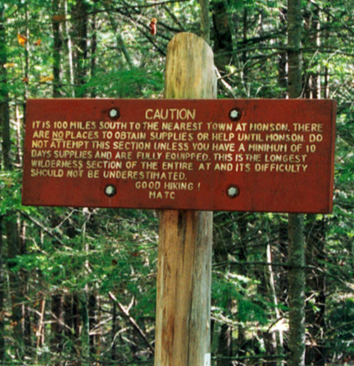
English: The image shows a sign on the Appalachian Trail at the northern trailhead of the 100-Mile Wilderness giving the following warning: "CAUTION. IT IS 100 MILES SOUTH TO THE NEAREST TOWN AT MONSON. THERE ARE NO PLACES TO OBTAIN SUPPLIES OR HELP UNTIL MONSON. DO NOT ATTEMPT THIS SECTION UNLESS YOU HAVE A MINIMUM OF 10 DAYS SUPPLIES AND ARE FULLY EQUIPPED. THIS IS THE LONGEST WILDERNESS SECTION OF THE ENTIRE AT AND ITS DIFFICULTY SHOULD NOT BE UNDERESTIMATED. GOOD HIKING! MATC" |
| Date | |
| Source | Own work - photo made by Bob Walker in Maine on the Appalachian Trail at the northern trailhead of the 100-Mile Wilderness in 2002. |
| Auteur | User Paphrag on en.wikipedia |
| Autres versions |
Originally from en.wikipedia; description page is (was) here * 16:05, 20 June 2005 [[:en:User:Paphrag|Paphrag]] 500×517 (148,102 bytes) <span class="comment">(The image shows a sign on Appalachian Trail at the north end of the 100-Mile Wilderness trailhead with the following warning: "IT IS 100 MILES SOUTH TO THE NEAREST TOWN AT MONSON. THERE ARE NO PLACES TO OBTAIN SUPPLIES OR HELP UNTIL MONSON. DO NOT ATTEMPT)</span> |
Conditions d’utilisation[modifier]
Ce fichier est disponible selon les termes de la licence Creative Commons Attribution – Partage dans les Mêmes Conditions 2.5 Générique
- Vous êtes libre :
- de partager – de copier, distribuer et transmettre cette œuvre
- d’adapter – de modifier cette œuvre
- Sous les conditions suivantes :
- paternité – Vous devez donner les informations appropriées concernant l'auteur, fournir un lien vers la licence et indiquer si des modifications ont été faites. Vous pouvez faire cela par tout moyen raisonnable, mais en aucune façon suggérant que l’auteur vous soutient ou approuve l’utilisation que vous en faites.
- partage à l’identique – Si vous modifiez, transformez, ou vous basez sur cette œuvre, vous devez distribuer votre contribution sous la même licence ou une licence compatible avec celle de l’original.
Historique du fichier
Cliquer sur une date et heure pour voir le fichier tel qu'il était à ce moment-là.
| Date et heure | Vignette | Dimensions | Utilisateur | Commentaire | |
|---|---|---|---|---|---|
| actuel | 7 août 2006 à 16:43 | | 500 × 517 (145 kio) | Liftarn (d | contributions) | {{Information| |Description=The image shows a sign on the Appalachian Trail at the northern trailhead of the 100-Mile Wilderness giving the following warning: "CAUTION. IT IS 100 MILES SOUTH TO THE NEAREST TOWN AT MONSON. THERE ARE NO PLACES TO OBTAIN SUP |
Vous ne pouvez pas remplacer ce fichier.
Utilisations locales du fichier
Aucune page n’utilise ce fichier.
Utilisations du fichier sur d’autres wikis
Les autres wikis suivants utilisent ce fichier :
- Utilisation sur de.wikipedia.org
- Utilisation sur en.wikipedia.org
- Utilisation sur fr.wikipedia.org
- Utilisation sur it.wikipedia.org