Category:Hiking and footpath signs in the United States
Jump to navigation
Jump to search
Subcategories
This category has the following 31 subcategories, out of 31 total.
*
A
- Appalachian Trail signs (18 F)
- Trail signs in Arizona (2 F)
C
- Trail signs in California (75 F)
- Trail signs in Connecticut (20 F)
F
- Trail signs in Florida (39 F)
G
H
- Trail signs in Hawaii (7 F)
I
K
- Trail signs in Kentucky (1 F)
L
- Trail signs in Louisiana (3 F)
M
- Trail signs in Maryland (18 F)
- Trail signs in Minnesota (3 F)
- Trail signs in Montana (7 F)
N
- Trail signs in Nevada (5 F)
- Trail signs in New Mexico (3 F)
O
- Trail signs in Ohio (14 F)
T
- Trail signs in Tennessee (4 F)
- Trail signs in Texas (3 F)
U
- Trail signs in Utah (35 F)
V
- Trail signs in Vermont (27 F)
- Trail signs in Virginia (60 F)
W
- Trail signs in Wyoming (36 F)
Media in category "Hiking and footpath signs in the United States"
The following 121 files are in this category, out of 121 total.
-
 100MilesSign.jpg 500 × 517; 145 KB
-
 12 miles to our rest stop... (7982981954).jpg 4,000 × 3,000; 2.44 MB
-

-

-

-

-

-

-

-

-

-

-

-

-

-

-

-

-
-
-

-

-
 AlpineAreaSign CamelsHumpMt 20140921 (16097018551).jpg 4,896 × 3,672; 8.85 MB
-
 Alum Cave Bluffs Trailhead.JPG 1,280 × 960; 295 KB
-
 Appalachian trail near Jefferson Rock (21848557659).jpg 1,080 × 1,080; 285 KB
-
 Appalachian Trail sign at Harpers Ferry.png 1,484 × 723; 324 KB
-
 ArchesNationalPark-TurretArch.jpg 4,272 × 2,848; 4.67 MB
-
 Awendaw Passage - Palmetto Trail.jpg 4,327 × 3,245; 2.72 MB
-
 Bat house sign in forrest.jpg 3,504 × 2,336; 691 KB
-
 BCLPC-470WestTrailSentrance.jpg 800 × 600; 82 KB
-
 BCTBCGmap.JPG 640 × 480; 50 KB
-
 Black mountains dead trees.jpg 480 × 640; 101 KB
-
 Bright Angel Trailhead04.jpg 2,520 × 1,680; 2.7 MB
-
 Cardigan State Park, 30 May 2009, no. 18.jpg 2,592 × 3,888; 6.75 MB
-
 CFPAHousatonicRangeTrailBlueTrailSign2.jpg 1,499 × 1,142; 1,007 KB
-
 CFPAHousatonicRangeTrailKellysSlideCaveSign1.jpg 1,536 × 2,048; 2.11 MB
-
 CFPAHousatonicRangeTrailSign2.jpg 1,536 × 2,048; 1.8 MB
-
 CFPAHousatonicRangeTrailTorysCaveSign1.jpg 1,536 × 2,048; 1.31 MB
-
 CFPAHousatonicRangeTrailTorysCaveSign2.jpg 1,536 × 2,048; 1.9 MB
-
 CFPAWhitestoneCliffsTrailHeadSign1.jpg 1,536 × 2,048; 2.23 MB
-
 CFPAWhitestoneCliffsTrailHeadSign2.jpg 2,048 × 1,536; 2.14 MB
-
-
 Cheesequake Blue Trail indicator.jpg 4,288 × 2,848; 4.15 MB
-
 CityofGoldenTuckerGulchTrail.jpg 800 × 600; 150 KB
-
 Crag Mountain Trail closure.jpg 3,000 × 2,400; 2.68 MB
-
 Danger Keep Off Sign at Cohab Canyon Trail.jpg 2,816 × 1,880; 2.44 MB
-
 Deer Hill Trail National Public Lands Day 2017 (36962138174).jpg 7,360 × 4,912; 15.5 MB
-
 Deer Hill Trail National Public Lands Day 2017 (37001732343).jpg 7,360 × 4,912; 19.61 MB
-
 Do not enter Kilauea restriction area.jpg 2,592 × 3,456; 1.55 MB
-
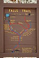 Falls Trail Map.JPG 2,000 × 3,008; 2.3 MB
-
 Flooded Columbia River in 2011- Trail Closed Sign.jpg 2,248 × 4,000; 3.02 MB
-
 Flooding of Hale Lake Blocking a Trail.jpg 2,048 × 2,720; 3.9 MB
-
 FL Bald Cypress Trail in the snow (5304130566).jpg 2,736 × 3,648; 2.15 MB
-
 Freeway Park Seattle 28.jpg 2,592 × 1,944; 883 KB
-
 Grand rounds.jpg 384 × 512; 64 KB
-
 Green Climbing Trail.jpg 1,536 × 2,048; 2.18 MB
-
 GRPO1759.jpg 2,928 × 1,994; 1.49 MB
-
 Hiking Club Nature Trail - Monson Lake State Park, Minnesota (35110921650).jpg 5,760 × 3,840; 20.96 MB
-
 Hiking trail sign.jpg 359 × 461; 49 KB
-
 Humphreys Trail 11,400 ft. marker (3910036537).jpg 2,048 × 1,536; 1.9 MB
-
 Ice Age Trail Sign.jpg 2,400 × 1,800; 882 KB
-
 Illegal Trail Marker, San Bernardino National Forest.jpg 458 × 310; 60 KB
-
 Illinoispp2.jpg 2,448 × 3,264; 1.73 MB
-
 Jenny Jump State Forest bear warning sign.jpg 2,750 × 4,874; 8.02 MB
-
 Lake Maria State Park in Winter, Minnesota (23551608164).jpg 5,760 × 3,840; 22.59 MB
-
 Lake Maria State Park Trails (25015838071).jpg 5,760 × 3,840; 9.93 MB
-
 Lantern Hill Trail signs.jpg 1,936 × 2,592; 2.57 MB
-
 LillinonahTrail NewtownAlsTrailSign.jpg 1,536 × 2,048; 1.74 MB
-
 LillinonahTrail ScenicTrailSign.JPG 2,048 × 1,536; 1.64 MB
-
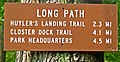 Long Path sign.jpg 609 × 314; 98 KB
-
 Longleaf Trace - panoramio.jpg 4,288 × 3,216; 3.27 MB
-
 Ludington State Park hiking trails.JPG 1,632 × 1,224; 826 KB
-
 M & M trailhead sign.jpg 2,194 × 3,474; 3.7 MB
-
 M&M reroute.JPG 2,155 × 2,193; 1.94 MB
-
 McAfee Knob fire road.jpg 800 × 600; 236 KB
-
 Metacomet Trail 1.jpg 2,592 × 3,888; 1.75 MB
-
 Metacomet Trail near Rattlesnake Mountain, October 24, 2007.jpg 1,600 × 2,400; 704 KB
-
 Midlandtrailsign.jpg 1,153 × 1,777; 2.48 MB
-
 Montezuma Castle 1989 01.jpg 994 × 643; 670 KB
-
 Mount Cardigan State Park, 30 May 2009, no. 7.jpg 3,888 × 2,592; 7.45 MB
-
 Mount Monadnock State Park Headquarters.jpg 4,608 × 3,456; 5.04 MB
-
 Mount Monadnock trail signs.jpg 4,608 × 3,456; 3.57 MB
-
 Mullan, ID. (10490383075).jpg 2,048 × 1,536; 1.31 MB
-
 Multnomah Falls (December 2013) - 21.JPG 3,000 × 4,000; 4.05 MB
-
 MUTCD RS-068.svg 91 × 91; 6 KB
-
 MUTCD RS-114.svg 91 × 91; 10 KB
-
 MUTCD RS-123.svg 91 × 91; 6 KB
-
 MUTCD-CA PS-123.svg 2,160 × 2,160; 6 KB
-

-
 Nature's Number 6.jpg 1,999 × 1,999; 704 KB
-
 Navigating-Ghost-River-section.jpg 1,749 × 1,189; 1.41 MB
-
 No Washing Bikes in River Sign East Burke VT June 2018.jpg 460 × 613; 150 KB
-
 Oconaluftee River Trail sign P9090768.jpg 2,304 × 3,072; 1.38 MB
-
 Painted blaze.JPG 581 × 775; 201 KB
-
 PaugusettTrailBlueBlazeAndScenicViewSign.jpg 1,536 × 2,048; 1.78 MB
-
 Pechuck Lookout (20721642728).jpg 2,480 × 2,060; 7.03 MB
-
 Pechuck Lookout (20722823829).jpg 3,346 × 2,530; 9.62 MB
-
 Pechuck Lookout (20909590455).jpg 3,346 × 2,530; 9.23 MB
-
 Pinhoti trail marker.jpg 376 × 500; 83 KB
-
 Pools, Rocks, or Switchbacks?.jpg 3,586 × 2,391; 3.2 MB
-
 Rainbow Falls Trail - panoramio.jpg 920 × 690; 454 KB
-
 RAKeepOff.JPG 640 × 480; 45 KB
-
 Rattlesnake Mountain Trail sign.jpg 800 × 600; 111 KB
-
 Reelfoot National Wildlife Refuge - May-2023 - 52932598503.jpg 3,024 × 4,032; 6.56 MB
-
 Scoutatmap.jpg 2,592 × 1,944; 2.07 MB
-
 Seven-Islands-Loop-Trail-sign-tn1.jpg 3,983 × 2,877; 2.3 MB
-
 Sign Alligator River NWR ncwetlands KG (19).jpg 6,000 × 4,000; 9.03 MB
-
 Silers-bald-summit2.jpg 638 × 478; 284 KB
-
 Somerville Community Path. 01.jpg 675 × 900; 144 KB
-
 Somerville Community Path. 02.jpg 675 × 900; 157 KB
-
 South Bay Harbor Trail sign, boston.jpg 3,006 × 5,344; 6.83 MB
-
 Trail C14 sign, Carlisle MA.jpg 4,032 × 3,024; 6.64 MB
-
 Trail Closures in the Grand Canyon - (17219733635).jpg 2,836 × 3,782; 3.97 MB
-
 Trail head signs (7243061988).jpg 2,592 × 3,872; 6.38 MB
-
 Trail Sign at Puʻu Loa Petroglyphs (2927323684).jpg 3,892 × 2,586; 7.55 MB
-
 Trail signs, Mt Pisgah Conservation Area, Northborough MA.jpg 4,032 × 3,024; 7.09 MB
-
 Tryon Creek State Natural Area, sign.JPG 3,000 × 4,000; 4.36 MB
-
 Us-id-kootenai-mineral-ridge-trail.jpg 1,200 × 1,800; 877 KB
-
 Waterloo 539.jpg 3,264 × 1,952; 2.16 MB
-
 Winchester and Potomac Railroad Bridge, Harpers Ferry, WV - Appalachian Trail sign.jpg 3,493 × 2,328; 3.24 MB
-
 Wood River Wetland (32604664672).jpg 5,472 × 2,794; 14.65 MB

.jpg)


.jpg)

.jpg)


.jpg)
.jpg)


.jpg)


.jpg)

.jpg)


.jpg)
.jpg)


.jpg)
_-_21.JPG)


.jpg)
.jpg)
.jpg)


.jpg)


.jpg)
.jpg)
.jpg)


.jpg)