File:115th United States Congress Congressional Districts.pdf
跳转到导航
跳转到搜索

此PDF文件的JPG预览的大小:800 × 593像素。 其他分辨率:320 × 237像素 | 640 × 475像素 | 1,024 × 759像素 | 1,280 × 949像素 | 2,560 × 1,898像素 | 6,675 × 4,950像素。
原始文件 (6,675 × 4,950像素,文件大小:18.44 MB,MIME类型:application/pdf)
说明
说明
添加一行文字以描述该文件所表现的内容
| 描述 |
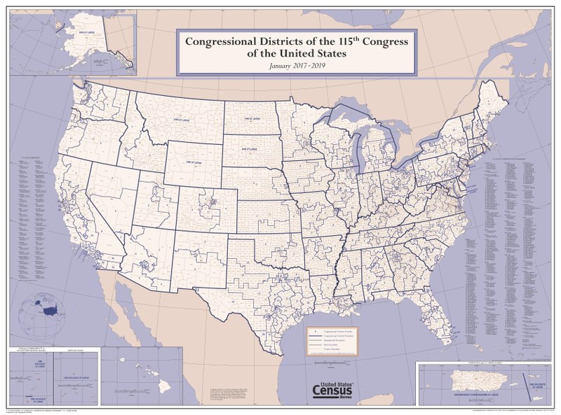
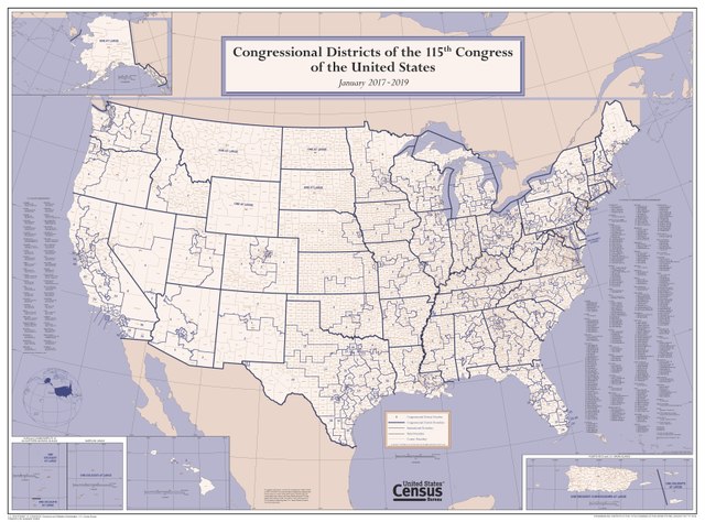
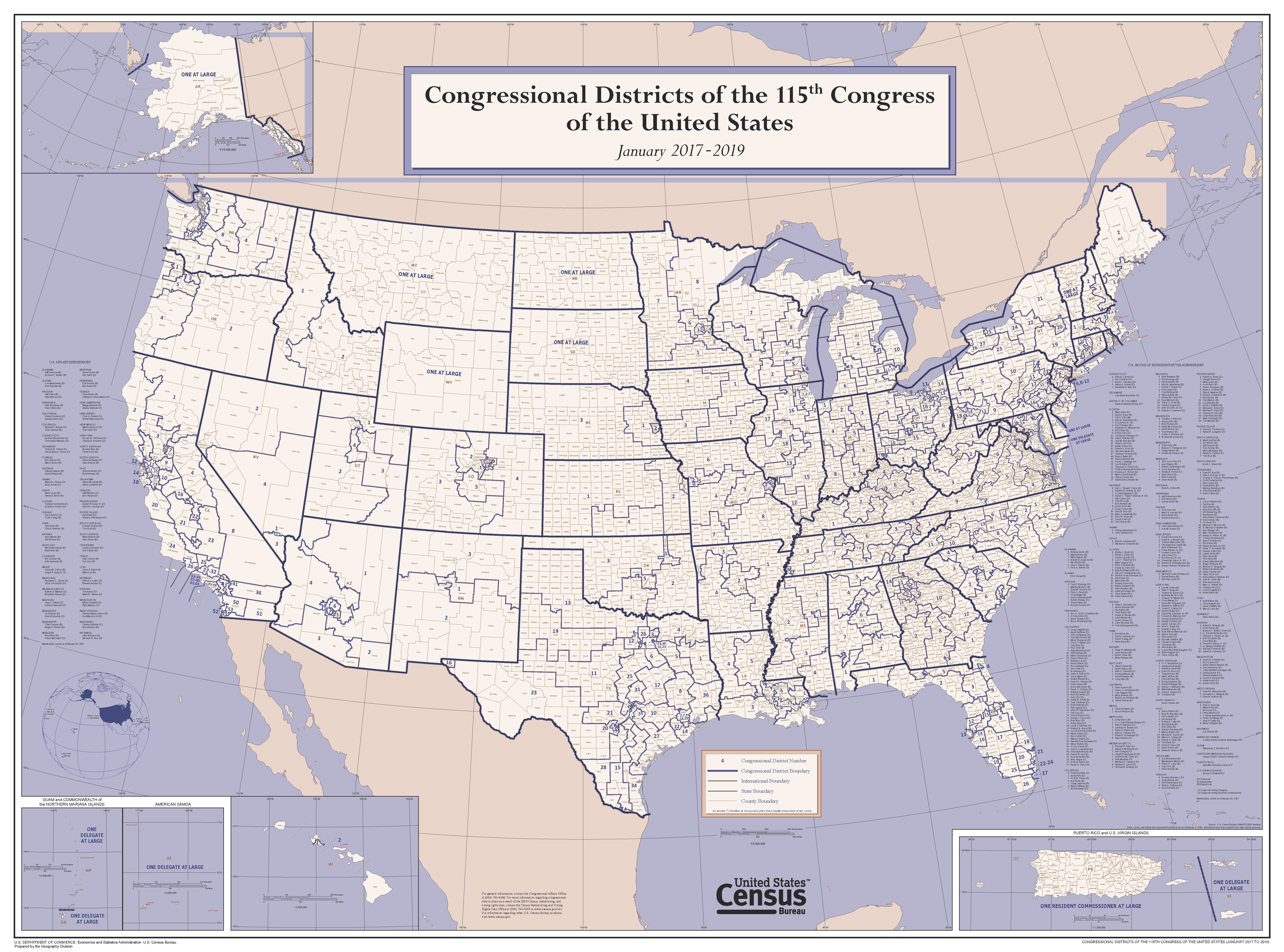
English: This wall map depicts congressional district boundaries in effect for the 115th Congress of the United States (January 2017-2019). The map includes county names and boundaries for each state, the District of Columbia, Puerto Rico, American Samoa, Guam, the Commonwealth of the Northern Mariana Islands, and U.S. Virgin Islands. The map also includes a listing of the names of all members of the 115th Congress, as of January 10, 2017. |
|||
| 日期 | ||||
| 来源 | https://www2.census.gov/geo/maps/cong_dist/uswall/cd115/CD115_US_WallMap.pdf | |||
| 作者 | U.S. Census Bureau | |||
| 授权 (二次使用本文件) |
|

文件历史
点击某个日期/时间查看对应时刻的文件。
| 日期/时间 | 缩略图 | 大小 | 用户 | 备注 | |
|---|---|---|---|---|---|
| 当前 | 2017年9月27日 (三) 04:02 |  | 6,675 × 4,950(18.44 MB) | Kingofthedead(留言 | 贡献) | {{Information |Description ={{en|1=This wall map depicts congressional district boundaries in effect for the 115th Congress of the United States (January 2017-2019). The map includes county names and boundaries for each state, the District of Columb... |
您不可以覆盖此文件。
文件用途
全域文件用途
以下其他wiki使用此文件:
- ar.wikipedia.org上的用途
- en.wikipedia.org上的用途
- nl.wikipedia.org上的用途
- zh.wikipedia.org上的用途