File:118 Milford Bay.png
Jump to navigation
Jump to search

Size of this preview: 449 × 600 pixels. Other resolutions: 180 × 240 pixels | 359 × 480 pixels | 575 × 768 pixels | 766 × 1,024 pixels | 2,442 × 3,262 pixels.
Original file (2,442 × 3,262 pixels, file size: 22.83 MB, MIME type: image/png)
Captions
Captions
Add a one-line explanation of what this file represents
Summary[edit]
| Description |
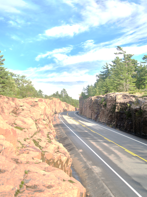
English: Ontario's longest rock cut (with exception to the single sided cuts on Highway 400 south of Parry Sound) is located on Highway 118 between Milford Bay and Port Carling, in the Muskoka region. HDR from three exposures. |
| Date |
|
| Source |
Own work
|
| Author | Uploaded by Floydian at en.wikipedia |
| Object location | | View this and other nearby images on: OpenStreetMap |
|---|
Licensing[edit]
This file is licensed under the Creative Commons Attribution-Share Alike 3.0 Unported license.
- You are free:
- to share – to copy, distribute and transmit the work
- to remix – to adapt the work
- Under the following conditions:
- attribution – You must give appropriate credit, provide a link to the license, and indicate if changes were made. You may do so in any reasonable manner, but not in any way that suggests the licensor endorses you or your use.
- share alike – If you remix, transform, or build upon the material, you must distribute your contributions under the same or compatible license as the original.
Original upload log[edit]
The original description page was here. All following user names refer to en.wikipedia.
Upload date | User | Bytes | Dimensions | Comment
- 2011-08-26 21:24 (UTC) | Floydian | 23939419 (bytes) | 2442×3262 | {{Information |Description=Ontario's longest rock cut (with exception to the single sided cuts on Highway 400 south of Parry Sound) is located on Highway 118 between Milford Bay and Port Carling, in the Muskoka region. HDR from three exposures. |Source={{
File history
Click on a date/time to view the file as it appeared at that time.
| Date/Time | Thumbnail | Dimensions | User | Comment | |
|---|---|---|---|---|---|
| current | 08:14, 12 December 2011 | | 2,442 × 3,262 (22.83 MB) | SreeBot (talk | contribs) | (Original text) : {{Information |Description=Ontario's longest rock cut (with exception to the single sided cuts on Highway 400 south of Parry Sound) is located on Highway 118 between Milford Bay and Port Carling, in the Muskoka region. HDR from three exp |
You cannot overwrite this file.
File usage on Commons
The following page uses this file:
File usage on other wikis
The following other wikis use this file:
- Usage on en.wikipedia.org
- Usage on fr.wikipedia.org