File:12.07.18 Kylesku Bridge (42708000125).jpg
Jump to navigation
Jump to search

Size of this preview: 800 × 468 pixels. Other resolutions: 320 × 187 pixels | 640 × 375 pixels | 1,024 × 600 pixels | 1,280 × 749 pixels | 2,560 × 1,499 pixels | 5,988 × 3,506 pixels.
Original file (5,988 × 3,506 pixels, file size: 14.16 MB, MIME type: image/jpeg)
Captions
Captions
Add a one-line explanation of what this file represents
Summary
[edit].jpg&action=edit§ion=1)
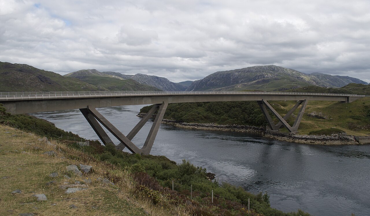
| Description | Following on from the previous picture, this is the bridge that was completed in July 1984 thus eliminating the need for the ferry across Loch a' Chàirn Bhàin on the main A894 road. |
| Date | |
| Source | 12.07.18 Kylesku Bridge |
| Author | Phil Richards from London, UK |
| Camera location | | View this and other nearby images on: OpenStreetMap |
|---|
.jpg¶ms=058.257439_N_-005.020408_E_globe:Earth_type:camera_source:Flickr_&language=en)
Licensing
[edit].jpg&action=edit§ion=2)
This file is licensed under the Creative Commons Attribution-Share Alike 2.0 Generic license.
- You are free:
- to share – to copy, distribute and transmit the work
- to remix – to adapt the work
- Under the following conditions:
- attribution – You must give appropriate credit, provide a link to the license, and indicate if changes were made. You may do so in any reasonable manner, but not in any way that suggests the licensor endorses you or your use.
- share alike – If you remix, transform, or build upon the material, you must distribute your contributions under the same or compatible license as the original.
| This image was originally posted to Flickr by philstephenrichards at https://flickr.com/photos/13035092@N00/42708000125 (archive). It was reviewed on 5 November 2018 by FlickreviewR 2 and was confirmed to be licensed under the terms of the cc-by-sa-2.0. |
File history
Click on a date/time to view the file as it appeared at that time.
| Date/Time | Thumbnail | Dimensions | User | Comment | |
|---|---|---|---|---|---|
| current | 20:41, 5 November 2018 | | 5,988 × 3,506 (14.16 MB) | Strainu (talk | contribs) | Transferred from Flickr via #flickr2commons |
You cannot overwrite this file.
File usage on Commons
There are no pages that use this file.
.jpg&oldid=742930369)