File:1799 Cary Map of Franconia, Germany ( Nuremburg ) - Geographicus - Franconia-cary-1799.jpg
Aller à la navigation
Aller à la recherche

Taille de cet aperçu : 675 × 600 pixels. Autres résolutions : 270 × 240 pixels | 540 × 480 pixels | 864 × 768 pixels | 1 152 × 1 024 pixels | 2 305 × 2 048 pixels | 5 000 × 4 443 pixels.
Fichier d’origine (5 000 × 4 443 pixels, taille du fichier : 7,44 Mio, type MIME : image/jpeg)
Légendes
Légendes
Ajoutez en une ligne la description de ce que représente ce fichier
Description[modifier]
_-_Geographicus_-_Franconia-cary-1799.jpg&action=edit§ion=1)
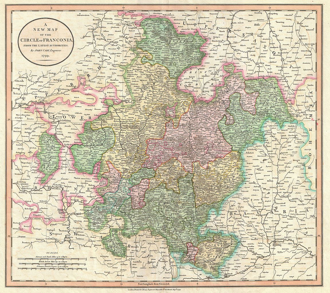
| John Cary : A New Map of the Circle of Franconia, from the Latest Authorities.
( |
||||||||||||||||||||||||||
|---|---|---|---|---|---|---|---|---|---|---|---|---|---|---|---|---|---|---|---|---|---|---|---|---|---|---|
| Artiste |
|
|||||||||||||||||||||||||
| Titre |
A New Map of the Circle of Franconia, from the Latest Authorities. |
|||||||||||||||||||||||||
| Description |
English: An extremely attractive example of John Cary’s 1799 map of Franconia, Germany. Covers from Upper Saxony south to Swabia, west to the Lower Rhine and west to the Bavaria. Includes the important mediaeval and renaissance center of Nuremburg. Today Franconia is a historic district and has been consolidated with Bavaria. Highly detailed with color coding according to region. Shows forests, cities, palaces, forts, roads and rivers. All in all, one of the most interesting and attractive atlas maps Franconia to appear in first years of the 19th century. Prepared in 1799 by John Cary for issue in his magnificent 1808 New Universal Atlas . |
|||||||||||||||||||||||||
| Date | 1799 (dated) | |||||||||||||||||||||||||
| Dimensions | hauteur : 18,5 pouces (46,9 cm) ; largeur : 20,5 pouces (52 cm) | |||||||||||||||||||||||||
| Numéro d’inventaire |
liens Geographicus : Franconia-cary-1799 |
|||||||||||||||||||||||||
| Source / photographe |
Cary, John, Cary's New Universal Atlas, containing distinct maps of all the principal states and kingdoms throughout the World. From the latest and best authorities extant. London: Printed for J. Cary, Engraver and Map-seller, No. 181, near Norfolk Street, Strand, 1808.
|
|||||||||||||||||||||||||
| Autorisation (Réutilisation de ce fichier) |
|
|||||||||||||||||||||||||
Historique du fichier
Cliquer sur une date et heure pour voir le fichier tel qu'il était à ce moment-là.
| Date et heure | Vignette | Dimensions | Utilisateur | Commentaire | |
|---|---|---|---|---|---|
| actuel | 22 mars 2011 à 12:26 | | 5 000 × 4 443 (7,44 Mio) | BotMultichillT (d | contributions) | {{subst:User:Multichill/Geographicus |link=http://www.geographicus.com/P/AntiqueMap/Franconia-cary-1799 |product_name=1799 Cary Map of Franconia, Germany ( Nuremburg ) |map_title=A New Map of the Circle of Franconia, from the Latest Authorities. |descript |
Vous ne pouvez pas remplacer ce fichier.
Utilisations locales du fichier
La page suivante utilise ce fichier :
_-_Geographicus_-_Franconia-cary-1799.jpg)
Utilisations du fichier sur d’autres wikis
Les autres wikis suivants utilisent ce fichier :
- Utilisation sur cs.wikipedia.org
- Utilisation sur fr.wikipedia.org
_-_Geographicus_-_Franconia-cary-1799.jpg&oldid=821850229)