File:1852 map of Montgomery, Alabama.jpeg
Jump to navigation
Jump to search
Size of this preview: 495 × 600 pixels. Other resolutions: 198 × 240 pixels | 396 × 480 pixels | 634 × 768 pixels | 845 × 1,024 pixels | 1,690 × 2,048 pixels | 3,372 × 4,087 pixels.
Original file (3,372 × 4,087 pixels, file size: 1.55 MB, MIME type: image/jpeg)
Captions
Captions
Add a one-line explanation of what this file represents
| Description |
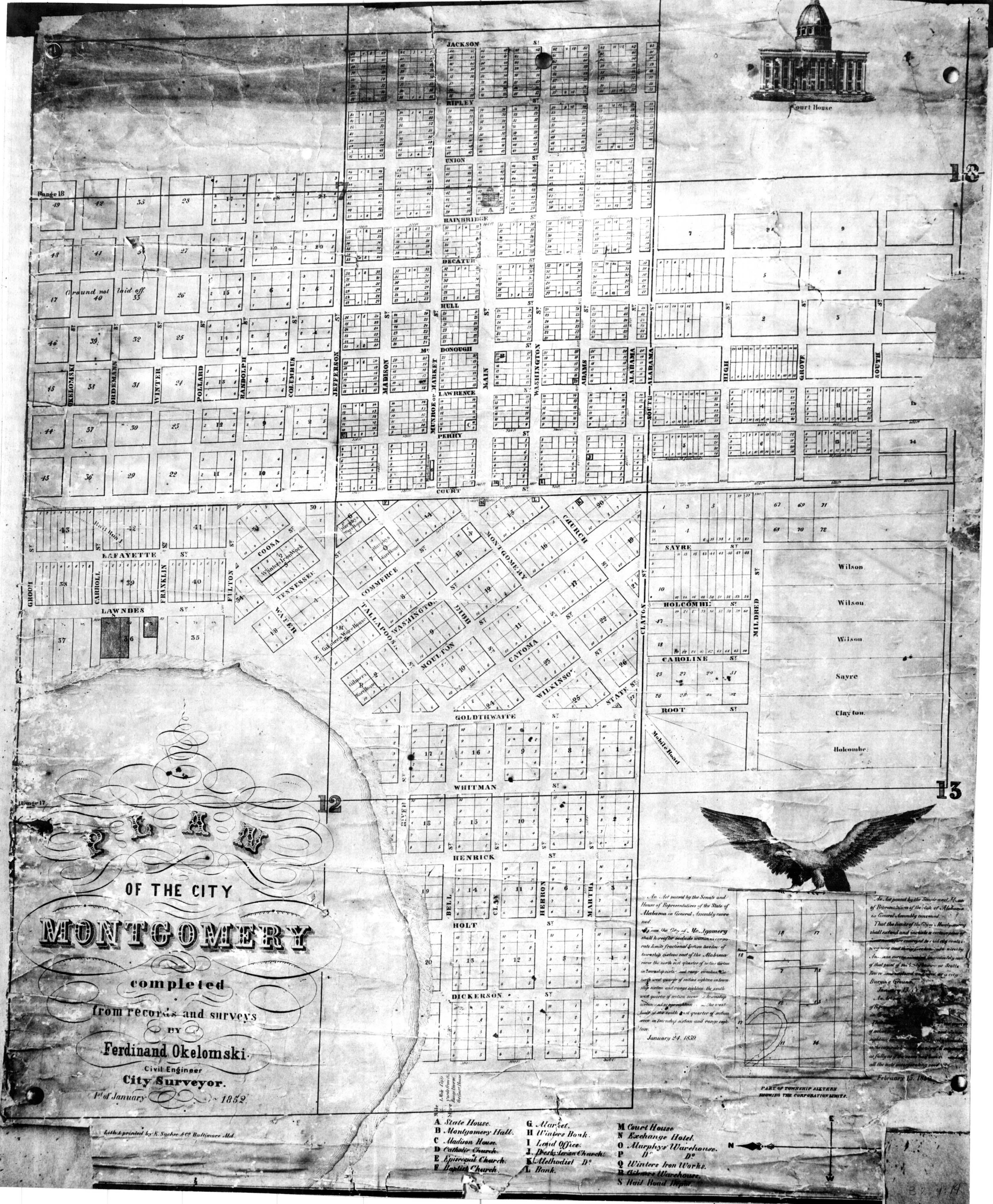
English: Plan of the City of Montgomery, Alabama |
||||
| Date | |||||
| Source | University of Alabama Historical Map Archive | ||||
| Author | Ferdinand Okelomski; Publisher: K. Sachse, Baltimore | ||||
| Permission (Reusing this file) |
|
||||
File history
Click on a date/time to view the file as it appeared at that time.
| Date/Time | Thumbnail | Dimensions | User | Comment | |
|---|---|---|---|---|---|
| current | 00:28, 28 August 2009 | | 3,372 × 4,087 (1.55 MB) | Spyder Monkey (talk | contribs) | {{Information |Description={{en|Plan of the City of Montgomery, Alabama}} |Source=[http://alabamamaps.ua.edu/historicalmaps/counties/montgomery/montgomery.html University of Alabama Historical Map Archive] |Date=1852 |Author=Ferdinand Okelomski; Publisher |
You cannot overwrite this file.
File usage on Commons
There are no pages that use this file.