File:1855 Colton Map or City Plan of Paris, France - Geographicus - Paris-c-55.jpg
Aller à la navigation
Aller à la recherche
Taille de cet aperçu : 734 × 600 pixels. Autres résolutions : 294 × 240 pixels | 588 × 480 pixels | 940 × 768 pixels | 1 253 × 1 024 pixels | 2 507 × 2 048 pixels | 3 000 × 2 451 pixels.
Fichier d’origine (3 000 × 2 451 pixels, taille du fichier : 2,84 Mio, type MIME : image/jpeg)
Légendes
Légendes
Ajoutez en une ligne la description de ce que représente ce fichier
| Joseph Hutchins Colton : The Environs of Paris
( |
|||||||||||||||||||||
|---|---|---|---|---|---|---|---|---|---|---|---|---|---|---|---|---|---|---|---|---|---|
| Artiste |
|
||||||||||||||||||||
| Titre |
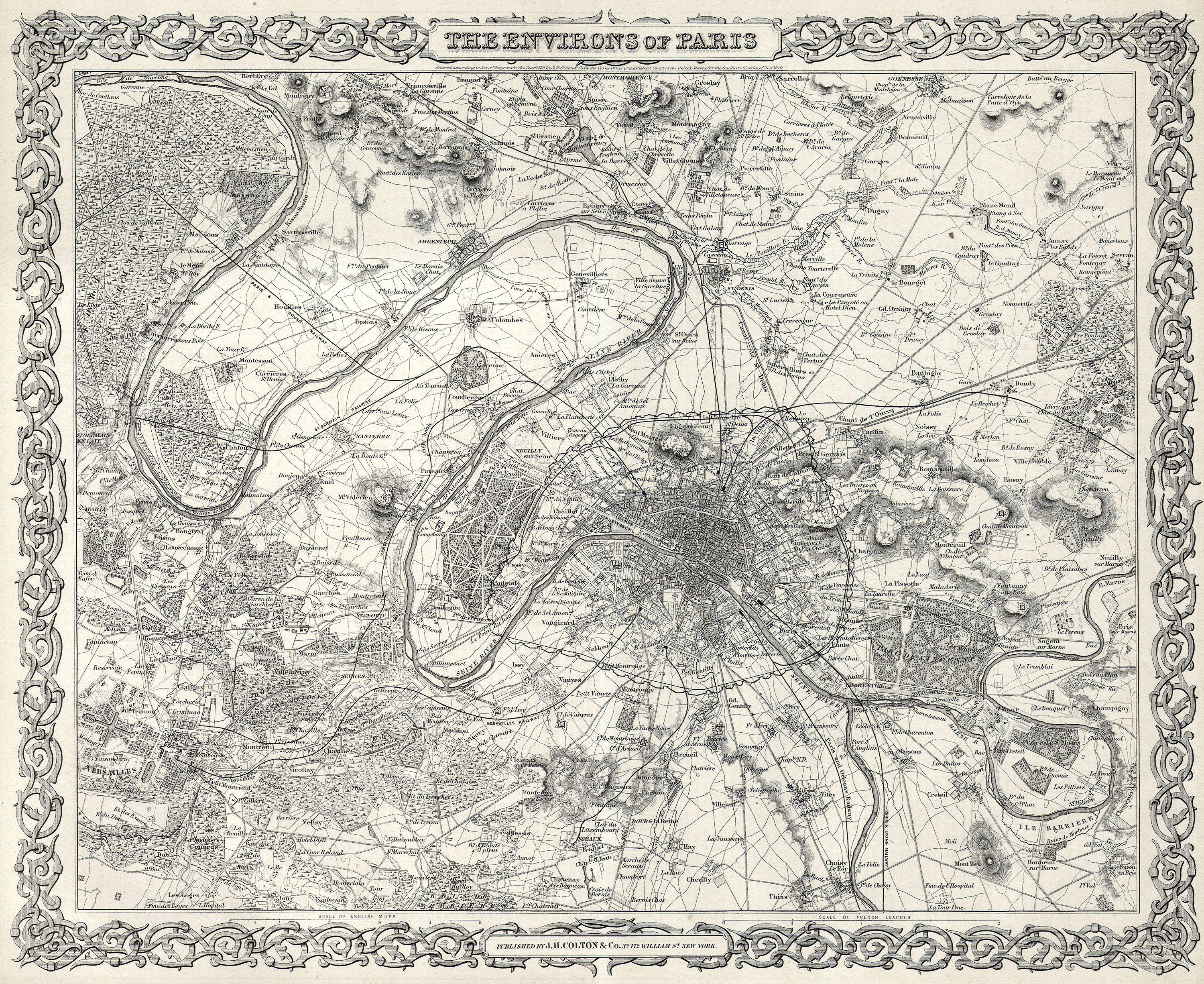
The Environs of Paris |
||||||||||||||||||||
| Description |
English: This rare hand colored map of Paris and Environs is a copper plate engraving dating to 1855. Produced by the respected mid 19th century American Mapmaker J. H. Colton. Map covers the Seine valley in a roughly 30 mile radius of Paris. Versailles appears in the extreme southwest and Vitry in the extreme northeast. The whole is beautifully detailed down to individual buildings. A beautiful and superbly detailed map. |
||||||||||||||||||||
| Date | 1855 | ||||||||||||||||||||
| Dimensions | hauteur : 13 pouces (33 cm) ; largeur : 16 pouces (40,6 cm) | ||||||||||||||||||||
| Numéro d’inventaire |
liens Geographicus : Paris-c-55 |
||||||||||||||||||||
| Source / photographe |
|
||||||||||||||||||||
| Autorisation (Réutilisation de ce fichier) |
|
||||||||||||||||||||

Historique du fichier
Cliquer sur une date et heure pour voir le fichier tel qu'il était à ce moment-là.
| Date et heure | Vignette | Dimensions | Utilisateur | Commentaire | |
|---|---|---|---|---|---|
| actuel | 25 mars 2011 à 02:38 | | 3 000 × 2 451 (2,84 Mio) | BotMultichillT (d | contributions) | {{subst:User:Multichill/Geographicus |link=http://www.geographicus.com/P/AntiqueMap/Paris-c-55 |product_name=1855 Colton Map or City Plan of Paris, France |map_title=The Environs of Paris |description=This rare hand colored map of Paris and Environs is a |
Vous ne pouvez pas remplacer ce fichier.
Utilisations locales du fichier
La page suivante utilise ce fichier :
Utilisations du fichier sur d’autres wikis
Les autres wikis suivants utilisent ce fichier :
- Utilisation sur de.wikipedia.org
- Utilisation sur en.wikipedia.org
- Utilisation sur fr.wikipedia.org