File:1887 Perspective Map of Anniston Alabama.jpg
Jump to navigation
Jump to search
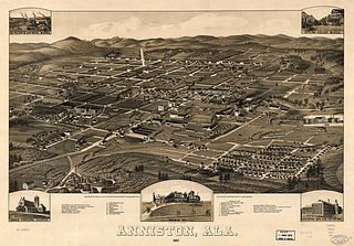
Size of this preview: 800 × 558 pixels. Other resolutions: 320 × 223 pixels | 640 × 446 pixels | 1,024 × 714 pixels | 1,280 × 892 pixels | 2,560 × 1,785 pixels | 7,712 × 5,376 pixels.
Original file (7,712 × 5,376 pixels, file size: 9.67 MB, MIME type: image/jpeg)
Captions
Captions
Add a one-line explanation of what this file represents
Summary
[edit]| Description |
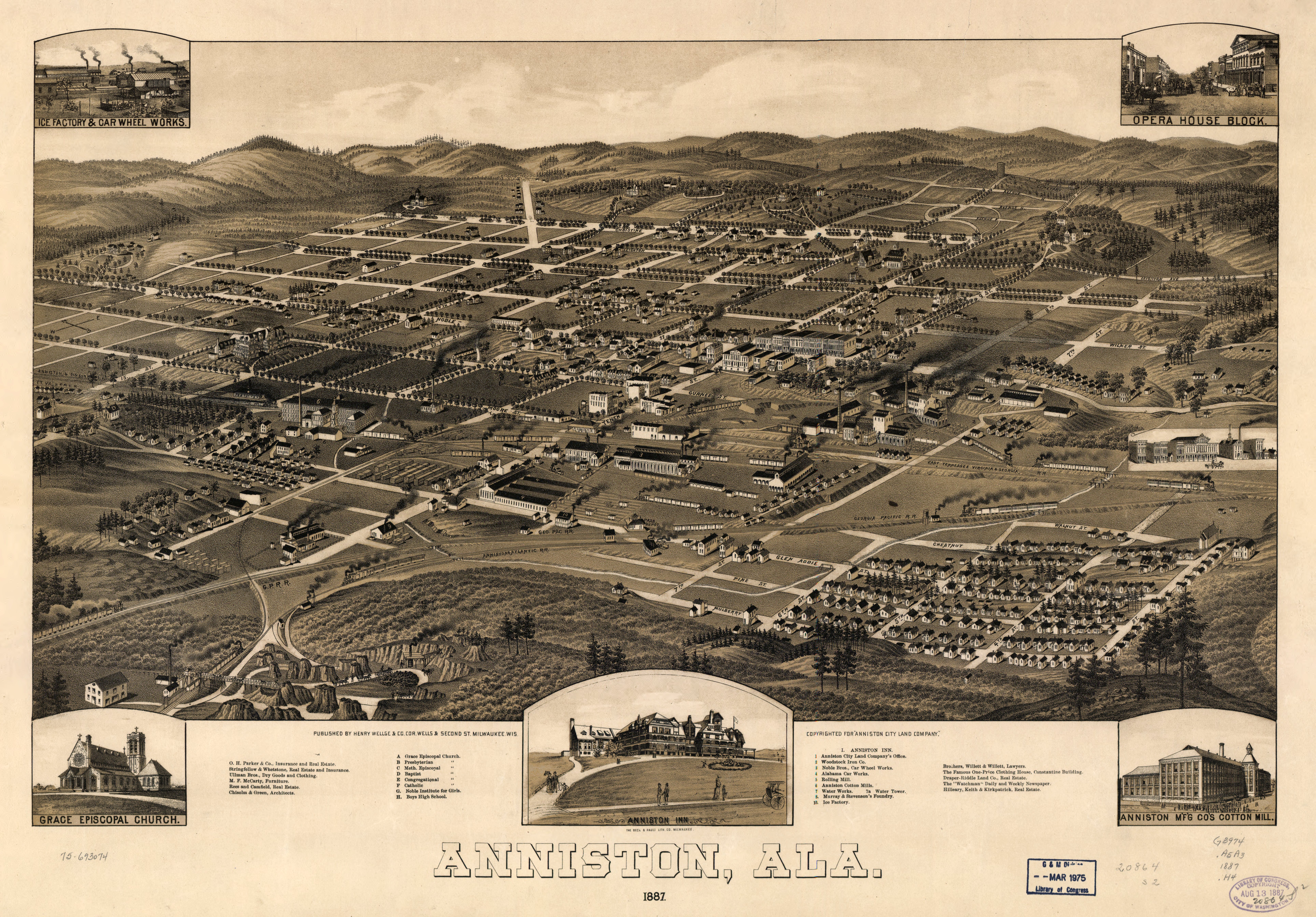
English: This perspective/panoramic map, created by Henry Wellge, shows a bird's eye view of Anniston, Alabama in 1887. It was published by Beck & Pauli Lith. Co. and "copyrighted for 'Anniston City Land Company'". It is not drawn to scale. It contains illustrations and an index to points of interest: Grace Episcopal Church, Presbyterian Church, Methodist Church, Baptist Church, Congregational Church, Catholic Church, Noble Institute for Girls, Boys High School, Anniston City Land Company's Office, Woodstock Iron Co., Noble Bros. Car Wheel Works, Alabama Car Works, Rolling Mill, Anniston Cotton Mills, Water Works, Water Tower, Murray & Stevenson's Foundry, Ice Factory, and others. |
| Date | |
| Source | Library of Congress Geography and Map Division, digital ID g3974a pm000010. http://hdl.loc.gov/loc.gmd/g3974a.pm000010 |
| Author | Henry Wellge of Henry Wellge & Co., published by Beck & Pauli Lith. Co. |
| Other versions | File:Anniston Alabama map 1887.png |
| This is a retouched picture, which means that it has been digitally altered from its original version. Modifications: level adjustment, conversion from JPEG2000 to JPEG. Modifications made by Earthsound.
|

Note:
[edit]
- Perspective map not drawn to scale.
- Bird's-eye-view.
- Reference: LC Panoramic maps (2nd ed.), 8
- Includes illus. and index to points of interest.
Medium
[edit]
- col. map 52 x 83 cm.
Repository
[edit]
- Library of Congress Geography and Map Division Washington, D.C. 20540-4650 USA

|
This map is available from the United States Library of Congress's Geography & Map Division
under the digital ID g3974a.pm000010. This tag does not indicate the copyright status of the attached work. A normal copyright tag is still required. See Commons:Licensing.
|
Licensing
[edit]
This work is in the public domain in the United States because it was published (or registered with the U.S. Copyright Office) before January 1, 1929.
Public domain works must be out of copyright in both the United States and in the source country of the work in order to be hosted on the Commons. If the work is not a U.S. work, the file must have an additional copyright tag indicating the copyright status in the source country.
Note: This tag should not be used for sound recordings. |
File history
Click on a date/time to view the file as it appeared at that time.
| Date/Time | Thumbnail | Dimensions | User | Comment | |
|---|---|---|---|---|---|
| current | 18:04, 3 May 2011 | | 7,712 × 5,376 (9.67 MB) | Earthsound (talk | contribs) | {{Information |Description ={{en|1=This perspective/panoramic map, created by Henry Wellge, shows a bird's eye view of Anniston, Alabama in 1887. It was published by Beck & Pauli Lith. Co. and "copyrighted for 'Anniston City Land Company'". It is not d |
You cannot overwrite this file.
File usage on Commons
The following 2 pages use this file:
File usage on other wikis
The following other wikis use this file:
- Usage on en.wikipedia.org
- Usage on ga.wikipedia.org