File:1897 (?) Map of the original grants of village lots from the Dutch West India Company to the inhabitants of New-Amsterdam (now New-York) lying below the present line of Wall Street, grants commencing A.D. 1642 - commonwealth 9s161d14t.jpg
Jump to navigation
Jump to search

Size of this preview: 759 × 600 pixels. Other resolutions: 304 × 240 pixels | 608 × 480 pixels | 972 × 768 pixels | 1,280 × 1,012 pixels | 2,560 × 2,023 pixels | 7,075 × 5,591 pixels.
Original file (7,075 × 5,591 pixels, file size: 42.66 MB, MIME type: image/jpeg)
Captions
Captions
Add a one-line explanation of what this file represents
Summary
[edit]_Map_of_the_original_grants_of_village_lots_from_the_Dutch_West_India_Company_to_the_inhabitants_of_New-Amsterdam_(now_New-York)_lying_below_the_present_line_of_Wall_Street,_grants_commencing_A.D._1642_-_commonwealth_9s161d14t.jpg&action=edit§ion=1)
| Description |
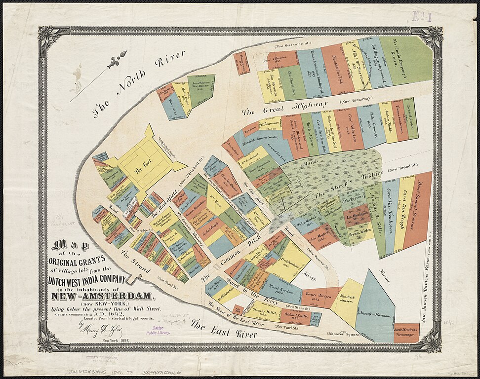
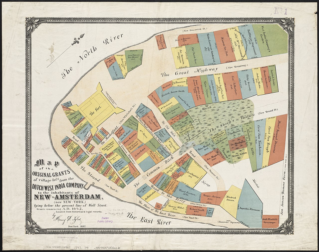
English: 1897 (?) Map of the original grants of village lots from the Dutch West India Company to the inhabitants of New-Amsterdam (now New-York) lying below the present line of Wall Street, grants commencing A.D. 1642 - commonwealth 9s161d14t. From the Digital Commonwealth (https://www.digitalcommonwealth.org/search/commonwealth:9s161d14t). |
| Date | circa 1897 |
| Source | Digital Commonwealth |
| Author | Henry Dunreath Tyler |
Licensing
[edit]_Map_of_the_original_grants_of_village_lots_from_the_Dutch_West_India_Company_to_the_inhabitants_of_New-Amsterdam_(now_New-York)_lying_below_the_present_line_of_Wall_Street,_grants_commencing_A.D._1642_-_commonwealth_9s161d14t.jpg&action=edit§ion=2)
|
This work is in the public domain in its country of origin and other countries and areas where the copyright term is the author's life plus 70 years or fewer. This work is in the public domain in the United States because it was published (or registered with the U.S. Copyright Office) before January 1, 1929. | |
| This file has been identified as being free of known restrictions under copyright law, including all related and neighboring rights. | |
File history
Click on a date/time to view the file as it appeared at that time.
| Date/Time | Thumbnail | Dimensions | User | Comment | |
|---|---|---|---|---|---|
| current | 20:21, 10 December 2021 | | 7,075 × 5,591 (42.66 MB) | Daderot (talk | contribs) | Uploaded a work by Henry Dunreath Tyler from Digital Commonwealth with UploadWizard |
You cannot overwrite this file.
File usage on Commons
There are no pages that use this file.
_Map_of_the_original_grants_of_village_lots_from_the_Dutch_West_India_Company_to_the_inhabitants_of_New-Amsterdam_(now_New-York)_lying_below_the_present_line_of_Wall_Street,_grants_commencing_A.D._1642_-_commonwealth_9s161d14t.jpg&oldid=769475942)