File:1899 Dublin County Council election (party of winning candidate by electoral area).svg
Jump to navigation
Jump to search

Size of this PNG preview of this SVG file: 431 × 599 pixels. Other resolutions: 173 × 240 pixels | 345 × 480 pixels | 553 × 768 pixels | 737 × 1,024 pixels | 1,474 × 2,048 pixels | 657 × 913 pixels.
Original file (SVG file, nominally 657 × 913 pixels, file size: 264 KB)
Captions
Captions
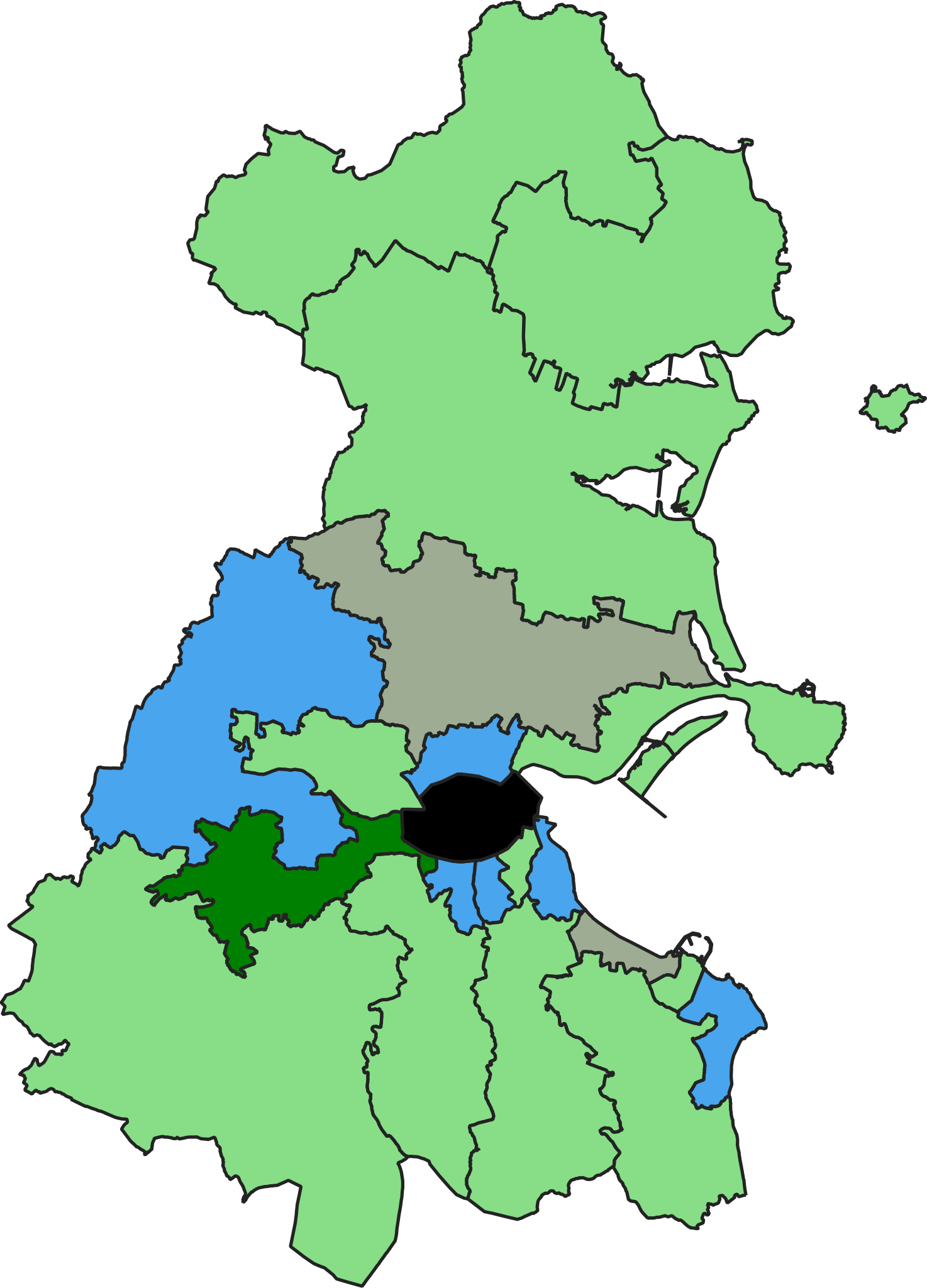
Map of the 1899 Dublin County Council election, showing all electoral areas coloured in accordance with the party of the winning candidate.
Summary
[edit].svg&action=edit§ion=1)
| Description |
English: Map of the 1899 Dublin County Council election, showing all electoral areas coloured in accordance with the party of the winning candidate.
All electoral areas returned 1 representative. Area governed by Dublin Corporation is coloured black. Nationalist: 11 seats
Unionist: 6 seats
Land and Labour League (Nationalist): 2 seats
Redmondite nationalist: 1 seat |
| Date | |
| Source | Own work |
| Author | MrPenguin21 |
Licensing
[edit].svg&action=edit§ion=2)
I, the copyright holder of this work, hereby publish it under the following license:
This file is licensed under the Creative Commons Attribution-Share Alike 4.0 International license.
- You are free:
- to share – to copy, distribute and transmit the work
- to remix – to adapt the work
- Under the following conditions:
- attribution – You must give appropriate credit, provide a link to the license, and indicate if changes were made. You may do so in any reasonable manner, but not in any way that suggests the licensor endorses you or your use.
- share alike – If you remix, transform, or build upon the material, you must distribute your contributions under the same or compatible license as the original.
File history
Click on a date/time to view the file as it appeared at that time.
| Date/Time | Thumbnail | Dimensions | User | Comment | |
|---|---|---|---|---|---|
| current | 10:49, 6 June 2020 | | 657 × 913 (264 KB) | MrPenguin21 (talk | contribs) | Uploaded own work with UploadWizard |
You cannot overwrite this file.
File usage on Commons
There are no pages that use this file.
File usage on other wikis
The following other wikis use this file:
- Usage on en.wikipedia.org
- Usage on www.wikidata.org
.svg&oldid=850095926)