File:1902 Subig Bay (Subic Bay) Luzon, Philippines nautical chart 4254, by Manila Sub Office, United States Coast and Geodetic Survey.jpg
Jump to navigation
Jump to search

Size of this preview: 476 × 600 pixels. Other resolutions: 190 × 240 pixels | 381 × 480 pixels | 610 × 768 pixels | 813 × 1,024 pixels | 1,626 × 2,048 pixels | 2,672 × 3,366 pixels.
Original file (2,672 × 3,366 pixels, file size: 1.21 MB, MIME type: image/jpeg)
Captions
Captions
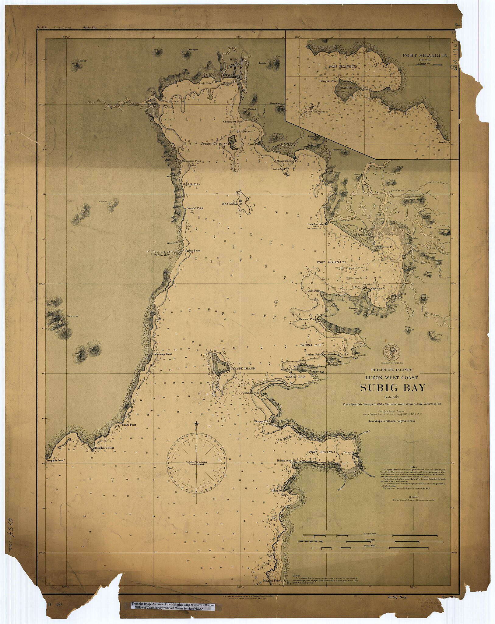
1902 Subig Bay (Subic Bay) Luzon, Philippines nautical chart 4254, by Manila Sub Office, United States Coast and Geodetic Survey
Summary[edit]
Scanned image of US Coast & Geodetic Survey Manila Office nautical chart #4254 Subig (Subic) Bay, Luzon, Philippines, 1902.
From the Image Archives of the Historical Map & Chart Collection archive copy at the Wayback Machine/Office of Coast Survey/National Ocean Service/NOAA/United States government. Converted from MrSID to JPEG format for upload to Commons.
_4254,_by_Manila_Sub_Office,_United_States_Coast_and_Geodetic_Survey_(cropped).jpg)
_Luzon,_Philippines_nautical_chart_4254,_by_Manila_Sub_Office,_United_States_Coast_and_Geodetic_Survey.jpg&action=edit§ion=1)
Licensing[edit]
_Luzon,_Philippines_nautical_chart_4254,_by_Manila_Sub_Office,_United_States_Coast_and_Geodetic_Survey.jpg&action=edit§ion=2)
This image is in the public domain because it contains materials that originally came from the U.S. National Oceanic and Atmospheric Administration, taken or made as part of an employee's official duties.
|
File history
Click on a date/time to view the file as it appeared at that time.
| Date/Time | Thumbnail | Dimensions | User | Comment | |
|---|---|---|---|---|---|
| current | 01:02, 17 March 2006 | | 2,672 × 3,366 (1.21 MB) | Cdc~commonswiki (talk | contribs) | Scanned image of US Coast & Geodetic Survey Manila Office nautical chart #4254 Subig (Subic) Bay, Luzon, Philippines, 1902. From the Image Archives of the [http://chartmaker.ncd.noaa.gov/csdl/ctp/abstract.htm Historical Map & Chart Collection]/Office of |
You cannot overwrite this file.
File usage on Commons
The following 3 pages use this file:
File usage on other wikis
The following other wikis use this file:
- Usage on ast.wikipedia.org
- Usage on da.wikipedia.org
- Usage on en.wikipedia.org
- Usage on es.wikipedia.org
- Usage on fr.wikipedia.org
- Usage on id.wikipedia.org
- Usage on ja.wikipedia.org
- Usage on nl.wikipedia.org
- Usage on no.wikipedia.org
- Usage on pt.wikipedia.org
- Usage on ru.wikipedia.org
- Usage on sv.wikipedia.org
- Usage on tl.wikipedia.org
- Usage on vi.wikipedia.org
- Usage on www.wikidata.org
- Usage on zh.wikipedia.org
_Luzon,_Philippines_nautical_chart_4254,_by_Manila_Sub_Office,_United_States_Coast_and_Geodetic_Survey.jpg&oldid=868831662)