File:1945-02-15GerWW2BattlefrontAtlas.jpg
跳至導覽
跳至搜尋
預覽大小:616 × 600 像素。 其他解析度:247 × 240 像素 | 493 × 480 像素 | 789 × 768 像素 | 1,250 × 1,217 像素。
原始檔案 (1,250 × 1,217 像素,檔案大小:1.26 MB,MIME 類型:image/jpeg)
說明
說明
添加單行說明來描述出檔案所代表的內容

|
這個檔案已經被1945-02-15GerWW2BattlefrontAtlas reworked.jpg取代。 建議您使用其他圖像。請注意要刪除被取代的圖像的話,您需要首先取得社群共識。
|

|
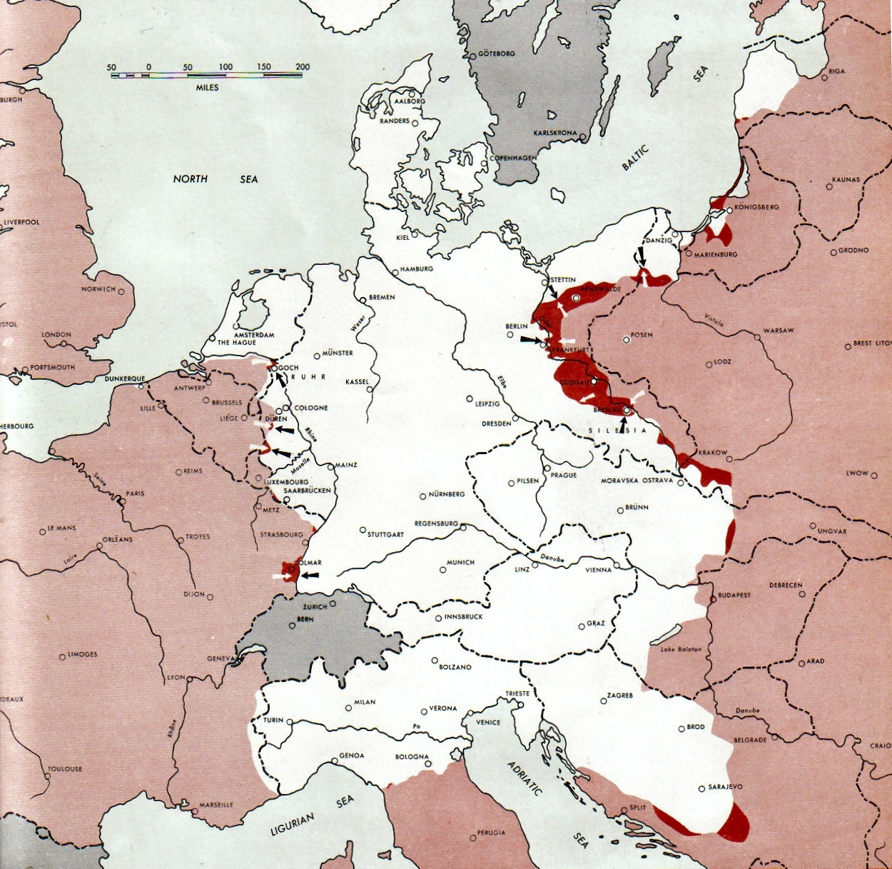
Atlas of the World Battle Fronts - War against Germany: 1945-02-15
← Previous map: 1945-02-01
→ Next map: 1945-03-01
摘要
[編輯]
| 描述 |
Neutral nations (Sweden, Switzerland, Spain, Andorra)
Under Allied control
Allied forces
Axis forces or control
  July 1, 1943 to June 30 1945 To the Secretary of War". (See Cover, Forward and Map details)  |
| 日期 | |
| 來源 | Document "Atlas of the World Battle Fronts in Semimonthly Phases to August 15th 1945: Supplement to The Biennial report of the Chief of Staff of the United States Army July 1, 1943 to June 30 1945 To the Secretary of War" |
| 作者 | Army Map Service |
| 授權許可 (重用此檔案) |
Public Domain: Work of US army |
授權條款
[編輯]
|
|
 |
檔案歷史
點選日期/時間以檢視該時間的檔案版本。
| 日期/時間 | 縮圖 | 尺寸 | 用戶 | 備註 | |
|---|---|---|---|---|---|
| 目前 | 2011年8月28日 (日) 09:15 | | 1,250 × 1,217(1.26 MB) | Finavon(對話 | 貢獻) | 1 degree rotation; caption cropped |
| 2007年12月24日 (一) 19:16 |  | 1,274 × 1,714(1.78 MB) | Mike Young(對話 | 貢獻) | {{Information |Description= thumb|left|75pxthumb|right|75pxMap of the front against Germany: This map is taken from the source "Atlas of the World Battle Fronts in Semimonthly |
無法覆蓋此檔案。
檔案用途
全域檔案使用狀況
以下其他 wiki 使用了這個檔案:
- be-tarask.wikipedia.org 的使用狀況
- da.wikipedia.org 的使用狀況
- en.wikipedia.org 的使用狀況
- en.wikisource.org 的使用狀況
- es.wikipedia.org 的使用狀況
- hu.wikipedia.org 的使用狀況
- hy.wikipedia.org 的使用狀況
- id.wikipedia.org 的使用狀況
- ko.wikipedia.org 的使用狀況
- no.wikipedia.org 的使用狀況
- ro.wikipedia.org 的使用狀況
- vi.wikipedia.org 的使用狀況
- zh.wikipedia.org 的使用狀況