File:1945 OS area map.jpg
Jump to navigation
Jump to search

Size of this preview: 610 × 599 pixels. Other resolutions: 244 × 240 pixels | 489 × 480 pixels | 686 × 674 pixels.
Original file (686 × 674 pixels, file size: 227 KB, MIME type: image/jpeg)
Captions
Captions
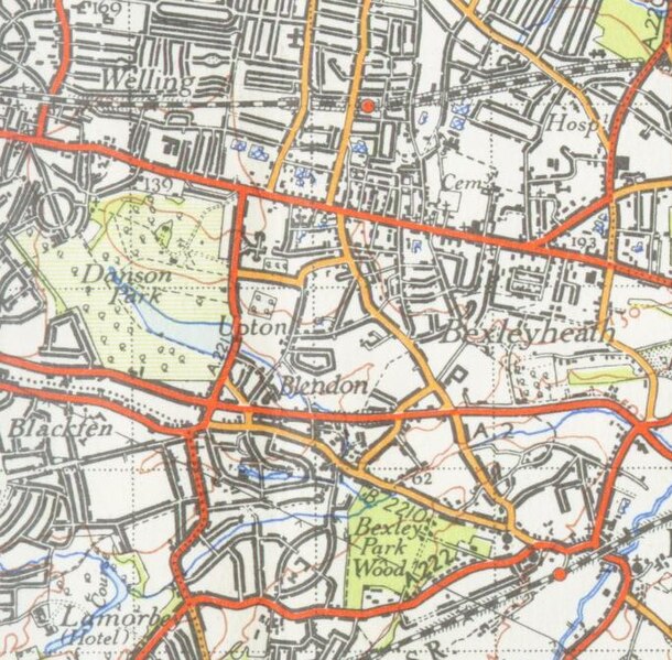
A 1945 OS area map of NW Kent around Bexleyheath
Summary[edit]
| Description |
English: The hamlet of Upton shown on a 1945 OS area map of NW Kent around Bexleyheath |
| Date | |
| Source |
This is a cropped version of the Commons media file File:Dartfordmap1945.jpg. The original work is an Ordnance Survey map over 50 years old, which is covered by Crown Copyright which in this case expires 50 years after publication. Ordnance Survey does however ask that they be credited and that the date of publication be given. Any ancillary rights gained through the creation of the electronic version are granted as freely usable under any circumstances. |
| Author | Ordnance Survey |
Licensing[edit]
This file is licensed under the Creative Commons Attribution-Share Alike 4.0 International license.
- You are free:
- to share – to copy, distribute and transmit the work
- to remix – to adapt the work
- Under the following conditions:
- attribution – You must give appropriate credit, provide a link to the license, and indicate if changes were made. You may do so in any reasonable manner, but not in any way that suggests the licensor endorses you or your use.
- share alike – If you remix, transform, or build upon the material, you must distribute your contributions under the same or compatible license as the original.
File history
Click on a date/time to view the file as it appeared at that time.
| Date/Time | Thumbnail | Dimensions | User | Comment | |
|---|---|---|---|---|---|
| current | 20:18, 6 November 2019 | | 686 × 674 (227 KB) | Roger 8 Roger (talk | contribs) | User created page with UploadWizard |
You cannot overwrite this file.
File usage on Commons
There are no pages that use this file.
File usage on other wikis
The following other wikis use this file:
- Usage on en.wikipedia.org