File:1966-04 Tour de controle d'Orly.jpg
Jump to navigation
Jump to search

Size of this preview: 616 × 600 pixels. Other resolutions: 246 × 240 pixels | 493 × 480 pixels | 789 × 768 pixels | 1,052 × 1,024 pixels | 1,904 × 1,854 pixels.
Original file (1,904 × 1,854 pixels, file size: 897 KB, MIME type: image/jpeg)
Captions
Captions
Add a one-line explanation of what this file represents
Summary
[edit]
| Description |
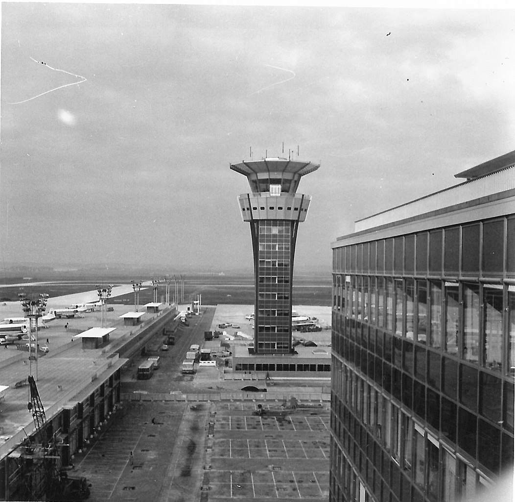
English: Radar tower of Orly-Sud (Paris, France) airport in april 1966.
Français : Tour de controle de l'aéroport d'Orly-Sud en avril 1966. |
| Date | |
| Source | Self-photographed |
| Author | Tangopaso |
| Camera location | | View this and other nearby images on: OpenStreetMap |
|---|
Licensing
[edit]
| I, the copyright holder of this work, release this work into the public domain. This applies worldwide. In some countries this may not be legally possible; if so: I grant anyone the right to use this work for any purpose, without any conditions, unless such conditions are required by law. |
File history
Click on a date/time to view the file as it appeared at that time.
| Date/Time | Thumbnail | Dimensions | User | Comment | |
|---|---|---|---|---|---|
| current | 19:29, 16 May 2017 | | 1,904 × 1,854 (897 KB) | Tangopaso (talk | contribs) | {{Information |Description= {{en|1=Radar tower of Orly-Sud (Paris, France) airport in april 1966.}} {{fr|1=Tour de controle de l'aéroport d'Orly-Sud en avril 1966.}} |source={{sf}} |date=1966-03 |author=Tangopaso |permission= |other... |
You cannot overwrite this file.
File usage on Commons
The following page uses this file:
File usage on other wikis
The following other wikis use this file:
- Usage on de.wikipedia.org
- Usage on en.wikipedia.org
- Usage on fr.wikipedia.org
- Usage on www.wikidata.org