File:19750114 Fukuhama S50 CKU7424-C7B-2 20220623.jpg
Jump to navigation
Jump to search

Size of this preview: 612 × 599 pixels. Other resolutions: 245 × 240 pixels | 490 × 480 pixels | 784 × 768 pixels | 1,046 × 1,024 pixels | 2,109 × 2,065 pixels.
Original file (2,109 × 2,065 pixels, file size: 1.41 MB, MIME type: image/jpeg)
Captions
Captions
Add a one-line explanation of what this file represents
Summary
[edit]
| Description |
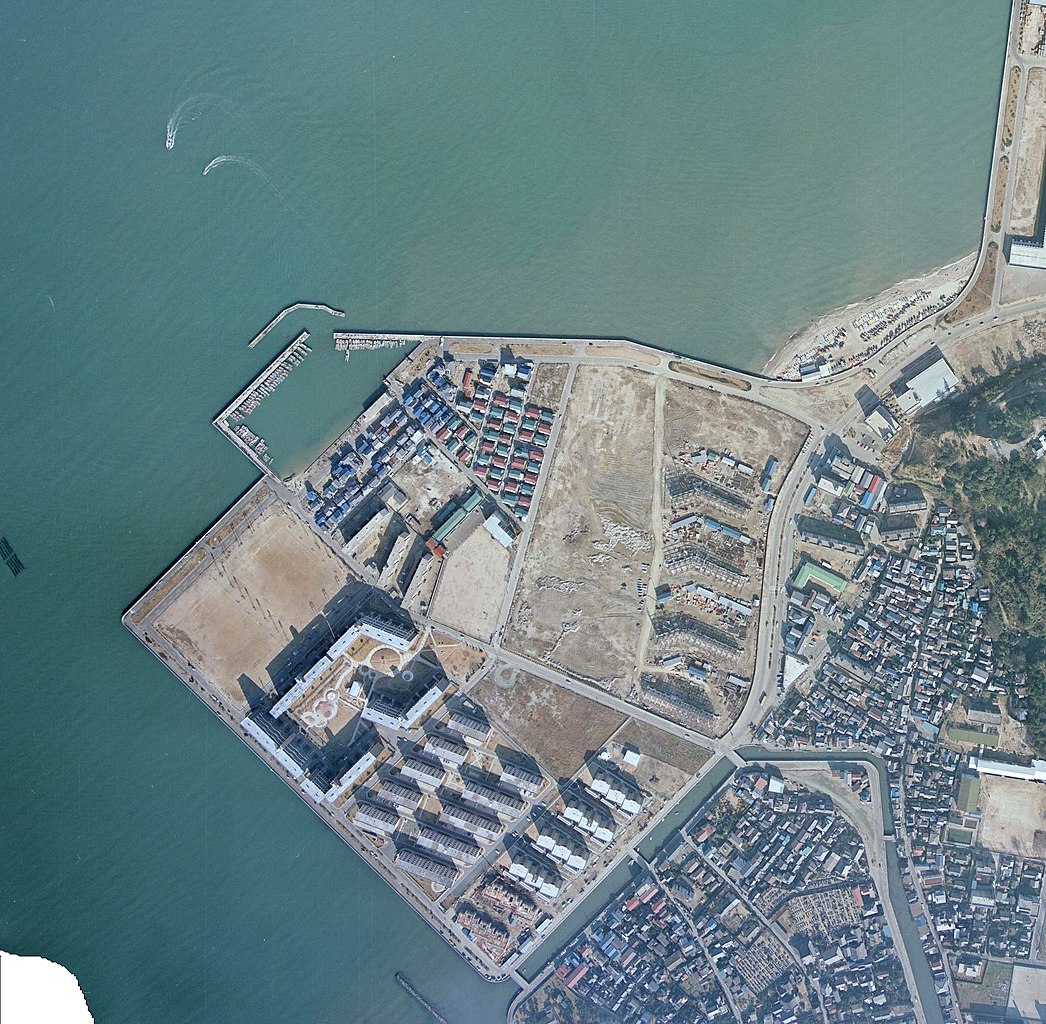
日本語: 1975年1月14日撮影の福浜地区の航空写真、国土地理院地図・空中写真閲覧サービス( https://mapps.gsi.go.jp/ )のCKU7424-C7B-2を加工して作成 |
| Date | |
| Source | 国土地理院地図・空中写真閲覧サービス( https://mapps.gsi.go.jp/ )のCKU811-C13-28を加工して作成 |
| Author | 国土交通省国土地理院 |
福浜と唐人町との間に暗渠化される前の黒門川を確認できる。当該箇所は、2023年現在、福岡市道港福浜線(福岡市道路愛称:よかトピア通り)が通っている。
Licensing
[edit]

|
The copyright holder of this file, the Ministry of Land, Infrastructure, Transport and Tourism of Japan, allows anyone to use it for any purpose, provided that the copyright holder is properly attributed. Redistribution, derivative work, commercial use, and all other use is permitted. |
Attribution:
Copyright © National Land Image Information (Color Aerial Photographs), Ministry of Land, Infrastructure, Transport and Tourism
|
 |
This image is copyrighted by the Ministry of Land, Infrastructure, Transport and Tourism of Japan. For terms of use, see the stipulation to use of National Land Information (in Japanese) and message from MLIT (in Japanese and English). When you display this image on an article, include the following phrase in the description: "Made based on National Land Image Information (Color Aerial Photographs), Ministry of Land, Infrastructure, Transport and Tourism".
|
国土地理院コンテンツ利用規約https://www.gsi.go.jp/kikakuchousei/kikakuchousei40182.html
File history
Click on a date/time to view the file as it appeared at that time.
| Date/Time | Thumbnail | Dimensions | User | Comment | |
|---|---|---|---|---|---|
| current | 06:33, 24 June 2022 | | 2,109 × 2,065 (1.41 MB) | Hirho (talk | contribs) | Uploaded a work by 国土交通省国土地理院 from 国土地理院地図・空中写真閲覧サービス(https://mapps.gsi.go.jp/)のCKU811-C13-28を加工して作成 with UploadWizard |
You cannot overwrite this file.
File usage on Commons
There are no pages that use this file.