File:1987 Madrid elecciones municipales distritos.svg
Jump to navigation
Jump to search

Size of this PNG preview of this SVG file: 436 × 599 pixels. Other resolutions: 174 × 240 pixels | 349 × 480 pixels | 559 × 768 pixels | 745 × 1,024 pixels | 1,490 × 2,048 pixels | 462 × 635 pixels.
Original file (SVG file, nominally 462 × 635 pixels, file size: 2.98 MB)
Captions
Captions
Add a one-line explanation of what this file represents
Summary[edit]
| Description |
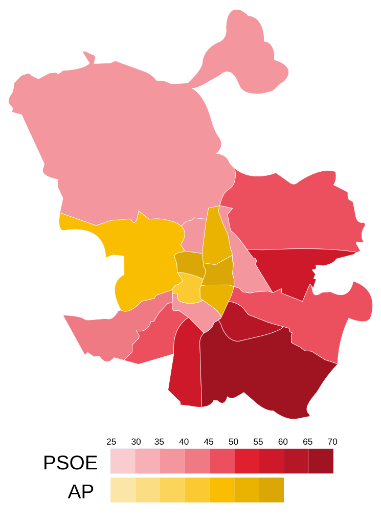
Español: Mapa que muestra los resultados de las elecciones municipales de Madrid de 1987. Los distritos han sido coloreados según el porcentaje de votos válidos alcanzado por la candidatura que obtuvo mayor respaldo en dichas zonas. |
| Date | |
| Source | Own work, basado en mapa de Crates - Trabajo propio, Dominio público, https://commons.wikimedia.org/w/index.php?curid=2105620 |
| Author | MP DDT |
Licensing[edit]
I, the copyright holder of this work, hereby publish it under the following license:
This file is licensed under the Creative Commons Attribution-Share Alike 4.0 International license.
- You are free:
- to share – to copy, distribute and transmit the work
- to remix – to adapt the work
- Under the following conditions:
- attribution – You must give appropriate credit, provide a link to the license, and indicate if changes were made. You may do so in any reasonable manner, but not in any way that suggests the licensor endorses you or your use.
- share alike – If you remix, transform, or build upon the material, you must distribute your contributions under the same or compatible license as the original.
File history
Click on a date/time to view the file as it appeared at that time.
| Date/Time | Thumbnail | Dimensions | User | Comment | |
|---|---|---|---|---|---|
| current | 14:35, 11 June 2022 | | 462 × 635 (2.98 MB) | MP DDT (talk | contribs) | Correción de la división territorial |
| 11:44, 11 June 2022 |  | 462 × 635 (2.05 MB) | MP DDT (talk | contribs) | Uploaded own work with UploadWizard |
You cannot overwrite this file.
File usage on Commons
The following page uses this file:
File usage on other wikis
The following other wikis use this file:
- Usage on es.wikipedia.org