File:2010 Sandstorm over Eastern China.jpg
Jump to navigation
Jump to search

Size of this preview: 720 × 600 pixels. Other resolutions: 288 × 240 pixels | 576 × 480 pixels | 922 × 768 pixels | 1,229 × 1,024 pixels | 2,458 × 2,048 pixels | 4,800 × 4,000 pixels.
Original file (4,800 × 4,000 pixels, file size: 2.88 MB, MIME type: image/jpeg)
Captions
Captions
Add a one-line explanation of what this file represents
Summary
[edit]
| Description |
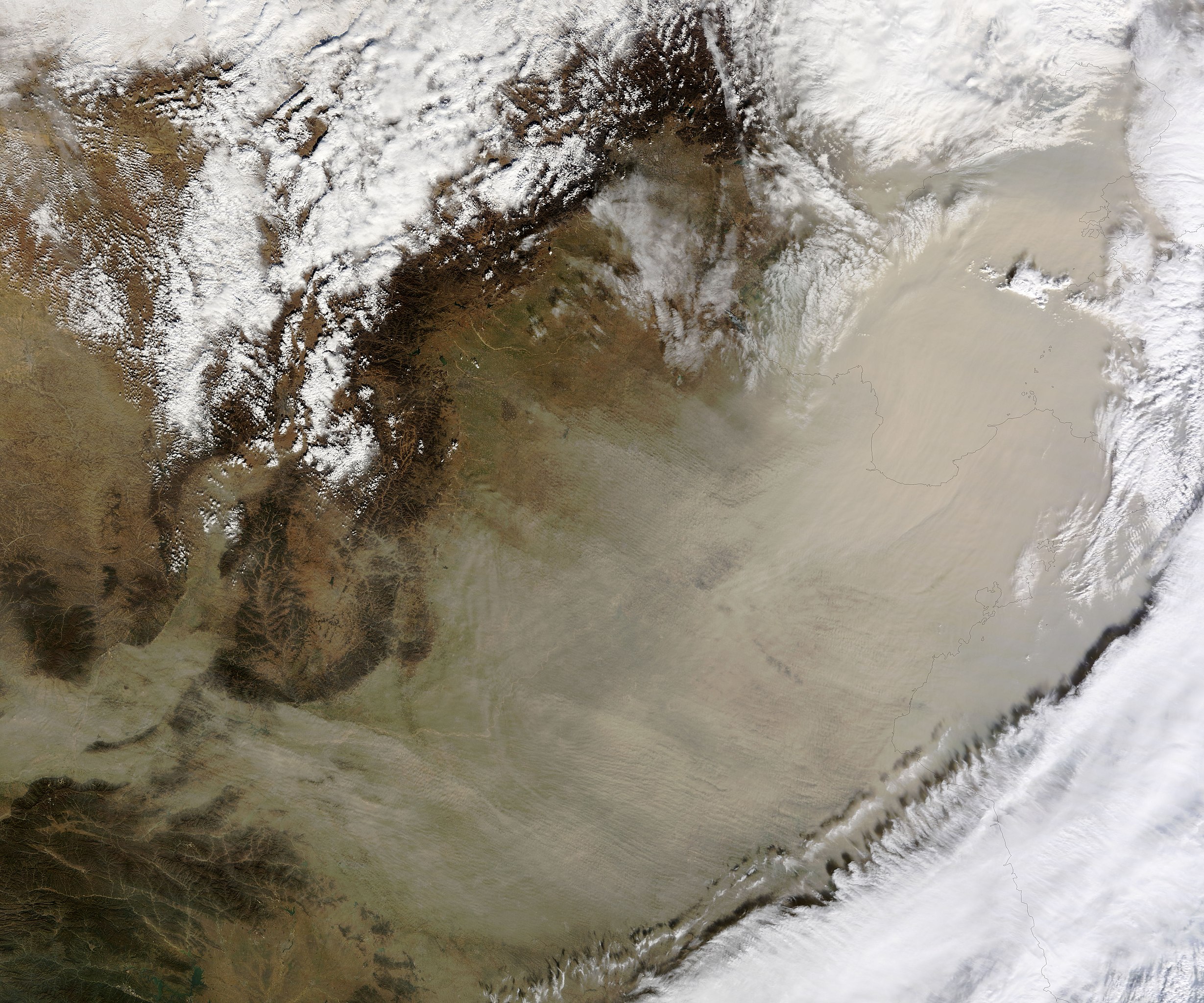
English: On November 11, 2010, a wall of sand blew across eastern China. The airborne sand entirely hides much of the North China Plain, Shandong Peninsula, and the Bo Hai from view in this true colour image. |
| Date | |
| Source | NASA Earth Observatory |
| Author | Jeff Schmaltz |
Image captured by the Moderate Resolution Imaging Spectroradiometer (MODIS) on NASA’s Terra satellite. Image courtesy of the MODIS Rapid Response Team at NASA GSFC.
Licensing
[edit]
| This file is in the public domain in the United States because it was solely created by NASA. NASA copyright policy states that "NASA material is not protected by copyright unless noted". (See Template:PD-USGov, NASA copyright policy page or JPL Image Use Policy.) | ||
 |
Warnings:
|
| Annotations | This image is annotated: View the annotations at Commons |
File history
Click on a date/time to view the file as it appeared at that time.
| Date/Time | Thumbnail | Dimensions | User | Comment | |
|---|---|---|---|---|---|
| current | 11:06, 12 November 2010 | | 4,800 × 4,000 (2.88 MB) | Originalwana (talk | contribs) | {{Information |Description={{en|1=On November 11, 2010, a wall of sand blew across eastern China. The airborne sand entirely hides much of the North China Plain, Shandong Peninsula, and the Bo Hai from view in this true colour image. }} |Source=[http://ea |
You cannot overwrite this file.
File usage on Commons
The following page uses this file:
File usage on other wikis
The following other wikis use this file:
- Usage on ar.wikipedia.org
- Usage on en.wikipedia.org
- Usage on ja.wikipedia.org
- Usage on zh.wikipedia.org