File:2012-09 Księże Pole 06 Kościół św. Bartłomieja.jpg
From Wikimedia Commons, the free media repository
Jump to navigation
Jump to search
Size of this preview: 400 × 600 pixels. Other resolutions: 160 × 240 pixels | 320 × 480 pixels | 512 × 768 pixels | 682 × 1,024 pixels | 1,365 × 2,048 pixels | 3,456 × 5,184 pixels.
Original file (3,456 × 5,184 pixels, file size: 4.53 MB, MIME type: image/jpeg)
File information
Structured data
Captions
Summary
[edit]Description2012-09 Księże Pole 06 Kościół św. Bartłomieja.jpg |
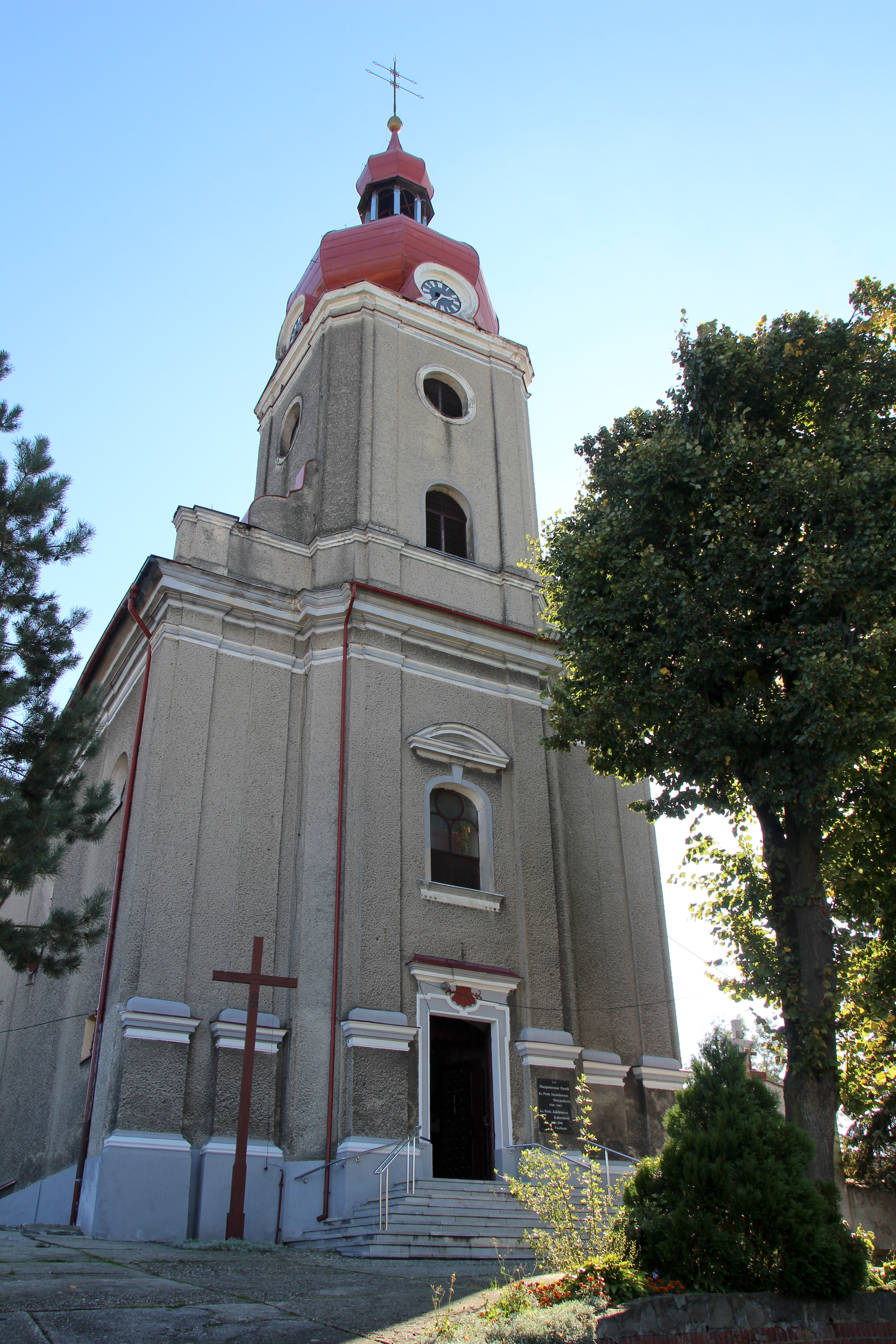
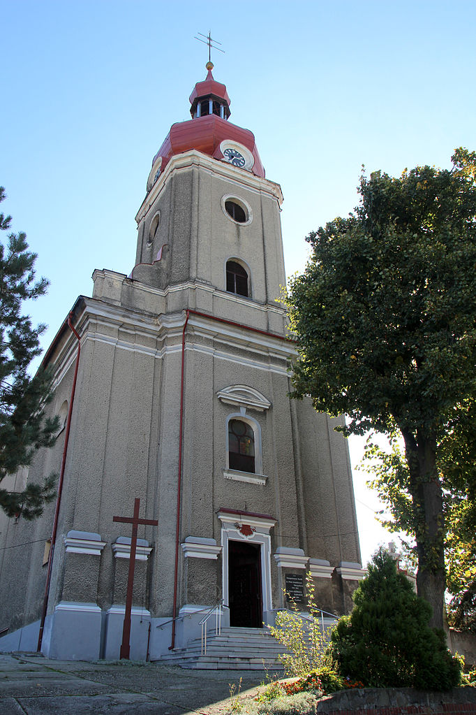
Polski: Księże Pole - rzymskokatolicki kościół pararafialny pw. św. Bartłomieja, 1756-63, 1906
Deutsch: Księże Pole (Knispel) ist ein Dorf in Polen in der Wojewodschaft Opole, Gemeinde Baborów.
Nederlands: Księże Pole is een plaats in het Poolse district Głubczycki, woiwodschap Opole.
Čeština: Kněžpole (polsky Księże Pole je vesnice a katastrální území v polské gmině Baborów.
|
Date | |
Source | Own work |
Author | Ralf Lotys (Sicherlich) |
Permission (Reusing this file) |
This file is licensed under the Creative Commons Attribution 4.0 International license. Attribution: Ralf Lotys (Sicherlich)
|
Camera location | 50° 06′ 32.56″ N, 17° 57′ 59.46″ E | View this and other nearby images on: OpenStreetMap | 50.109044; 17.966517 |
---|
File history
Click on a date/time to view the file as it appeared at that time.
Date/Time | Thumbnail | Dimensions | User | Comment | |
---|---|---|---|---|---|
current | 12:00, 5 April 2015 | 3,456 × 5,184 (4.53 MB) | Sicherlich (talk | contribs) |
You cannot overwrite this file.
File usage on Commons
The following 2 pages use this file:
File usage on other wikis
The following other wikis use this file:
- Usage on de.wikipedia.org
- Usage on www.wikidata.org
Metadata
This file contains additional information such as Exif metadata which may have been added by the digital camera, scanner, or software program used to create or digitize it. If the file has been modified from its original state, some details such as the timestamp may not fully reflect those of the original file. The timestamp is only as accurate as the clock in the camera, and it may be completely wrong.
Camera manufacturer | Canon |
---|---|
Camera model | Canon EOS 600D |
Author | Ralf Lotys |
Copyright holder |
|
Exposure time | 1/60 sec (0.016666666666667) |
F-number | f/8 |
ISO speed rating | 100 |
Date and time of data generation | 09:30, 9 September 2012 |
Lens focal length | 18 mm |
Latitude | 50° 6′ 32.56″ N |
Longitude | 17° 57′ 59.46″ E |
Altitude | 260.248 meters above sea level |
Label | Kościół św. Bartłomieja |
Online copyright statement | https://creativecommons.org/licenses/by/4.0/deed.en |
Image title |
|
Short title |
|
Usage terms |
|
City shown | Księże Pole |
Horizontal resolution | 6,170 dpi |
Vertical resolution | 6,170 dpi |
Software used | Adobe Photoshop Lightroom 3.6 (Macintosh) |
File change date and time | 13:45, 5 April 2015 |
Exposure Program | Landscape mode (for landscape photos with the background in focus) |
Exif version | 2.3 |
Date and time of digitizing | 09:30, 9 September 2012 |
APEX shutter speed | 5.906891 |
APEX aperture | 6 |
APEX exposure bias | 0 |
Maximum land aperture | 3.625 APEX (f/3.51) |
Subject distance | 21.9 meters |
Metering mode | Pattern |
Flash | Flash did not fire, compulsory flash suppression |
DateTimeOriginal subseconds | 71 |
DateTimeDigitized subseconds | 71 |
Focal plane X resolution | 5,728.1767955801 |
Focal plane Y resolution | 5,808.4033613445 |
Focal plane resolution unit | inches |
Custom image processing | Normal process |
Exposure mode | Auto exposure |
White balance | Auto white balance |
Scene capture type | Standard |
GPS time (atomic clock) | 08:29 |
Geodetic survey data used | WGS-84 |
GPS date | 30 September 2012 |
GPS tag version | 0.0.2.2 |
Serial number of camera | 083063015325 |
Lens used | 18-250mm |
Date metadata was last modified | 15:45, 5 April 2015 |
Unique ID of original document | 3672B217AB558248ECB3D4D7C7884C1A |
Copyright status | Copyrighted |
Keywords |
|
Country shown | Poland |
Province or state shown | Województwo Opolskie |
Code for country shown | PL |
IIM version | 4 |
Structured data
Items portrayed in this file
depicts
50°6'32.55962"N, 17°57'59.46268"E
September 2012
image/jpeg
638ecb4f21cf5d9e8e0d427686599c710a33db75
4,751,110 byte
5,184 pixel
3,456 pixel
Hidden categories: