File:2013 Northern Wakayama Earthquake Alarm Regions Map.png
Jump to navigation
Jump to search

No higher resolution available.
2013_Northern_Wakayama_Earthquake_Alarm_Regions_Map.png (394 × 437 pixels, file size: 148 KB, MIME type: image/png)
Captions
Captions
Add a one-line explanation of what this file represents
Summary[edit]
| Description |
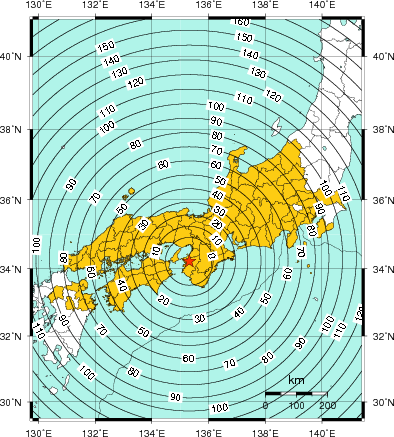
中文(中国大陆):2013年和歌山县北部地震警报对象地区分布图。 |
| Date | |
| Source | http://www.data.jma.go.jp/svd/eew/data/nc/pub_hist/2013/08/20130808165608/reachtime/pub_si_1.png |
| Author | 日本气象厅 |
Licensing[edit]

|
This work is licensed under the Government of Japan Standard Terms of Use (Ver.2.0). The Terms of Use are compatible with the Creative Commons Attribution License 4.0 International. For terms of use this work, see this license page.
|
This file is licensed under the Creative Commons Attribution 4.0 International license.
- You are free:
- to share – to copy, distribute and transmit the work
- to remix – to adapt the work
- Under the following conditions:
- attribution – You must give appropriate credit, provide a link to the license, and indicate if changes were made. You may do so in any reasonable manner, but not in any way that suggests the licensor endorses you or your use.
File history
Click on a date/time to view the file as it appeared at that time.
| Date/Time | Thumbnail | Dimensions | User | Comment | |
|---|---|---|---|---|---|
| current | 14:23, 2 August 2018 | | 394 × 437 (148 KB) | Patlabor Ingram (talk | contribs) | User created page with UploadWizard |
You cannot overwrite this file.
File usage on Commons
There are no pages that use this file.
File usage on other wikis
The following other wikis use this file:
- Usage on zh.wikipedia.org