File:2018-P10-Noord-Brabant.jpg
Jump to navigation
Jump to search
Size of this preview: 800 × 445 pixels. Other resolutions: 320 × 178 pixels | 640 × 356 pixels | 1,024 × 570 pixels | 1,280 × 712 pixels | 3,435 × 1,912 pixels.
Original file (3,435 × 1,912 pixels, file size: 1.44 MB, MIME type: image/jpeg)
Captions
Captions
Add a one-line explanation of what this file represents
Summary
[edit]
| Description |
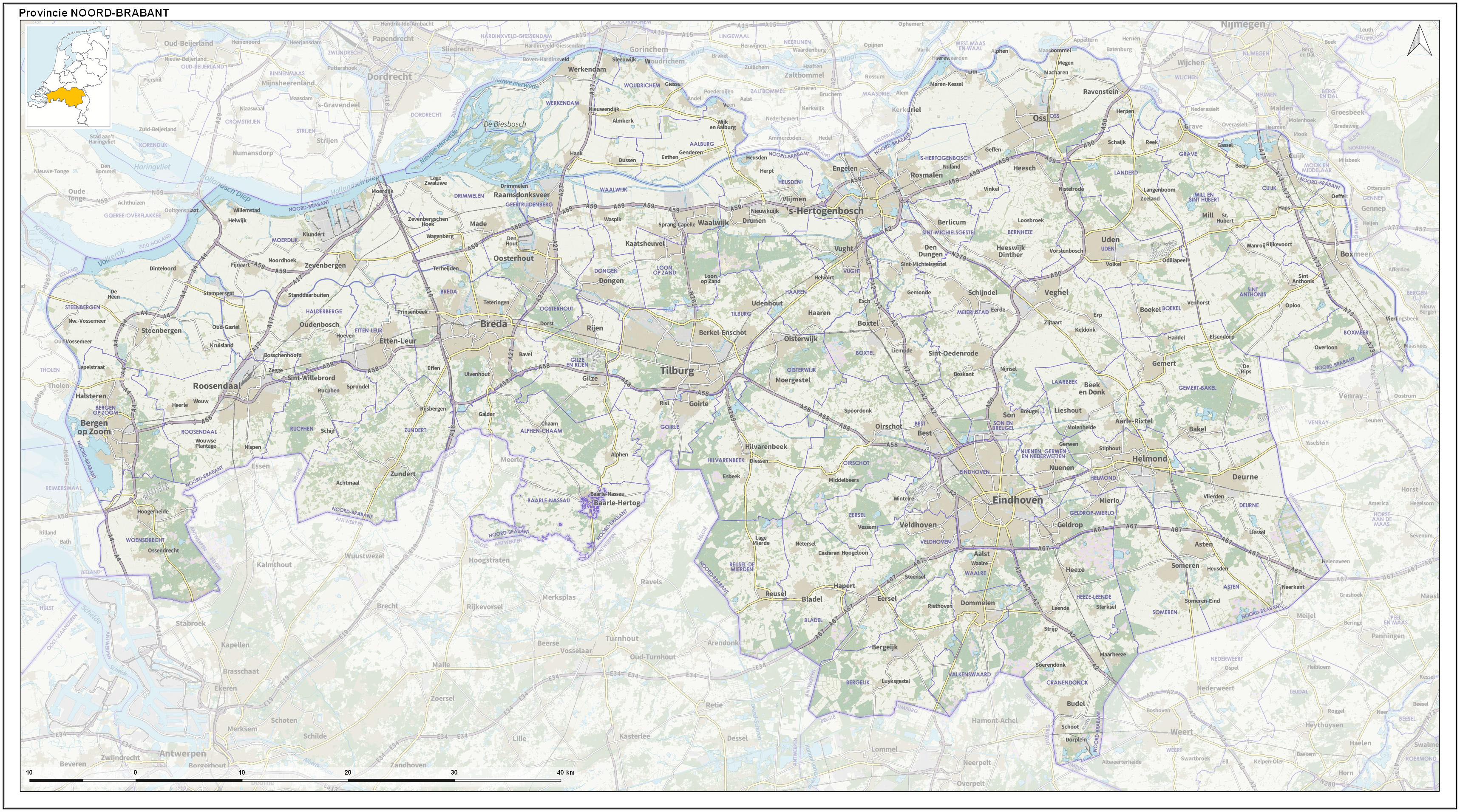
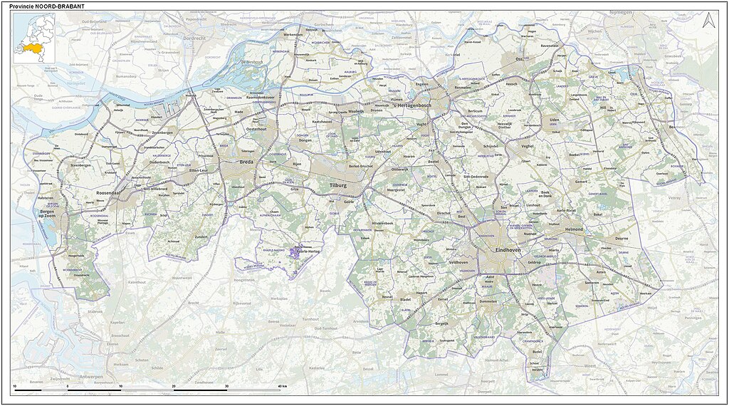
English: Toographic overview map of the Dutch Province of North Brabant as of 2018. Compiled by Jan-Willem van Aalst using Dutch Governmental open data (CC-BY Kadaster) and OpenStreetMap data (CC-BY OpenStreetMap contributors).
Nederlands: Topografische overzichtskaart van de Nederlandse provincie Noord-Brabant per 2018. Kaartbeeld samengesteld door Jan-Willem van Aalst uit Nederlandse open overheidsdata (CC-BY Kadaster) en OpenStreetMap data (CC-BY OpenStreetMap bijdragers). |
| Date | |
| Source | Own work |
| Author | Janwillemvanaalst |
Licensing
[edit]
I, the copyright holder of this work, hereby publish it under the following license:
This file is licensed under the Creative Commons Attribution-Share Alike 4.0 International license.
- You are free:
- to share – to copy, distribute and transmit the work
- to remix – to adapt the work
- Under the following conditions:
- attribution – You must give appropriate credit, provide a link to the license, and indicate if changes were made. You may do so in any reasonable manner, but not in any way that suggests the licensor endorses you or your use.
- share alike – If you remix, transform, or build upon the material, you must distribute your contributions under the same or compatible license as the original.
File history
Click on a date/time to view the file as it appeared at that time.
| Date/Time | Thumbnail | Dimensions | User | Comment | |
|---|---|---|---|---|---|
| current | 13:15, 31 December 2017 | | 3,435 × 1,912 (1.44 MB) | Janwillemvanaalst (talk | contribs) | User created page with UploadWizard |
You cannot overwrite this file.
File usage on Commons
There are no pages that use this file.
File usage on other wikis
The following other wikis use this file:
- Usage on ar.wikipedia.org
- Usage on ca.wikipedia.org
- Usage on en.wikipedia.org
- Usage on fi.wikipedia.org
- Usage on fo.wikipedia.org
- Usage on it.wikipedia.org
- Usage on ku.wikipedia.org
- Usage on pt.wikipedia.org
- Usage on uz.wikipedia.org
- Usage on zh.wikipedia.org