File:20180810 1702Z F18 85h 10E.png
Jump to navigation
Jump to search

Size of this preview: 600 × 600 pixels. Other resolutions: 240 × 240 pixels | 480 × 480 pixels | 768 × 768 pixels | 1,024 × 1,024 pixels | 1,600 × 1,600 pixels.
Original file (1,600 × 1,600 pixels, file size: 412 KB, MIME type: image/png)
Captions
Captions
Add a one-line explanation of what this file represents
Summary[edit]
| Description |
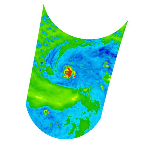
English: 1600 1600 2 2 17.5700 -165.1100 3.1970 31.9430 179.8136 -150.0336
10E HECTOR 180810 1200 17.6N 165.2W EPAC 115 951 F18 SSMIS 85h ssmis_91h 2018 08 10 17 02 222 Aug 6105182 38 -99 -99 10 |
| Date | |
| Source | https://www.nrlmry.navy.mil/archdat/test/kml/TC/2018/EPAC/10E |
| Author | NRL's Marine Meteorology Division |
Licensing[edit]
This file is a work of a sailor or employee of the U.S. Navy, taken or made as part of that person's official duties. As a work of the U.S. federal government, it is in the public domain in the United States.
|
 | |
| This file has been identified as being free of known restrictions under copyright law, including all related and neighboring rights. | ||
File history
Click on a date/time to view the file as it appeared at that time.
| Date/Time | Thumbnail | Dimensions | User | Comment | |
|---|---|---|---|---|---|
| current | 02:58, 11 August 2018 | | 1,600 × 1,600 (412 KB) | Supportstorm (talk | contribs) | == {{int:filedesc}} == {{Information |description ={{en|1=1600 1600 2 2 17.5700 -165.1100 3.1970 31.9430 179.8136 -150.0336 10E HECTOR 180810 1200 17.6N 165.2W EPAC 115 951 F18 SSMIS 85h ssmis_91h 2018 08 10 17 02 222 Aug 6105182 38 -99 -99 10}} |date =2018-08-10 |source =https://www.nrlmry.navy.mil/archdat/test/kml/TC/2018/EPAC/10E |author =NRL's Marine Meteorology Division }} == {{int:license-header}} == {{PD-USGov-Military-Navy}} [[Category:Satellite pictures of H... |
You cannot overwrite this file.
File usage on Commons
The following page uses this file: