File:2019 CWB TD20 forecast map (en-US).png
Jump to navigation
Jump to search
Size of this preview: 800 × 586 pixels. Other resolutions: 320 × 234 pixels | 640 × 469 pixels | 956 × 700 pixels.
Original file (956 × 700 pixels, file size: 54 KB, MIME type: image/png)
Captions
Captions
Add a one-line explanation of what this file represents
Summary
[edit]| Description |
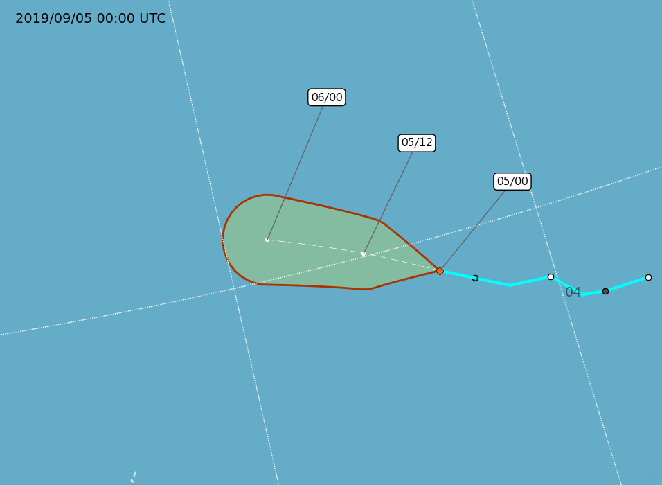
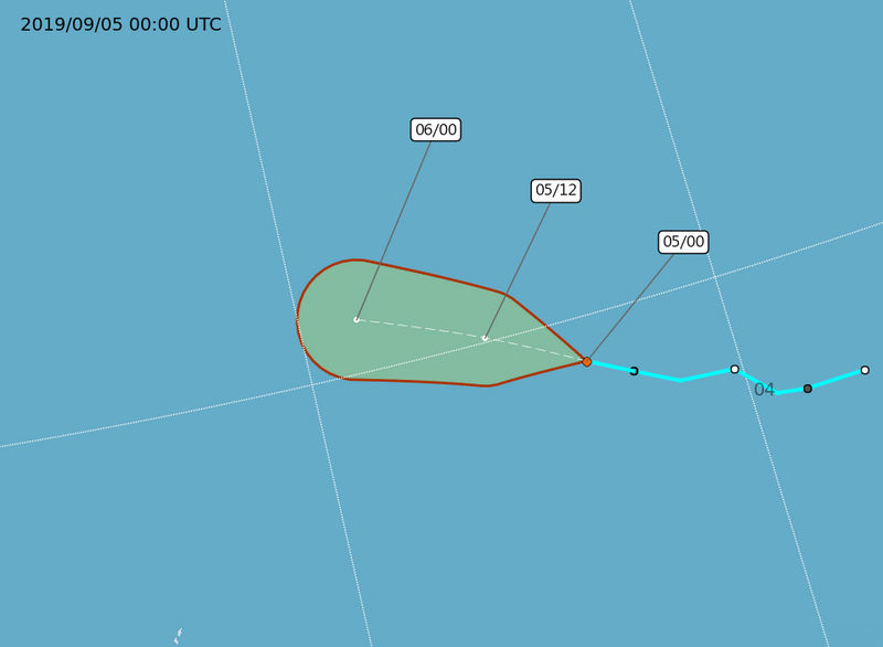
English: Central Weather Administration's forecast map of Northwest Pacific tropical depression TD20. |
| Date | |
| Source | https://www.cwb.gov.tw/Data/typhoon/TY_NEWS/Download_PTA_201909030000_TD20_enus.png |
| Author | Central Weather Administration |
| Other versions |
Traditional Chinese: .png) |

.png&action=edit§ion=1)
Licensing
[edit].png&action=edit§ion=2)

|
The copyright holder of this file, Central Weather Administration, allows anyone to use it for any purpose, provided that the copyright holder is properly attributed. Redistribution, derivative work, commercial use, and all other use is permitted. |
Attribution:
|
|
|
This file is licensed under the Government Website Open Information Announcement.
Information on Related Items:
|
 |
|
|
File history
Click on a date/time to view the file as it appeared at that time.
| Date/Time | Thumbnail | Dimensions | User | Comment | |
|---|---|---|---|---|---|
| current | 02:36, 5 September 2019 | | 956 × 700 (54 KB) | Cewbot (talk | contribs) | Import CWB tropical cyclone forecast map of Northwest Pacific tropical depression TD20: Position 050000z at one nine point zero zero north (19.0N) one five six point five zero east (156.5E), Movement: WNW 22km/hr. Minimum pressure 1000 hpa, Max sustained winds near center 15 meter per second, Gusts 23 meter per second. https://www.cwb.gov.tw/Data/typhoon/TY_NEWS/Download_PTA_201909050000_TD20_enus.png (2019-09-05 00:00 UTC) |
| 22:36, 4 September 2019 |  | 956 × 700 (57 KB) | Cewbot (talk | contribs) | Import CWB tropical cyclone forecast map of Northwest Pacific tropical depression TD20: Position 041800z at one eight point five zero north (18.5N) one five seven point five zero east (157.5E), Movement: NW 28km/hr. Minimum pressure 1000 hpa, Max sustained winds near center 15 meter per second, Gusts 23 meter per second. https://www.cwb.gov.tw/Data/typhoon/TY_NEWS/Download_PTA_201909041800_TD20_enus.png (2019-09-04 18:00 UTC) | |
| 14:35, 4 September 2019 |  | 956 × 700 (55 KB) | Cewbot (talk | contribs) | Import CWB tropical cyclone forecast map of Northwest Pacific tropical depression TD20: Position 041200z at one eight point five zero north (18.5N) one five seven point five zero east (157.5E), Movement: NW 23km/hr. Minimum pressure 1000 hpa, Max sustained winds near center 15 meter per second, Gusts 23 meter per second. https://www.cwb.gov.tw/Data/typhoon/TY_NEWS/Download_PTA_201909041200_TD20_enus.png (2019-09-04 12:00 UTC) | |
| 08:35, 4 September 2019 |  | 956 × 700 (57 KB) | Cewbot (talk | contribs) | Import CWB tropical cyclone forecast map of Northwest Pacific tropical depression TD20: Position 040600z at one eight point zero zero north (18.0N) one five eight point five zero east (158.5E), Movement: NW 21km/hr. Minimum pressure 1000 hpa, Max sustained winds near center 15 meter per second, Gusts 23 meter per second. https://www.cwb.gov.tw/Data/typhoon/TY_NEWS/Download_PTA_201909040600_TD20_enus.png (2019-09-04 06:00 UTC) | |
| 04:35, 4 September 2019 |  | 956 × 700 (56 KB) | Cewbot (talk | contribs) | Import CWB tropical cyclone forecast map of Northwest Pacific tropical depression TD20: Position 040000z at one seven point nine zero north (17.9N) one five nine point eight zero east (159.8E), Movement: WNW 15km/hr. Minimum pressure 1000 hpa, Max sustained winds near center 15 meter per second, Gusts 23 meter per second. https://www.cwb.gov.tw/Data/typhoon/TY_NEWS/Download_PTA_201909040000_TD20_enus.png (2019-09-04 00:00 UTC) | |
| 20:35, 3 September 2019 |  | 956 × 700 (58 KB) | Cewbot (talk | contribs) | Import CWB tropical cyclone forecast map of Northwest Pacific tropical depression TD20: Position 031800z at one seven point one zero north (17.1N) one six zero point six zero east (160.6E), Movement: WNW 22km/hr. Minimum pressure 1000 hpa, Max sustained winds near center 15 meter per second, Gusts 23 meter per second. https://www.cwb.gov.tw/Data/typhoon/TY_NEWS/Download_PTA_201909031800_TD20_enus.png (2019-09-03 18:00 UTC) | |
| 14:35, 3 September 2019 |  | 956 × 700 (58 KB) | Cewbot (talk | contribs) | Import CWB tropical cyclone forecast map of Northwest Pacific tropical depression TD20: Position 031200z at one seven point zero zero north (17.0N) one six one point three zero east (161.3E), Movement: WNW 22km/hr. Minimum pressure 1000 hpa, Max sustained winds near center 15 meter per second, Gusts 23 meter per second. https://www.cwb.gov.tw/Data/typhoon/TY_NEWS/Download_PTA_201909031200_TD20_enus.png (2019-09-03 12:00 UTC) | |
| 08:35, 3 September 2019 |  | 956 × 700 (56 KB) | Cewbot (talk | contribs) | Import CWB tropical cyclone forecast map of Northwest Pacific tropical depression TD20: Position 030600z at one seven point zero zero north (17.0N) one six one point five zero east (161.5E), Movement: WNW 18km/hr. Minimum pressure 1005 hpa, Max sustained winds near center 15 meter per second, Gusts 23 meter per second. https://www.cwb.gov.tw/Data/typhoon/TY_NEWS/Download_PTA_201909030600_TD20_enus.png (2019-09-03 06:00 UTC) | |
| 02:35, 3 September 2019 |  | 956 × 700 (55 KB) | Cewbot (talk | contribs) | Import CWB tropical cyclone forecast map of Northwest Pacific tropical depression TD20: Position 030000z at one seven point zero zero north (17.0N) one six two point seven zero east (162.7E), Movement: WNW 20km/hr. Minimum pressure 1005 hpa, Max sustained winds near center 15 meter per second, Gusts 23 meter per second. https://www.cwb.gov.tw/Data/typhoon/TY_NEWS/Download_PTA_201909030000_TD20_enus.png (2019-09-03 00:00 UTC) |
You cannot overwrite this file.
File usage on Commons
The following page uses this file:
.png&oldid=899044456)