File:20200705 Berschweiler Tal mit Kreuzwäldchen und Holzer Wiese 01.jpg
![File:20200705 Berschweiler Tal mit Kreuzwäldchen und Holzer Wiese 01.jpg](https://upload.wikimedia.org/wikipedia/commons/thumb/2/2b/20200705_Berschweiler_Tal_mit_Kreuzw%C3%A4ldchen_und_Holzer_Wiese_01.jpg/800px-20200705_Berschweiler_Tal_mit_Kreuzw%C3%A4ldchen_und_Holzer_Wiese_01.jpg?20221113171507)
Original file (6,016 × 4,016 pixels, file size: 14.11 MB, MIME type: image/jpeg)
Captions
Captions
Summary
[edit]Description20200705 Berschweiler Tal mit Kreuzwäldchen und Holzer Wiese 01.jpg |
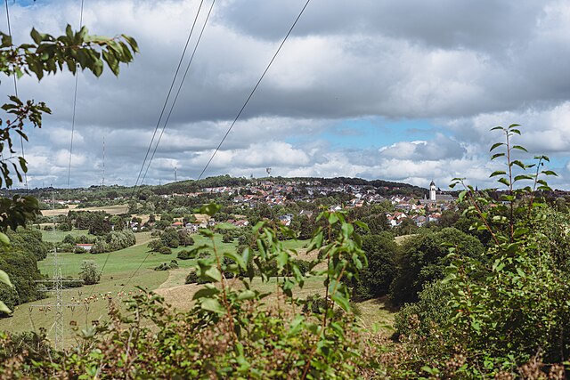
Deutsch: Blick über Wiesen des Landschaftsschutzgebiets Berschweiler Tal mit Kreuzwäldchen und Holzer Wiese nach Heusweiler-Holz.
English: View over the meadows of the protected landscape area Berschweiler Tal mit Kreuzwäldchen und Holzer Wiese to Heusweiler-Holz. |
Date | Taken on 5 July 2020, 15:38:13 |
Source | Own work |
Author | Flocci Nivis |
Licensing
[edit]![w:en:Creative Commons](https://upload.wikimedia.org/wikipedia/commons/thumb/7/79/CC_some_rights_reserved.svg/90px-CC_some_rights_reserved.svg.png)
![attribution](https://upload.wikimedia.org/wikipedia/commons/thumb/1/11/Cc-by_new_white.svg/24px-Cc-by_new_white.svg.png)
- You are free:
- to share – to copy, distribute and transmit the work
- to remix – to adapt the work
- Under the following conditions:
- attribution – You must give appropriate credit, provide a link to the license, and indicate if changes were made. You may do so in any reasonable manner, but not in any way that suggests the licensor endorses you or your use.
![]() |
This image was uploaded as part of Wiki Loves Earth 2021.
aragonés ∙ asturianu ∙ azərbaycanca ∙ Bahasa Indonesia ∙ Bahasa Melayu ∙ brezhoneg ∙ català ∙ čeština ∙ Cymraeg ∙ Deutsch ∙ eesti ∙ English ∙ español ∙ euskara ∙ français ∙ galego ∙ hrvatski ∙ italiano ∙ latviešu ∙ Nederlands ∙ norsk ∙ norsk bokmål ∙ português ∙ polski ∙ português do Brasil ∙ română ∙ shqip ∙ sicilianu ∙ slovenščina ∙ svenska ∙ Türkçe ∙ Ελληνικά ∙ беларуская (тарашкевіца) ∙ български ∙ македонски ∙ русский ∙ српски / srpski ∙ українська ∙ ქართული ∙ հայերեն ∙ नेपाली ∙ मराठी ∙ বাংলা ∙ മലയാളം ∙ ไทย ∙ 한국어 ∙ 日本語 ∙ 中文 ∙ 中文(台灣) ∙ 中文(简体) ∙ 中文(繁體) ∙ עברית ∙ اردو ∙ العربية ∙ فارسی ∙ +/− |
![]() |
Annotations InfoField | This image is annotated: View the annotations at Commons |
St. Josef
Wasserturm Heusweiler-Holz
Fördergerüst Schacht Holz
Sender Göttelborner Höhe
File history
Click on a date/time to view the file as it appeared at that time.
Date/Time | Thumbnail | Dimensions | User | Comment | |
---|---|---|---|---|---|
current | 17:15, 13 November 2022 | ![]() | 6,016 × 4,016 (14.11 MB) | FlocciNivis (talk | contribs) | various editing |
11:46, 3 May 2021 | ![]() | 5,887 × 3,936 (5.77 MB) | FlocciNivis (talk | contribs) | Uploaded own work with UploadWizard |
You cannot overwrite this file.
File usage on Commons
The following 2 pages use this file:
Metadata
This file contains additional information such as Exif metadata which may have been added by the digital camera, scanner, or software program used to create or digitize it. If the file has been modified from its original state, some details such as the timestamp may not fully reflect those of the original file. The timestamp is only as accurate as the clock in the camera, and it may be completely wrong.
Camera manufacturer | NIKON CORPORATION |
---|---|
Camera model | NIKON D750 |
Author | David Rasp |
Copyright holder |
|
Exposure time | 1/1,000 sec (0.001) |
F-number | f/5.6 |
ISO speed rating | 100 |
Date and time of data generation | 15:38, 5 July 2020 |
Lens focal length | 50 mm |
Latitude | 49° 20′ 6.18″ N |
Longitude | 6° 58′ 9.87″ E |
Altitude | 357.7 meters above sea level |
Horizontal resolution | 240 dpi |
Vertical resolution | 240 dpi |
Software used | Adobe Lightroom 6.0 (Windows) |
File change date and time | 18:07, 13 November 2022 |
Exposure Program | Aperture priority |
Exif version | 2.31 |
Date and time of digitizing | 15:38, 5 July 2020 |
APEX shutter speed | 9.965784 |
APEX aperture | 4.970854 |
APEX exposure bias | −0.33333333333333 |
Maximum land aperture | 1.6 APEX (f/1.74) |
Metering mode | Pattern |
Light source | Unknown |
Flash | Flash did not fire, compulsory flash suppression |
DateTimeOriginal subseconds | 05 |
DateTimeDigitized subseconds | 05 |
Color space | sRGB |
Focal plane X resolution | 1,675.0149841309 |
Focal plane Y resolution | 1,675.0149841309 |
Focal plane resolution unit | 3 |
Sensing method | One-chip color area sensor |
File source | Digital still camera |
Scene type | A directly photographed image |
Custom image processing | Normal process |
Exposure mode | Auto exposure |
White balance | Auto white balance |
Digital zoom ratio | 1 |
Focal length in 35 mm film | 50 mm |
Scene capture type | Standard |
Scene control | None |
Contrast | Normal |
Saturation | Normal |
Sharpness | Normal |
Subject distance range | Unknown |
GPS time (atomic clock) | 13:38 |
GPS date | 5 July 2020 |
GPS tag version | 0.0.2.2 |
Serial number of camera | 6088139 |
Lens used | 50.0 mm f/1.8 |
Date metadata was last modified | 19:07, 13 November 2022 |
Unique ID of original document | 83CEBB6A3F0405A86A47B97AAB31EC87 |
IIM version | 4 |
Structured data
5 July 2020
0.001 second
5.6
50 millimetre
100
image/jpeg
b40f792d5c6c22d08105b7a52b5a91e2761d95f5
14,797,955 byte
4,016 pixel
6,016 pixel
- Saarland photographs taken on 2020-07-05
- CC-BY-4.0
- Self-published work
- Images from Wiki Loves Earth 2021
- Images from Wiki Loves Earth 2021 in Germany
- Images with annotations
- Images from Wiki Loves Earth 2021, DE landscape
- Images from Wiki Loves Earth 2021, DE-SL
- Uploaded via Campaign:wle-de-sl
- Quality image candidates by User:FlocciNivis - Rejected
- Images by User:FlocciNivis