File:2021 July 6, Japan Standard Time morning 09 o'clock 48 minutes shooting. Aerial photograph of Atami debris flow disaster.jpg
Jump to navigation
Jump to search

Size of this preview: 799 × 599 pixels. Other resolutions: 320 × 240 pixels | 640 × 480 pixels | 1,024 × 768 pixels | 1,280 × 960 pixels | 2,560 × 1,921 pixels | 2,827 × 2,121 pixels.
Original file (2,827 × 2,121 pixels, file size: 2.02 MB, MIME type: image/jpeg)
Captions
Captions
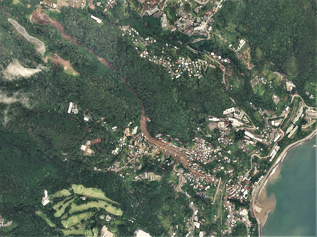
2021 July 6, Japan Standard Time morning 09 o'clock 48 minutes shooting. Aerial photograph of Atami debris flow disaster.
Summary
[edit]
| Description |
日本語: 2021年7月の熱海市伊豆山地区土石流被災地周辺の空中写真。2021年7月6日 09ː48 (JST) 撮影のC02-0020からC02-0023の合計4枚を合成作成。
English: Aerial photograph of Atami debris flow disaster taken at 9:48am July 6, 2021 (Japan Standard Time). |
| Date | |
| Source | 国土情報ウェブマッピングシステム |
| Author | 国土地理院 |
Licensing
[edit]

|
The copyright holder of this file, the Ministry of Land, Infrastructure, Transport and Tourism of Japan, allows anyone to use it for any purpose, provided that the copyright holder is properly attributed. Redistribution, derivative work, commercial use, and all other use is permitted. |
Attribution:
Copyright © National Land Image Information (Color Aerial Photographs), Ministry of Land, Infrastructure, Transport and Tourism
|
 |
This image is copyrighted by the Ministry of Land, Infrastructure, Transport and Tourism of Japan. For terms of use, see the stipulation to use of National Land Information (in Japanese) and message from MLIT (in Japanese and English). When you display this image on an article, include the following phrase in the description: "Made based on National Land Image Information (Color Aerial Photographs), Ministry of Land, Infrastructure, Transport and Tourism".
|
File history
Click on a date/time to view the file as it appeared at that time.
| Date/Time | Thumbnail | Dimensions | User | Comment | |
|---|---|---|---|---|---|
| current | 01:42, 7 July 2021 | | 2,827 × 2,121 (2.02 MB) | さかおり (talk | contribs) | Uploaded a work by 国土地理院 from 国土情報ウェブマッピングシステム with UploadWizard |
You cannot overwrite this file.
File usage on Commons
The following 2 pages use this file:
File usage on other wikis
The following other wikis use this file:
- Usage on de.wikipedia.org
- Usage on en.wikipedia.org
- Usage on id.wikipedia.org
- Usage on ja.wikipedia.org