File:2on projecte. Vegueries i comarques.jpg
Jump to navigation
Jump to search

Size of this preview: 532 × 599 pixels. Other resolutions: 213 × 240 pixels | 426 × 480 pixels | 682 × 768 pixels | 910 × 1,024 pixels | 1,819 × 2,048 pixels | 3,150 × 3,546 pixels.
Original file (3,150 × 3,546 pixels, file size: 1.43 MB, MIME type: image/jpeg)
Captions
Captions
Add a one-line explanation of what this file represents
Summary
[edit]
| Description |
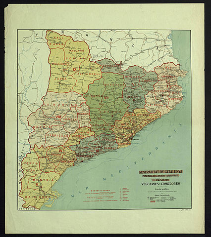
Català: Mapa del 2n projecte de Vegueries i comarques fet per la Comissió d'Estudi de la Divisió Territorial de Catalunya de la Generalitat de Catalunya, dibuixat per Vicenç Turell, cartògraf de la Generalitat Escala 1:635 000 aprox. |
| Date | circa 1936 |
| Source | Biblioteca de Catalunya - Memòria Digital de Catalunya |
| Author | Comissió d'Estudi de la Divisió Territorial de Catalunya |
Licensing
[edit]
|
This work is in the public domain in its country of origin and other countries and areas where the copyright term is the author's life plus 70 years or fewer. | |
| This file has been identified as being free of known restrictions under copyright law, including all related and neighboring rights. | |
File history
Click on a date/time to view the file as it appeared at that time.
| Date/Time | Thumbnail | Dimensions | User | Comment | |
|---|---|---|---|---|---|
| current | 01:17, 26 December 2014 | | 3,150 × 3,546 (1.43 MB) | Docosong (talk | contribs) | User created page with UploadWizard |
You cannot overwrite this file.
File usage on Commons
There are no pages that use this file.