File:411 South Kaibab Trail Grand Canyon - Cedar Ridge (4759070684).jpg
Jump to navigation
Jump to search

Size of this preview: 773 × 600 pixels. Other resolutions: 309 × 240 pixels | 619 × 480 pixels | 990 × 768 pixels | 1,280 × 993 pixels | 2,560 × 1,987 pixels | 3,600 × 2,794 pixels.
Original file (3,600 × 2,794 pixels, file size: 5.58 MB, MIME type: image/jpeg)
Captions
Captions
Add a one-line explanation of what this file represents
Summary
[edit].jpg&action=edit§ion=1)
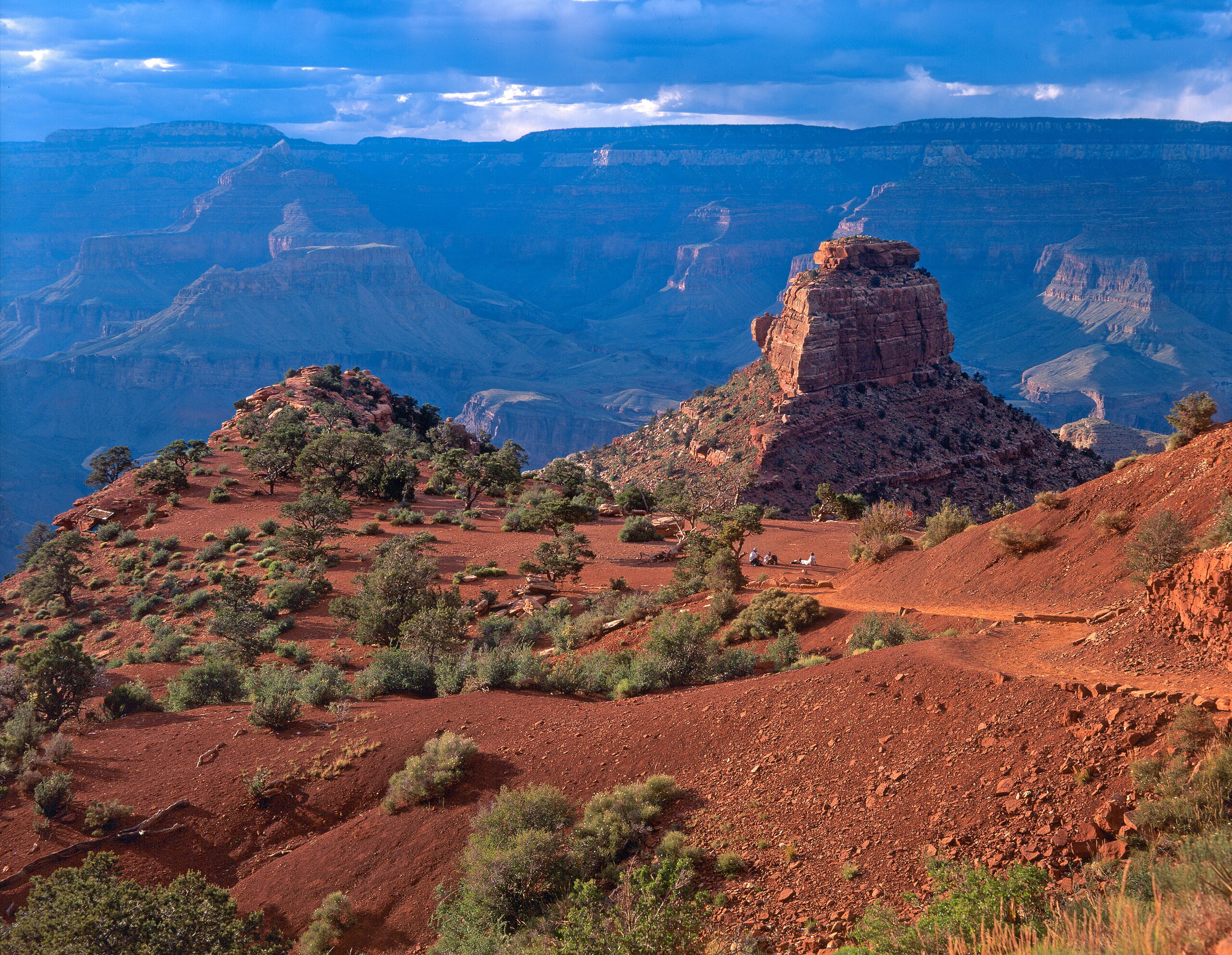
| Description | Nearing sunset at Cedar Ridge on the South Kaibab Trail - Grand Canyon National Park. A popular destination for a day hike, Cedar Ridge has restrooms - but no water. This level spot is 1,140 feet ( 347 m ) below the rim. It is a three mile round trip from the top and takes between 2 and 4 hours hiking time. O'neill Butte is to the right of center. NPS Photo by Michael Quinn. For information about how to plan a visit to Grand Canyon National Park visit: <a href="http://www.nps.gov/grca/index.htm" rel="nofollow">www.nps.gov/grca/index.htm</a> |
| Date | |
| Source | 411 South Kaibab Trail Grand Canyon - Cedar Ridge |
| Author | Grand Canyon National Park |
| Camera location | | View this and other nearby images on: OpenStreetMap |
|---|
.jpg¶ms=036.062681_N_-112.089182_E_globe:Earth_type:camera_source:Flickr_&language=en)
Licensing
[edit].jpg&action=edit§ion=2)
This file is licensed under the Creative Commons Attribution 2.0 Generic license.
- You are free:
- to share – to copy, distribute and transmit the work
- to remix – to adapt the work
- Under the following conditions:
- attribution – You must give appropriate credit, provide a link to the license, and indicate if changes were made. You may do so in any reasonable manner, but not in any way that suggests the licensor endorses you or your use.
| This image was originally posted to Flickr by Grand Canyon NPS at https://flickr.com/photos/50693818@N08/4759070684. It was reviewed on 20 April 2020 by FlickreviewR 2 and was confirmed to be licensed under the terms of the cc-by-2.0. |
File history
Click on a date/time to view the file as it appeared at that time.
| Date/Time | Thumbnail | Dimensions | User | Comment | |
|---|---|---|---|---|---|
| current | 19:09, 20 April 2020 | | 3,600 × 2,794 (5.58 MB) | Killarnee (talk | contribs) | Transferred from Flickr via #flickr2commons |
You cannot overwrite this file.
File usage on Commons
The following page uses this file:
.jpg&oldid=768136706)