File:97312 beit gimal, the womens monastery PikiWiki Israel.jpg
Jump to navigation
Jump to search

Size of this preview: 800 × 369 pixels. Other resolutions: 320 × 148 pixels | 640 × 296 pixels | 1,024 × 473 pixels | 1,280 × 591 pixels | 2,560 × 1,182 pixels | 4,608 × 2,128 pixels.
Original file (4,608 × 2,128 pixels, file size: 3.63 MB, MIME type: image/jpeg)
Captions
Captions
Add a one-line explanation of what this file represents
| Description |
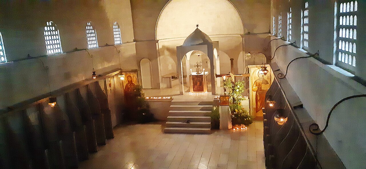
English: Name: Beit Gimal, the womens monastery Description: The nuns prayer hall. In the southern building of Beit Jamal are currently nuns of the Bethlehem Order, this order has 3 names: the Bethlehem Order; Order of the Assumption of Mary,and st Bruno עברית: שם: בית גימאל מנזר הנשים תיאור: אולם תפילת הנזירות. במבנה הדרומי בבית ג'מאל נמצאות כיום נזירות של מסדר בית לחם, למסדר זה ישנם 3 שמות: מסדר בית לחם; לזכר הולדת ישו בבית לחם. מסדר עליית מרים הקדושה,מסדר על שם סן ברונו הקדוש שייסד את המסדר הקרטוזיאני במאה ה-11. הערות: בית גִ'מָאל הוא כפר ומנזר קתולי של המסדר הסלזיאני ,סמוך לבית שמש.במתחם בית ג'מאל ישנם ארבעה מבנים מרכזיים: בית לנזירים הסליזיאניים המקדישים את עצמם לחינוך במקומות שבהם האוכלוסייה חלשה ונזקקת לעזרה, כנסיית סטפנוס הקדוש, מנזר לנשים של מסדר בית לחם של סן ברונו, ועל תל גמליאל שבדרום המתחם, נמצא המנזר לגברים של מסדר בית לחם של סן ברונו.לפי המסורת הנוצרית, המקום נקרא בעבר כפר גמלא (כפר גמליאל), על שם רבן גמליאל הזקן שהיה נשיא הסנהדרין במחצית ה-1 של המאה ה-1 לספירה.(ויקיפדיה) מיקום: מנזר בית גימאל קובץ מקורי: 20230815_184748.jpg |
| Date | 3.8.2023 |
| Source | Zalmanson Zeller via the PikiWiki - Israel free image collection project |
| Author | israel zeller ישראל זלר |
| Permission (Reusing this file) |
This file is licensed under the Creative Commons Attribution 2.5 Generic license. Attribution: Zeller Zalmanson Pikiwiki Israel
|

|
This file has been submitted through the Israeli Pikiwiki project and uploaded here automatically.
The project is cooperation between the Israel Internet Association and Wikimedia Israel in an effort to promote the concept of free content on the Web, by creating an image collection of digital-format, good quality photographs, documenting events relating to the history of Israel, or depicting places of distinction in Israel and the Middle East. The Pikiwiki Project is managed from 2021 by the "Heritage Stones" group.
Please consider notifying the project before renaming or deleting this file. Further information about the project can be found on the commons-l mailing list.
|
File history
Click on a date/time to view the file as it appeared at that time.
| Date/Time | Thumbnail | Dimensions | User | Comment | |
|---|---|---|---|---|---|
| current | 00:26, 23 August 2023 | | 4,608 × 2,128 (3.63 MB) | Pikiwikisrael (talk | contribs) |
You cannot overwrite this file.
File usage on Commons
There are no pages that use this file.