File:AirAsia route map.png
(Redirected from File:AA route map.PNG)
No higher resolution available.
AirAsia_route_map.png (800 × 273 pixels, file size: 61 KB, MIME type: image/png)
Captions
Captions
Add a one-line explanation of what this file represents
Summary[edit]
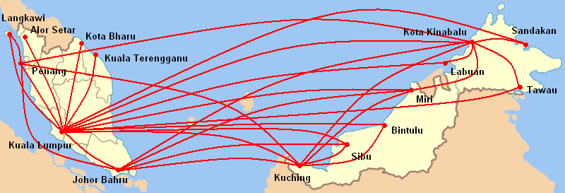
| Description | AirAsia domestic route map |
| Date | |
| Source | Own work |
| Author | Kawaputra |
Licensing[edit]
| I, the copyright holder of this work, release this work into the public domain. This applies worldwide. In some countries this may not be legally possible; if so: I grant anyone the right to use this work for any purpose, without any conditions, unless such conditions are required by law. |
File history
Click on a date/time to view the file as it appeared at that time.
| Date/Time | Thumbnail | Dimensions | User | Comment | |
|---|---|---|---|---|---|
| current | 03:55, 11 March 2011 | 800 × 273 (61 KB) | Kawaputra (talk | contribs) | AirAsia network within Malaysia (updated to March 2011) | |
| 11:15, 15 November 2007 | 600 × 205 (44 KB) | Kawaputra (talk | contribs) | {{Information |Description=AirAsia domestic route map |Source=self-made |Date=November 15, 2007 |Author= Kawaputra |Permission= |other_versions= }} Category:Malaysia |
You cannot overwrite this file.
File usage on Commons
The following page uses this file:
- File:AA route map.PNG (file redirect)
File usage on other wikis
The following other wikis use this file:
- Usage on en.wikipedia.org
- Usage on ko.wikipedia.org
- Usage on ms.wikipedia.org
- Usage on no.wikipedia.org
- Usage on vi.wikipedia.org