File:AH26 (N10) sign.svg
Jump to navigation
Jump to search

Size of this PNG preview of this SVG file: 466 × 599 pixels. Other resolutions: 187 × 240 pixels | 373 × 480 pixels | 597 × 768 pixels | 797 × 1,024 pixels | 1,593 × 2,048 pixels | 512 × 658 pixels.
Original file (SVG file, nominally 512 × 658 pixels, file size: 8 KB)
Captions
Captions
Add a one-line explanation of what this file represents
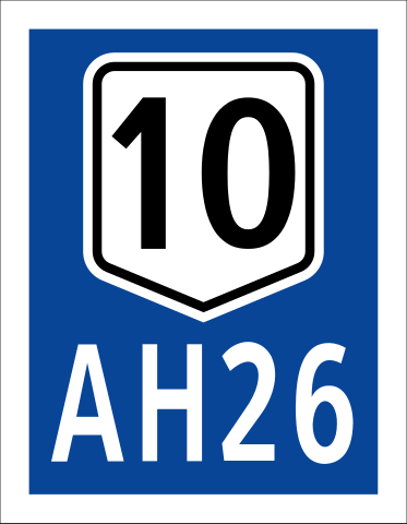
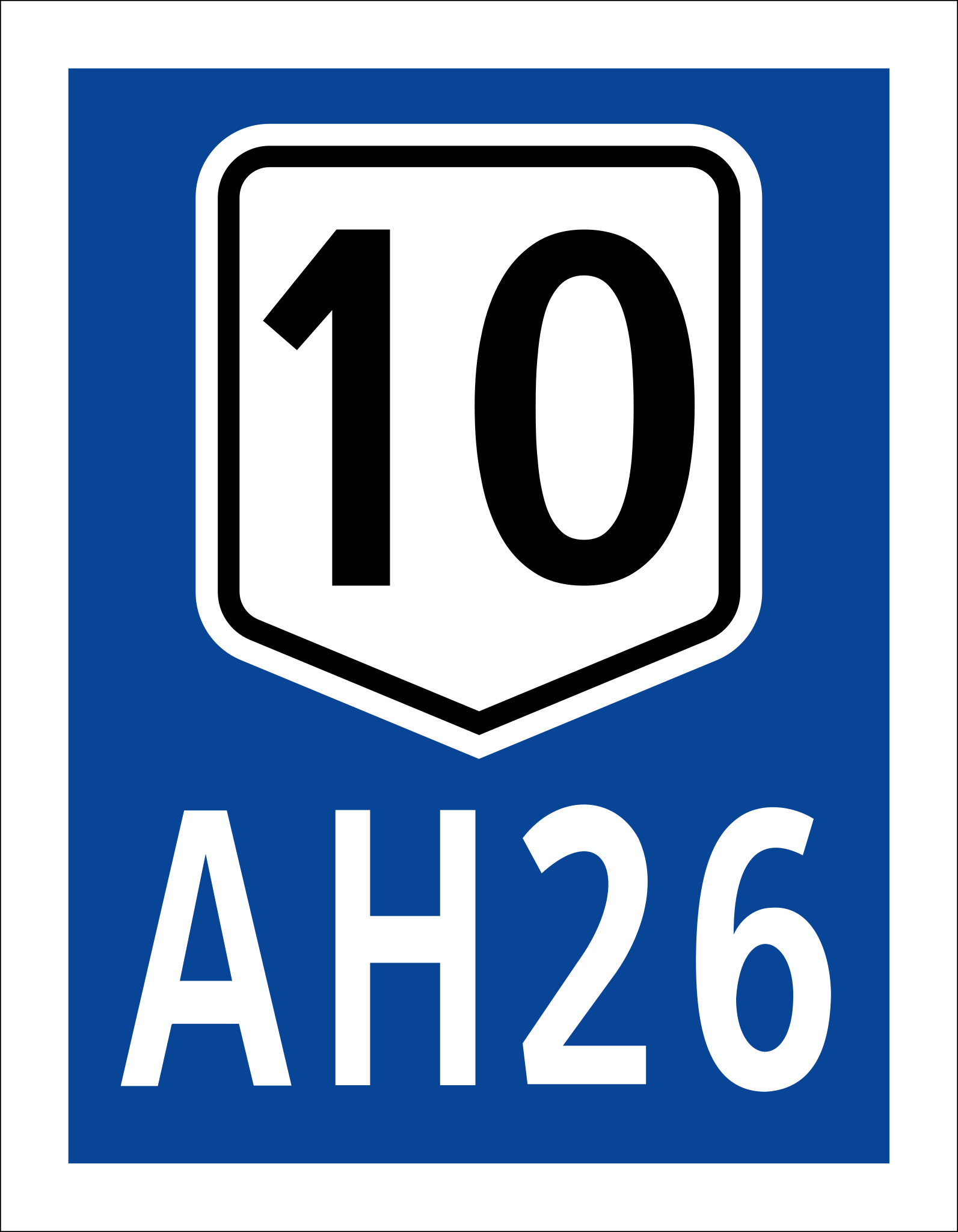
| Description | Route sign for Pan-Philippine Highway/AH26 on its spur route, the Davao-Bukidnon Highway and Sayre Highway (10). | ||
| Date | April 2, 2015, 7:37 PM (GMT+8) | ||
| Source | Own work | ||
| Author | TagaSanPedroAko | ||
| Permission (Reusing this file) |
|
||
| SVG development |
File history
Click on a date/time to view the file as it appeared at that time.
| Date/Time | Thumbnail | Dimensions | User | Comment | |
|---|---|---|---|---|---|
| current | 07:44, 18 August 2018 | | 512 × 658 (8 KB) | HueMan1 (talk | contribs) | Roadgeek? → Clearview 1B / Clearview 2B |
| 17:50, 22 April 2015 |  | 512 × 658 (5 KB) | Photo07 (talk | contribs) | Outline | |
| 20:09, 20 April 2015 |  | 512 × 658 (6 KB) | Photo07 (talk | contribs) | New Version. Feel free to revert if you wish. | |
| 11:37, 2 April 2015 |  | 744 × 1,052 (4 KB) | TagaSanPedroAko (talk | contribs) | {{Information |Description=Route sign for Pan-Philippine Highway/AH26 on its spur route, the Davao-Bukidnon Highway and Sayre Highway (10). |Source={{own}} |Date=April 2, 2015, 7:37 PM (GMT+8) |Author=[[User:TagaSanPedroAk... |
You cannot overwrite this file.
File usage on Commons
The following 3 pages use this file:
_sign.svg&redirect=no)
.svg)
File usage on other wikis
The following other wikis use this file:
- Usage on en.wikipedia.org
- Usage on en.wikivoyage.org
- Usage on id.wikipedia.org
- Usage on ja.wikivoyage.org
- Usage on th.wikipedia.org
- Usage on tl.wikipedia.org
_sign.svg&oldid=774085215)