File:AMH-5321-NA Map of Hollandia Nova.jpg

Original file (2,400 × 1,682 pixels, file size: 661 KB, MIME type: image/jpeg)
Captions
Captions
Summary
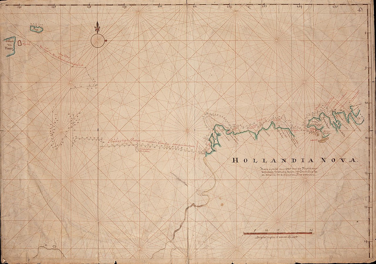
[edit]| Nederlands: Kaart van Hollandia-Nova
English: Map of Hollandia Nova Bahasa Indonesia: Peta Hollandia Nova( |
||||||||||||||||||||||||
|---|---|---|---|---|---|---|---|---|---|---|---|---|---|---|---|---|---|---|---|---|---|---|---|---|
| Author |
Nederlands: Anoniem / Anonymous (landmeter / kaartenmaker)
English: Anoniem / Anonymous (land surveyor / mapmaker) |
|||||||||||||||||||||||
| Title |
Nederlands: Kaart van Hollandia-Nova
English: Map of Hollandia Nova
Bahasa Indonesia: Peta Hollandia Nova |
|||||||||||||||||||||||
| Description |
Nederlands: Titel in catalogus Leupe (Nationaal Archief): Kaart van Hollandia-Nova, nader ontdeckt, Anno 1705, door het fluitschip Vossenbosch, de chialooup Wajer en de Phanttialling Nova-Hollandia, den 2 Maart van Timor vertrocken.
Rechtsboven genummerd: 43. Notities verso: [2 stempeltjes van het Rijksarchief]. Opmerking catalogus Leupe: Deze schepen stonden onder de bevelen van den schipper Maerten van Delft. Over deze reis bestaat een verslag, opgemaakt door de Raden van Indie, Zwaerdecroon en Chasteleyn, uit de journalen getrokken.English: Title in the Leupe catalogue (National Archives): Kaart van Hollandia-Nova, nader ontdeckt, Anno 1705, door het fluitschip Vossenbosch, de chialooup Wajer en de Phanttialling Nova-Hollandia, den 2 Maart van Timor vertrocken.
Numbered top right: 43. Notes on reverse: [2 stamps of the government archives (Rijksarchief)] Note in the Leupe catalogue: Deze schepen stonden onder de bevelen van den schipper Maerten van Delft. Over deze reis bestaat een verslag, opgemaakt door de Raden van Indie, Zwaerdecroon en Chasteleyn, uit de journalen getrokken.Bahasa Indonesia: Judul dalam katalog Leupe (Arsip Nasional): Kaart van Hollandia-Nova, nader ontdeckt, Anno 1705, door het fluitschip Vossenbosch, de chialooup Wajer en de Phanttialling Nova-Hollandia, den 2 Maart van Timor vertrocken.
Diberi nomor pada kanan atas: 43. Catatan di belakang: [2 stempel pada arsip pemerintah (Rijksarchief)] Catatan di katalog Leupe: Deze schepen stonden onder de bevelen van den schipper Maerten van Delft. Over deze reis bestaat een verslag, opgemaakt door de Raden van Indie, Zwaerdecroon en Chasteleyn, uit de journalen getrokken. |
|||||||||||||||||||||||
| Date | 1705 | |||||||||||||||||||||||
| Medium |
Nederlands: ingekleurde tekening op papier
English: coloured drawing on paper
Bahasa Indonesia: gambar berwarna di atas kertas |
|||||||||||||||||||||||
| Dimensions | height: 73.5 cm (28.9 in); width: 51.5 cm (20.2 in) | |||||||||||||||||||||||
| Collection |
|
|||||||||||||||||||||||
| Accession number |
NL-HaNA_4.VEL_500 (old number: VEL0500) |
|||||||||||||||||||||||
| Inscriptions |
-
|
|||||||||||||||||||||||
| Notes |
English: Subjects: chart / map / plan
Nederlands: Onderwerpen: plattegrond / kaart
English: Post: this image is related to a VOC trading post called Leti |
|||||||||||||||||||||||
| Source/Photographer |
|
|||||||||||||||||||||||
| Permission (Reusing this file) |
|
|||||||||||||||||||||||

| Object location | | View this and other nearby images on: OpenStreetMap |
|---|
File history
Click on a date/time to view the file as it appeared at that time.
| Date/Time | Thumbnail | Dimensions | User | Comment | |
|---|---|---|---|---|---|
| current | 17:59, 10 June 2014 | | 2,400 × 1,682 (661 KB) | HuskyBot (talk | contribs) | == {{int:filedesc}} == {{Artwork |title = {{nl|1=Kaart van Hollandia-Nova}} {{en|1=Map of Hollandia Nova}} |description = {{nl|1=Titel in catalogus Leupe (Nationaal Archief): ''Kaart van Hollandia-Nova, nader o... |
You cannot overwrite this file.
File usage on Commons
The following page uses this file:
File usage on other wikis
The following other wikis use this file:
- Usage on nl.wikipedia.org
- Usage on www.wikidata.org