File:AMH-5518-NA Map of part of Java's northern coast and part of the eastern coast of Sumatra.jpg
Jump to navigation
Jump to search
Size of this preview: 800 × 565 pixels. Other resolutions: 320 × 226 pixels | 640 × 452 pixels | 1,024 × 723 pixels | 1,280 × 904 pixels | 2,400 × 1,695 pixels.
Original file (2,400 × 1,695 pixels, file size: 761 KB, MIME type: image/jpeg)
Captions
Captions
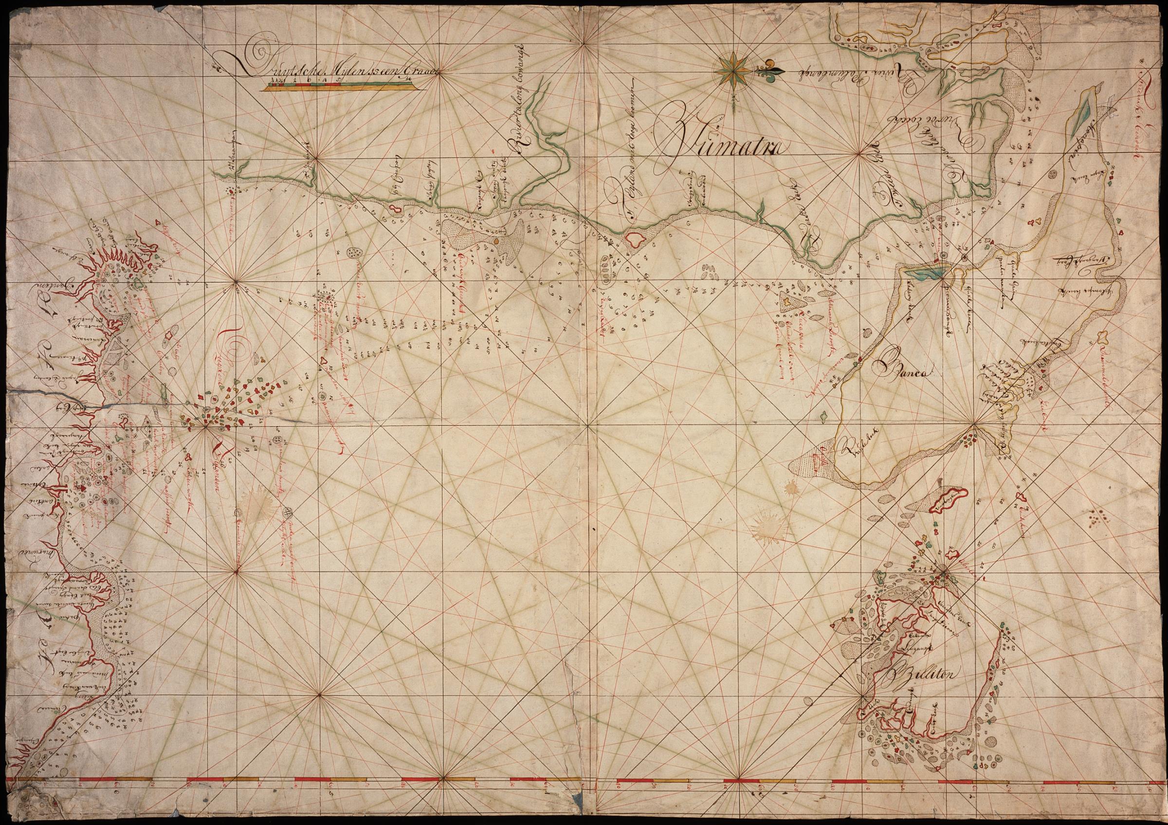
Map of part of Java's northern coast and part of the eastern coast of Sumatra
Summary
[edit]| Author |
Nederlands: Anoniem / Anonymous (landmeter / kaartenmaker)
English: Anoniem / Anonymous (land surveyor / mapmaker) |
|||||||||||||||||||||||
| Title |
Nederlands: Kaart van een deel van de noordkust van Java en van een deel van de oostkust van Sumatra
English: Map of part of Java's northern coast and part of the eastern coast of Sumatra
Bahasa Indonesia: Peta sebagian pantai utara Jawa dan sebagian pantai timur Sumatera |
|||||||||||||||||||||||
| Description |
Nederlands: Titel catalogus Leupe (NA): Kaart van de Noordkust van Java, van St. Nicolaes Bay tot Chiparaga, en van de Oostkust van Sumatra, van R. Sacampan tot de Rivier Palumbangh, benevens de eilanden Billiton en Banca.
Bijzonderheden: de kaart is op blauw papier geplakt.
English: Title in the Leupe catalogue (NA): Kaart van de Noordkust van Java, van St. Nicolaes Bay tot Chiparaga, en van de Oostkust van Sumatra, van R. Sacampan tot de Rivier Palumbangh, benevens de eilanden Billiton en Banca.
Particulars: the map has been pasted onto blue paper.
Bahasa Indonesia: Judul dalam katalog Leupe (NA): Kaart van de Noordkust van Java, van St. Nicolaes Bay tot Chiparaga, en van de Oostkust van Sumatra, van R. Sacampan tot de Rivier Palumbangh, benevens de eilanden Billiton en Banca.
Terkhusus: peta ini telah direkatkan pada kertas biru. |
|||||||||||||||||||||||
| Date | between 1740 and 1770 | |||||||||||||||||||||||
| Medium |
Nederlands: ingekleurde tekening op papier
English: coloured drawing on paper
Bahasa Indonesia: gambar berwarna di atas kertas |
|||||||||||||||||||||||
| Dimensions | height: 72 cm (28.3 in); width: 102.5 cm (40.3 in) | |||||||||||||||||||||||
| Collection |
|
|||||||||||||||||||||||
| Accession number |
NL-HaNA_4.VEL_340 (old number: VEL0340) |
|||||||||||||||||||||||
| Inscriptions |
-
|
|||||||||||||||||||||||
| Notes |
English: Subjects: compass / dial, chart / map / plan
Nederlands: Onderwerpen: kompas / windroos, plattegrond / kaart
English: Post: this image is related to a VOC trading post called Banten |
|||||||||||||||||||||||
| Source/Photographer |
|
|||||||||||||||||||||||
| Permission (Reusing this file) |
|
|||||||||||||||||||||||

| Object location | | View this and other nearby images on: OpenStreetMap |
|---|
File history
Click on a date/time to view the file as it appeared at that time.
| Date/Time | Thumbnail | Dimensions | User | Comment | |
|---|---|---|---|---|---|
| current | 08:23, 11 June 2014 | | 2,400 × 1,695 (761 KB) | HuskyBot (talk | contribs) | == {{int:filedesc}} == {{Artwork |title = {{nl|1=Kaart van een deel van de noordkust van Java en van een deel van de oostkust van Sumatra}} {{en|1=Map of part of Java's northern coast and part of the eastern coast of... |
You cannot overwrite this file.
File usage on Commons
The following page uses this file: