File:AMH-5524-NA Map of Sumatra and the Malacca Straits.jpg
Jump to navigation
Jump to search

Size of this preview: 461 × 599 pixels. Other resolutions: 184 × 240 pixels | 369 × 480 pixels | 591 × 768 pixels | 788 × 1,024 pixels | 1,846 × 2,400 pixels.
Original file (1,846 × 2,400 pixels, file size: 770 KB, MIME type: image/jpeg)
Captions
Captions
Add a one-line explanation of what this file represents
Summary
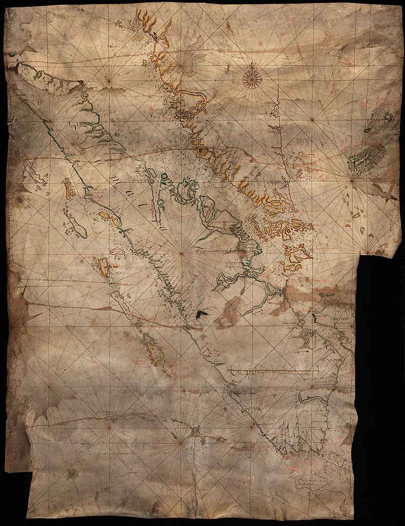
[edit]Nederlands: Kaart van Sumatra en de Straat van Malakka
English: Map of Sumatra and the Malacca Straits( |
||||||||||||||||||||||||
|---|---|---|---|---|---|---|---|---|---|---|---|---|---|---|---|---|---|---|---|---|---|---|---|---|
| Author |
Nederlands: Anoniem / Anonymous (landmeter / kaartenmaker)
English: Anoniem / Anonymous (land surveyor / mapmaker) |
|||||||||||||||||||||||
| Title |
Nederlands: Kaart van Sumatra en de Straat van Malakka
English: Map of Sumatra and the Malacca Straits |
|||||||||||||||||||||||
| Description |
Nederlands: Titel catalogus Leupe (NA): Kaart als voren, met de dieptens in Straat Banca enz., met 'Kaart als voren' wordt bedoeld de titel van VEL0352: Kaart van Straat van Malakka en nabij gelegen Eilanden.
Bijzonderheden: rechtsonder is een groot stuk weggesneden, linksonder een klein stukje. De kaart heeft verschillende bruine vlekken.English: Title in the Leupe catalogue (NA): Kaart als voren, met de dieptens in Straat Banca enz., 'Kaart als voren' or 'chart as before' refers to the title of VEL0352: Kaart van Straat van Malakka en nabij gelegen Eilanden.
Particulars: bottom right a large portion of the map has been cut away, and bottom left a small piece is missing. The map is stained brown in various places. |
|||||||||||||||||||||||
| Date | circa 1685 | |||||||||||||||||||||||
| Medium |
Nederlands: ingekleurde tekening op perkament
English: coloured drawing on parchment |
|||||||||||||||||||||||
| Dimensions | height: 70 cm (27.5 in); width: 92.5 cm (36.4 in) | |||||||||||||||||||||||
| Collection |
|
|||||||||||||||||||||||
| Accession number |
NL-HaNA_4.VEL_353 (old number: VEL0353) |
|||||||||||||||||||||||
| Inscriptions |
-
|
|||||||||||||||||||||||
| Notes |
English: Subjects: chart / map / plan, compass / dial
Nederlands: Onderwerpen: plattegrond / kaart, kompas / windroos |
|||||||||||||||||||||||
| Source/Photographer |
|
|||||||||||||||||||||||
| Permission (Reusing this file) |
|
|||||||||||||||||||||||

File history
Click on a date/time to view the file as it appeared at that time.
| Date/Time | Thumbnail | Dimensions | User | Comment | |
|---|---|---|---|---|---|
| current | 08:24, 11 June 2014 | | 1,846 × 2,400 (770 KB) | HuskyBot (talk | contribs) | == {{int:filedesc}} == {{Artwork |title = {{nl|1=Kaart van Sumatra en de Straat van Malakka}} {{en|1=Map of Sumatra and the Malacca Straits}} |description = {{nl|1=Titel catalogus Leupe (NA): ''Kaart als voren,... |
You cannot overwrite this file.
File usage on Commons
The following page uses this file: