File:AMH-5532-NA Map of part of the northern coast of Java, between Tanjong Awoerang and Tanjong Carawang.jpg
Jump to navigation
Jump to search

Size of this preview: 800 × 557 pixels. Other resolutions: 320 × 223 pixels | 640 × 445 pixels | 1,024 × 713 pixels | 1,280 × 891 pixels | 2,400 × 1,670 pixels.
Original file (2,400 × 1,670 pixels, file size: 683 KB, MIME type: image/jpeg)
Captions
Captions
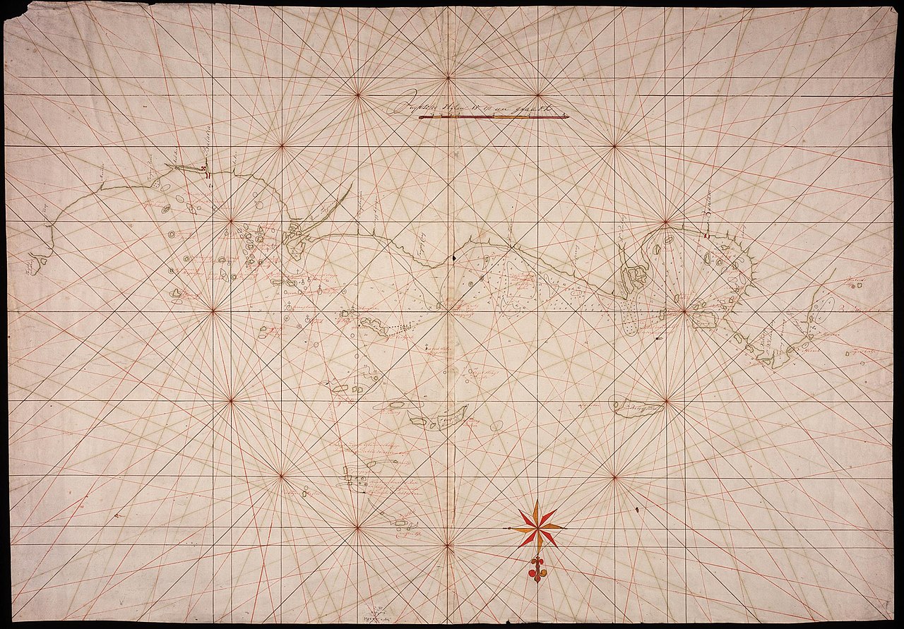
Map of part of the northern coast of Java, between Tanjong Awoerang and Tanjong Carawang
Summary
[edit]| Author |
Nederlands: Anoniem / Anonymous (landmeter / kaartenmaker)
English: Anoniem / Anonymous (land surveyor / mapmaker) |
|||||||||||||||||||||||
| Title |
Nederlands: Kaart van een gedeelte van de noordkust van Java, tussen Tanjong Awoerang en Tanjong Carawang
English: Map of part of the northern coast of Java, between Tanjong Awoerang and Tanjong Carawang
Bahasa Indonesia: Peta sebagian pantai utara Jawa, antara Tanjong Awoerang dan Tanjong Carawang |
|||||||||||||||||||||||
| Description |
Nederlands: Titel catalogus Leupe (NA): Kaart van een gedeelte van de Noordkust van Java, tusschen Tanjong Awoerang en Tanjong Carawang.
Naast de Nederlandse benamingen van enkele eilanden is soms ook de Maleise naam geschreven.
English: Title in the Leupe catalogue (NA): Kaart van een gedeelte van de Noordkust van Java, tusschen Tanjong Awoerang en Tanjong Carawang.
Alongside the Dutch names of several islands the Malay name has been added.
Bahasa Indonesia: Judul dalam katalog Leupe (AN): Kaart van een gedeelte van de Noordkust van Java, tusschen Tanjong Awoerang en Tanjong Carawang.
Di samping nama-nama Belanda dari beberapa pulau, nama Melayu telah ditambahkan. |
|||||||||||||||||||||||
| Date | circa 1750 | |||||||||||||||||||||||
| Medium |
Nederlands: pen op papier
English: pen on paper
Bahasa Indonesia: pulpen di atas kertas |
|||||||||||||||||||||||
| Dimensions | height: 103.5 cm (40.7 in); width: 72 cm (28.3 in) | |||||||||||||||||||||||
| Collection |
|
|||||||||||||||||||||||
| Accession number |
NL-HaNA_4.VEL_381 (old number: VEL0381) |
|||||||||||||||||||||||
| Inscriptions |
-
|
|||||||||||||||||||||||
| Notes |
English: Subjects: compass / dial, chart / map / plan
Nederlands: Onderwerpen: kompas / windroos, plattegrond / kaart
English: Post: this image is related to a VOC trading post called Banten |
|||||||||||||||||||||||
| Source/Photographer |
|
|||||||||||||||||||||||
| Permission (Reusing this file) |
|
|||||||||||||||||||||||

| Object location | | View this and other nearby images on: OpenStreetMap |
|---|
File history
Click on a date/time to view the file as it appeared at that time.
| Date/Time | Thumbnail | Dimensions | User | Comment | |
|---|---|---|---|---|---|
| current | 08:26, 11 June 2014 | | 2,400 × 1,670 (683 KB) | HuskyBot (talk | contribs) | == {{int:filedesc}} == {{Artwork |title = {{nl|1=Kaart van een gedeelte van de noordkust van Java, tussen Tanjong Awoerang en Tanjong Carawang}} {{en|1=Map of part of the northern coast of Java, between Tanjong Awoera... |
You cannot overwrite this file.
File usage on Commons
The following page uses this file: