File:A French-Canadian Village.jpg
Jump to navigation
Jump to search

Size of this preview: 800 × 568 pixels. Other resolutions: 320 × 227 pixels | 640 × 454 pixels | 1,024 × 727 pixels.
Original file (1,024 × 727 pixels, file size: 303 KB, MIME type: image/jpeg)
Captions
Captions
Add a one-line explanation of what this file represents
Summary[edit]
| Description |
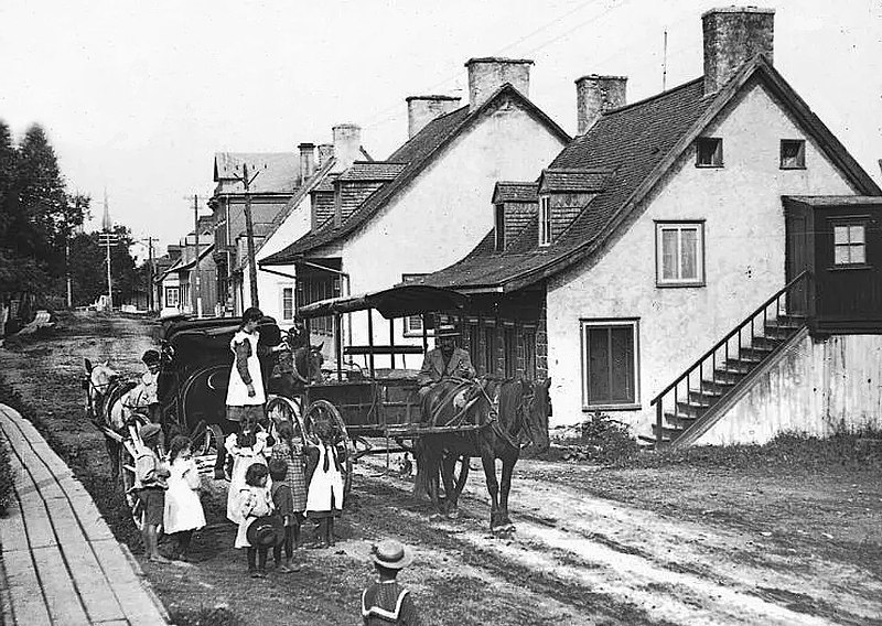
English: A French-Canadian Village
Français : Le chemin Royal, Beauport « À l'avant-plan, la maison fera place à l'avenue Saint-Ulric, quelques décennies plus tard. Au loin, on aperçoit les flèches de l'église de la Nativité-de-Notre-Dame, qui sera détruite par un incendie, en 1916. » |
| Date | circa 1903 |
| Source | lesoleil.com – collections.mnbaq.org |
| Author | Keystone View Company |
| Camera location | | View this and other nearby images on: OpenStreetMap |
|---|
Licensing[edit]
|
This work is in the public domain in its country of origin and other countries and areas where the copyright term is the author's life plus 70 years or fewer. This work is in the public domain in the United States because it was published (or registered with the U.S. Copyright Office) before January 1, 1929. | |
| This file has been identified as being free of known restrictions under copyright law, including all related and neighboring rights. | |
File history
Click on a date/time to view the file as it appeared at that time.
| Date/Time | Thumbnail | Dimensions | User | Comment | |
|---|---|---|---|---|---|
| current | 02:37, 16 November 2021 | | 1,024 × 727 (303 KB) | Jeangagnon (talk | contribs) | Uploaded a work by Keystone View Company from https://www.lesoleil.com/2021/11/13/le-chemin-royal-vers-1903-94a0ec3fbad15b0d31ff1119e523a57d with UploadWizard |
You cannot overwrite this file.
File usage on Commons
There are no pages that use this file.