File:A Map of Europe for the Illustration of King Alfred's Anglo-Saxon translation of Orosius. Engraved by J. Bayly.jpg

Original file (3,254 × 3,220 pixels, file size: 1.97 MB, MIME type: image/jpeg)
Captions
Captions
Summary[edit]
| Description |
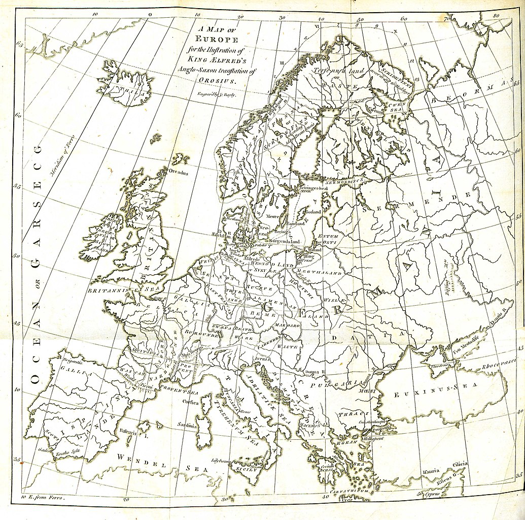
English: Folding engraved map published in: Daines Barrington (ed./transl.), King Ælfred’s Orosius: The Anglo-Saxon Version, from the Historian Orosius. By Ælfred the Great. Together with an English Translation from the Anglo-Saxon. London: printed by W. Bowyer and J. Nichols: and sold by S. Baker and G. Leigh; T. Payne; and B. White, 1773, II, after p. 260. Drawn up by Johann Reinhold Forster and his son Georg Forster (uncredited, see: Johann Reinhold Forster, Geschichte der Entdeckungen und Schiffahrten im Norden. Frankfurt an der Oder: Carl Gottlieb Strauß, 1784, pp. XIII–XIV, and: Walter Goffart, Historical Atlases: The First Three Hundred Years, 1570–1870. Chicago/London: The University of Chicago Press, 2003, pp. 197, 200). Engraved by John Bayly. Description of the map (Barrington, op. cit., I, p. xxiv): |
| Source | Daines Barrington (ed./transl.), King Ælfred’s Orosius: The Anglo-Saxon Version, from the Historian Orosius. By Ælfred the Great |
| Author | Drawn up by Johann Reinhold Forster and his son Georg Forster |
Licensing[edit]
|
This work is in the public domain in its country of origin and other countries and areas where the copyright term is the author's life plus 100 years or fewer. This work is in the public domain in the United States because it was published (or registered with the U.S. Copyright Office) before January 1, 1929. | |
| This file has been identified as being free of known restrictions under copyright law, including all related and neighboring rights. | |
| Annotations | This image is annotated: View the annotations at Commons |
File history
Click on a date/time to view the file as it appeared at that time.
| Date/Time | Thumbnail | Dimensions | User | Comment | |
|---|---|---|---|---|---|
| current | 11:11, 29 August 2016 | | 3,254 × 3,220 (1.97 MB) | BarringtonForster (talk | contribs) | Engraved folding map published in: Daines Barrington (ed./transl.), ''King Ælfred’s Orosius: The Anglo-Saxon Version, from the Historian Orosius. By Ælfred the Great. Together with an English Translation from the Anglo-Saxon''. London: printed by W... |
You cannot overwrite this file.
File usage on Commons
There are no pages that use this file.
File usage on other wikis
The following other wikis use this file:
- Usage on en.wikipedia.org
- Usage on lt.wikipedia.org
- Usage on pl.wikipedia.org
- Usage on pt.wikipedia.org
- Usage on sl.wikipedia.org