File:A Plat of Norristown, Pope County, State of Arkansas, July 1837.jpg
Jump to navigation
Jump to search
Size of this preview: 800 × 568 pixels. Other resolutions: 320 × 227 pixels | 640 × 454 pixels | 1,024 × 727 pixels | 1,280 × 908 pixels | 1,935 × 1,373 pixels.
Original file (1,935 × 1,373 pixels, file size: 229 KB, MIME type: image/jpeg)
Captions
Captions
Add a one-line explanation of what this file represents
Summary
[edit]
| Description |
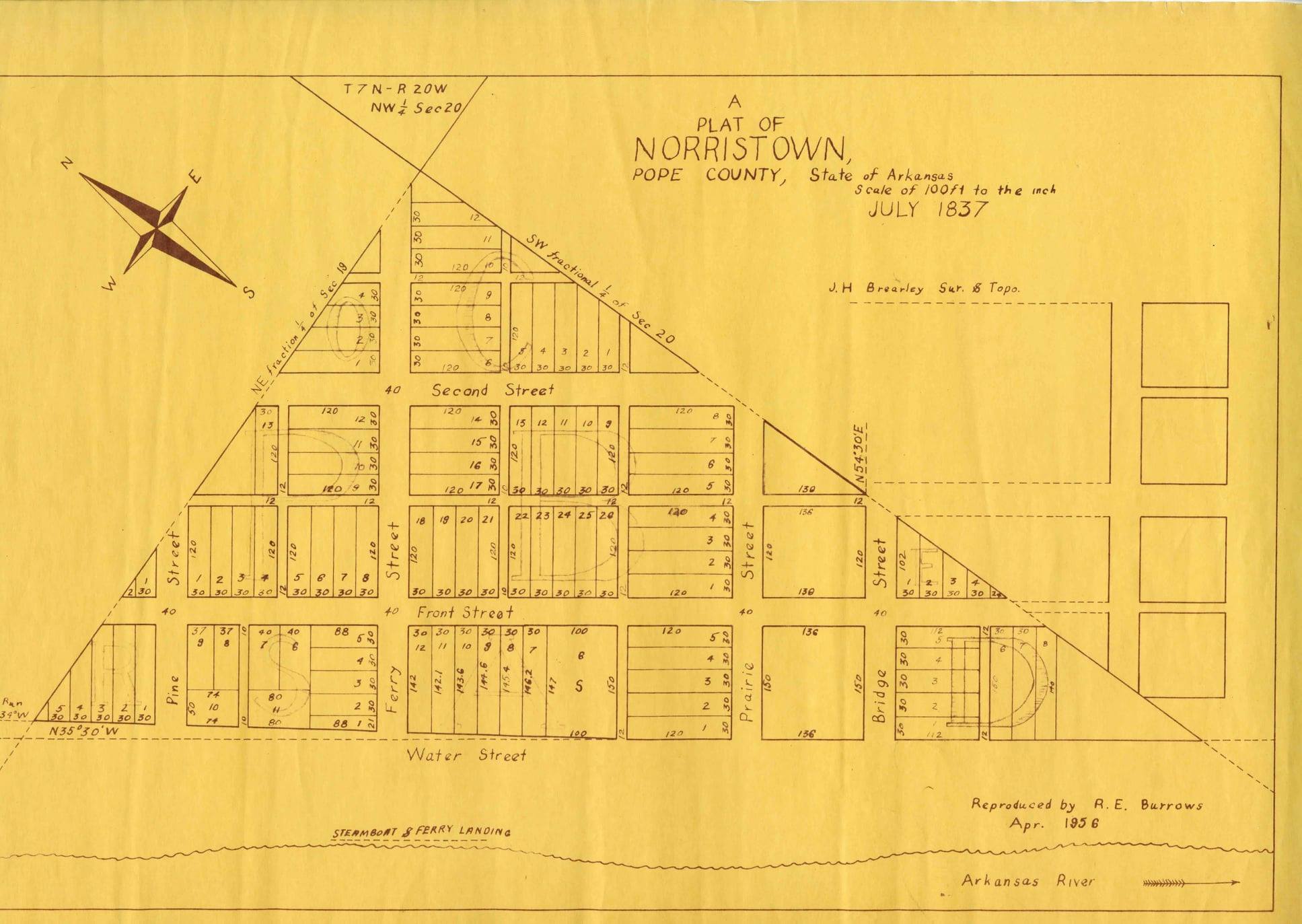
English: Norristown was a 19th-century town and trading center on the Arkansas River. This is a copy of the original 1837 plat map. |
| Date | |
| Source | This map is a July 1837 plat reproduced in April 1956. The original was in the public domain in the United States so the derivative reproduction is in the public domain as there was no creative addition in the reproduction |
| Author | Original plat J. H. Brearley; Reproduction R. E. Burrows |
Licensing
[edit]
This work is in the public domain in the United States because it was published (or registered with the U.S. Copyright Office) before January 1, 1929.
Public domain works must be out of copyright in both the United States and in the source country of the work in order to be hosted on the Commons. If the work is not a U.S. work, the file must have an additional copyright tag indicating the copyright status in the source country.
Note: This tag should not be used for sound recordings. |
File history
Click on a date/time to view the file as it appeared at that time.
| Date/Time | Thumbnail | Dimensions | User | Comment | |
|---|---|---|---|---|---|
| current | 16:09, 8 May 2023 | | 1,935 × 1,373 (229 KB) | Caronde (talk | contribs) | Uploaded a work by Original plat J. H. Brearley; Reproduction R. E. Burrows from This map is a July 1837 plat reproduced in April 1956. The original was in the public domain in the United States so the derivative reproduction is in the public domain as there was no creative addition in the reproduction with UploadWizard |
You cannot overwrite this file.
File usage on Commons
There are no pages that use this file.
File usage on other wikis
The following other wikis use this file:
- Usage on en.wikipedia.org