File:Absecon United Methodist Church Front with Historical Marker and Graveyard, 2021-10-08.jpg
Jump to navigation
Jump to search

Size of this preview: 800 × 600 pixels. Other resolutions: 320 × 240 pixels | 640 × 480 pixels | 1,024 × 768 pixels | 1,280 × 960 pixels | 2,560 × 1,920 pixels | 3,264 × 2,448 pixels.
Original file (3,264 × 2,448 pixels, file size: 2.57 MB, MIME type: image/jpeg)
Captions
Captions
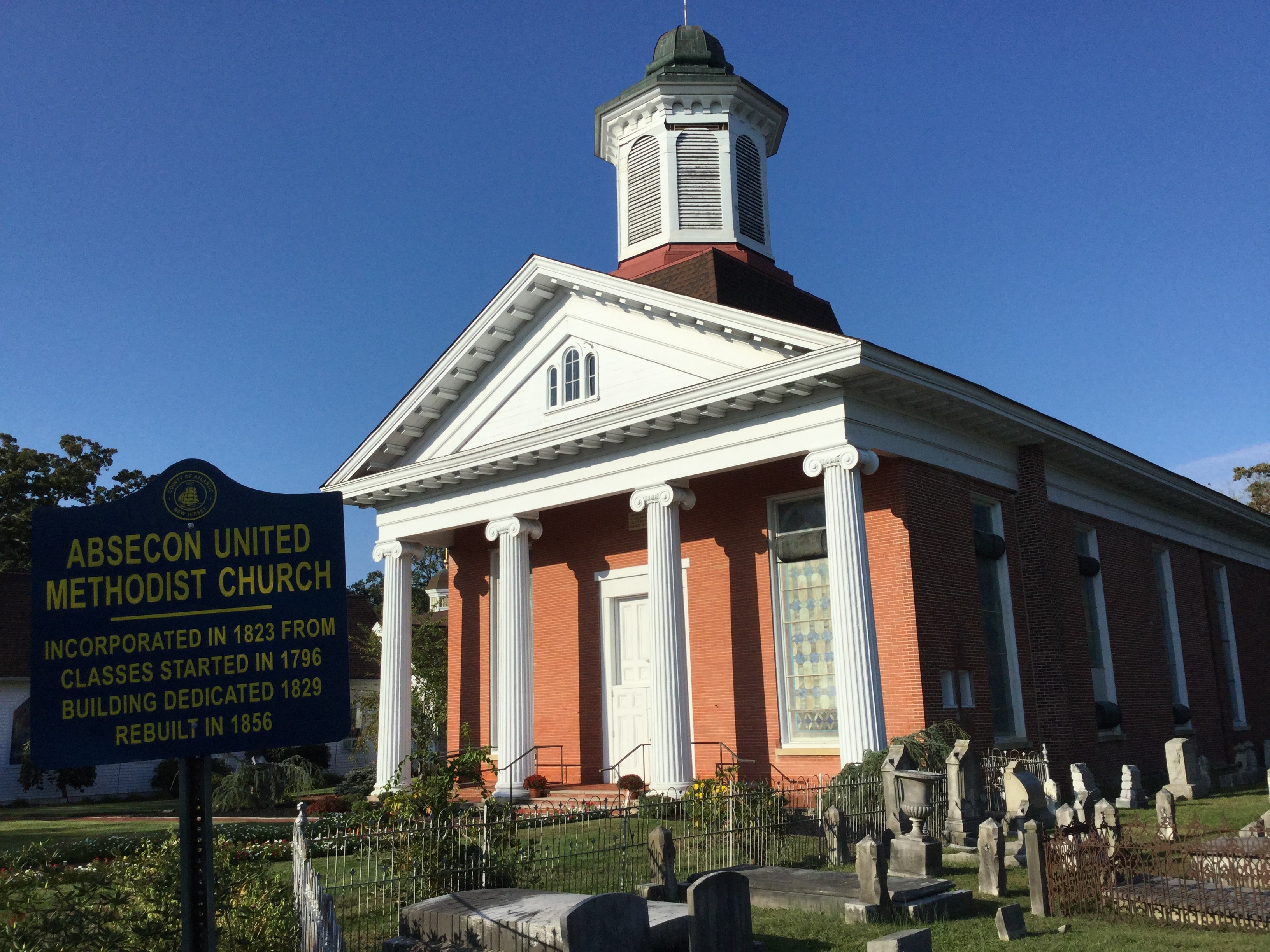
The front of the Absecon United Methodist Church, with its historical marker and part of the graveyard beside it.
Summary
[edit]
| Description |
English: The Absecon United Methodist Church, at Pitney Rd. and Church St., Absecon, Atlantic County, New Jersey, with its historical marker. Incorporated 1823, dedicated 1829, rebuilt 1856, historical marker erected 1978 by the Atlantic County Cultural and Heritage Commission. Picture taken on 8 October 2021 from the south along Church St., showing the portico at the church's entrance and part of the graveyard to its southeast.
Polski: Kościół Zjednoczony Metodystyczny Abseconu, przy skrzyżowaniu drogi Pitney i ulicy Kościelnej, w Absecon, Powiecie Atlantyckim, New Jersey, ze znakiem historycznym swoim. Rozpoczęty w roku 1823, zadedykowany w 1829, odbudowany w 1856; znak postawiła w 1987 Komisja Kultury i Dziedzictwa Powiatu Atlantyckiego. Zdjęcie zrobiłem 8 października 2021, z południa wzdłuż ulicy Kościelnej; pokazuje portyk przy wejściu i część cmentarza na południowy zachód od kościoła. |
| Date | |
| Source | Own work |
| Author | LaetusStudiis |
| Camera location | | View this and other nearby images on: OpenStreetMap |
|---|
Licensing
[edit]
I, the copyright holder of this work, hereby publish it under the following license:
This file is licensed under the Creative Commons Attribution-Share Alike 4.0 International license.
- You are free:
- to share – to copy, distribute and transmit the work
- to remix – to adapt the work
- Under the following conditions:
- attribution – You must give appropriate credit, provide a link to the license, and indicate if changes were made. You may do so in any reasonable manner, but not in any way that suggests the licensor endorses you or your use.
- share alike – If you remix, transform, or build upon the material, you must distribute your contributions under the same or compatible license as the original.

|
This image was uploaded as part of Wiki Loves Monuments 2021.
|
 |
File history
Click on a date/time to view the file as it appeared at that time.
| Date/Time | Thumbnail | Dimensions | User | Comment | |
|---|---|---|---|---|---|
| current | 18:40, 15 October 2021 | | 3,264 × 2,448 (2.57 MB) | LaetusStudiis (talk | contribs) | Uploaded own work with UploadWizard |
You cannot overwrite this file.
File usage on Commons
There are no pages that use this file.
File usage on other wikis
The following other wikis use this file:
- Usage on eo.wikipedia.org