File:Accurate Geographische Delineation des Zu dem Chursaechsischen Thüringen Gehörigen Ammtes Langensaltza - Schwarzburger Warte.jpg
![File:Accurate Geographische Delineation des Zu dem Chursaechsischen Thüringen Gehörigen Ammtes Langensaltza - Schwarzburger Warte.jpg](https://upload.wikimedia.org/wikipedia/commons/thumb/5/5e/Accurate_Geographische_Delineation_des_Zu_dem_Chursaechsischen_Th%C3%BCringen_Geh%C3%B6rigen_Ammtes_Langensaltza_-_Schwarzburger_Warte.jpg/800px-Accurate_Geographische_Delineation_des_Zu_dem_Chursaechsischen_Th%C3%BCringen_Geh%C3%B6rigen_Ammtes_Langensaltza_-_Schwarzburger_Warte.jpg?20200624174646)
Original file (1,948 × 1,012 pixels, file size: 667 KB, MIME type: image/jpeg)
Captions
Captions
Summary
[edit]DescriptionAccurate Geographische Delineation des Zu dem Chursaechsischen Thüringen Gehörigen Ammtes Langensaltza - Schwarzburger Warte.jpg |
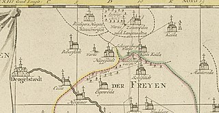
English: 1 Kt. : Grenzen kolor. (47 x 47 cm); Koordinaten E 10°06'26"-E 10°51'52"/N 51°20'58"-N 50°51'52"; Maßstab in graph. Form (gemeine Teützsche Meile). - Titelkartusche oben links. - Maßstabskartusche unten Mitte. - Erkl. der Zeichen unten links. - Mit 1 Register der Orte, Wälder, Berge u. Gewässer auf d. Plattenrand. - Aus: Atlas Saxonicus Novus (Kartenausschnitt: Sollstedter Warte oder Mühlhäuser Warte oder Schwarzburger Warte) |
|||
Date | ||||
Source |
|
|||
Author | Schenk, Pieter (der Jüngere) |
Licensing
[edit]Public domainPublic domainfalsefalse |
![]() |
This work is in the public domain in its country of origin and other countries and areas where the copyright term is the author's life plus 70 years or fewer.
|
This file has been identified as being free of known restrictions under copyright law, including all related and neighboring rights. |
https://creativecommons.org/publicdomain/mark/1.0/PDMCreative Commons Public Domain Mark 1.0falsefalse
File history
Click on a date/time to view the file as it appeared at that time.
Date/Time | Thumbnail | Dimensions | User | Comment | |
---|---|---|---|---|---|
current | 17:46, 24 June 2020 | ![]() | 1,948 × 1,012 (667 KB) | Millos55 (talk | contribs) | Uploaded own work with UploadWizard |
You cannot overwrite this file.
File usage on Commons
The following 2 pages use this file:
Metadata
This file contains additional information such as Exif metadata which may have been added by the digital camera, scanner, or software program used to create or digitize it. If the file has been modified from its original state, some details such as the timestamp may not fully reflect those of the original file. The timestamp is only as accurate as the clock in the camera, and it may be completely wrong.
Camera manufacturer | Phase One |
---|---|
Camera model | IQ180 |
Exposure time | 947/378,801 sec (0.0024999934002286) |
F-number | f/8 |
ISO speed rating | 35 |
Date and time of data generation | 10:49, 13 November 2015 |
Lens focal length | 80 mm |
Orientation | Normal |
Horizontal resolution | 300 dpi |
Vertical resolution | 300 dpi |
Software used | ACD Systems digitalen Bildverarbeitung |
File change date and time | 18:12, 24 June 2020 |
Y and C positioning | Centered |
Exposure Program | Manual |
Exif version | 0 |
Date and time of digitizing | 10:49, 13 November 2015 |
APEX shutter speed | 8.64386 |
APEX aperture | 6 |
APEX exposure bias | 0 |
Light source | Other light source |
DateTime subseconds | 881 |
Sensing method | One-chip color area sensor |
File source | Digital still camera |
Scene type | A directly photographed image |
Image width | 8,105 px |
Image height | 6,893 px |
Serial number of camera | FP040024 |
Lens used | Schneider LS 80mm f/2.8 |