File:Administrative map of Italy showing regions, provinces and communes.png
跳至導覽
跳至搜尋

預覽大小:463 × 599 像素。 其他解析度:185 × 240 像素 | 371 × 480 像素 | 593 × 768 像素 | 791 × 1,024 像素 | 1,632 × 2,112 像素。
原始檔案 (1,632 × 2,112 像素,檔案大小:198 KB,MIME 類型:image/png)
說明
說明
添加單行說明來描述出檔案所代表的內容
摘要[編輯]
| 描述 |
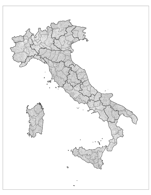
English: Administrative map of Italy showing the regions (black borders), the provinces (grey borders), and the communes (white borders). |
||
| 日期 | |||
| 來源 | 個人作品,使用: MapInfo Professional v8.5 (and various mapping resources) | ||
| 作者 | Rarelibra | ||
| 授權許可 (重用此檔案) |
|
||
| 其他版本 |
Derivative works of this file: |

|
File:Regions, provinces and municipalities in Italy.svg是本檔案的向量版本。 如果品質不低,就應該優先使用該檔案,而非PNG檔案。
File:Administrative map of Italy showing regions, provinces and communes.png → File:Regions, provinces and municipalities in Italy.svg
更多資訊請參閱Help:SVG/zh。 |
 |
檔案歷史
點選日期/時間以檢視該時間的檔案版本。
| 日期/時間 | 縮圖 | 尺寸 | 用戶 | 備註 | |
|---|---|---|---|---|---|
| 目前 | 2007年11月29日 (四) 14:25 | | 1,632 × 2,112(198 KB) | Rarelibra(對話 | 貢獻) | updated map - better borders, total conflation, and new color schema |
| 2007年1月5日 (五) 22:27 |  | 816 × 1,056(57 KB) | Rarelibra(對話 | 貢獻) | Map of the municipalities of Italy. Created by ~~~~ for public domain use, using MapInfo Professional v8.5 and various mapping resources. |
無法覆蓋此檔案。
檔案用途
下列3個頁面有用到此檔案:
全域檔案使用狀況
以下其他 wiki 使用了這個檔案:
- ar.wikipedia.org 的使用狀況
- arz.wikipedia.org 的使用狀況
- be.wikipedia.org 的使用狀況
- cy.wikipedia.org 的使用狀況
- fa.wikipedia.org 的使用狀況
- fi.wikipedia.org 的使用狀況
- fr.wikipedia.org 的使用狀況
- hi.wikipedia.org 的使用狀況
- hy.wikipedia.org 的使用狀況
- ia.wikipedia.org 的使用狀況
- kk.wikipedia.org 的使用狀況
- ko.wikipedia.org 的使用狀況
- mk.wikipedia.org 的使用狀況
- nl.wikinews.org 的使用狀況
- ro.wikipedia.org 的使用狀況
- ru.wikipedia.org 的使用狀況
- sv.wikipedia.org 的使用狀況
- tg.wikipedia.org 的使用狀況
- uz.wikipedia.org 的使用狀況
- www.wikidata.org 的使用狀況
- zh-min-nan.wikipedia.org 的使用狀況
- zh.wikipedia.org 的使用狀況