File:Aerial View of Geikie Peak.jpg
Jump to navigation
Jump to search
Size of this preview: 632 × 600 pixels. Other resolutions: 253 × 240 pixels | 506 × 480 pixels | 809 × 768 pixels | 1,079 × 1,024 pixels | 1,342 × 1,274 pixels.
Original file (1,342 × 1,274 pixels, file size: 433 KB, MIME type: image/jpeg)
Captions
Captions
Add a one-line explanation of what this file represents
Summary
[edit]
| Description |
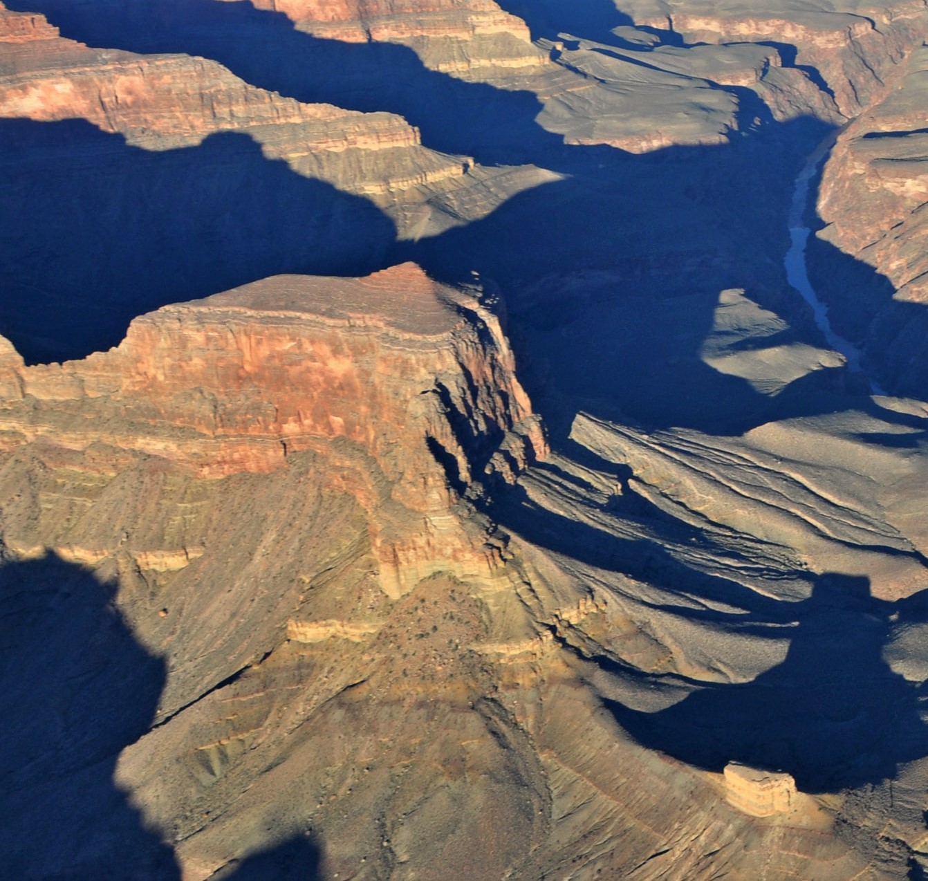
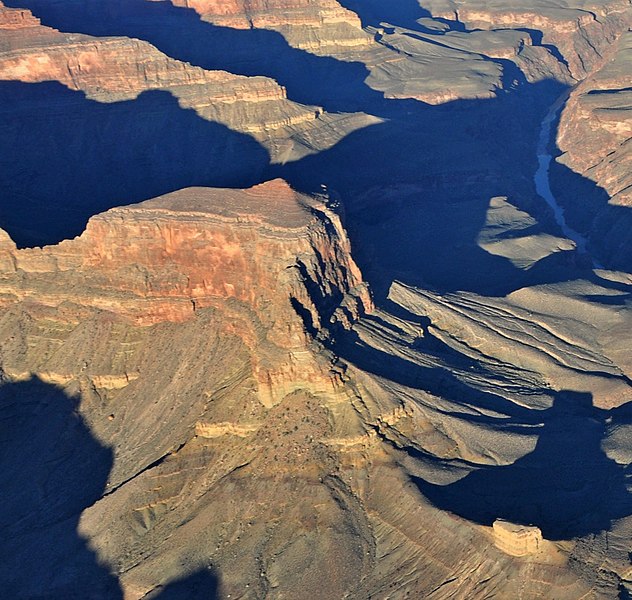
English: Sunrise aerial view of Geikie Peak, with Scylla Butte in lower right.
This photo is a view from one of the routes in the National Park Service (NPS) Preferred Alternative within the Draft Environmental Impact Statement (EIS), Special Flight Rules Area in the Vicinity of Grand Canyon National Park (GCNP), illustrating the high quality scenic views and grandeur of GCNP. |
| Date | |
| Source | File:Grand Canyon DEIS Aerial Colorado River, Geikie Peak (5477155394).jpg |
| Author | Grand Canyon National Park |
.jpg)
Licensing
[edit]
This file is licensed under the Creative Commons Attribution 2.5 Generic license.
- You are free:
- to share – to copy, distribute and transmit the work
- to remix – to adapt the work
- Under the following conditions:
- attribution – You must give appropriate credit, provide a link to the license, and indicate if changes were made. You may do so in any reasonable manner, but not in any way that suggests the licensor endorses you or your use.
| Annotations | This image is annotated: View the annotations at Commons |
File history
Click on a date/time to view the file as it appeared at that time.
| Date/Time | Thumbnail | Dimensions | User | Comment | |
|---|---|---|---|---|---|
| current | 03:21, 17 January 2021 | | 1,342 × 1,274 (433 KB) | Ron Clausen (talk | contribs) | Uploaded a work by Grand Canyon National Park from File:Grand Canyon DEIS Aerial Colorado River, Geikie Peak (5477155394).jpg with UploadWizard |
You cannot overwrite this file.
File usage on Commons
The following page uses this file:
File usage on other wikis
The following other wikis use this file:
- Usage on en.wikipedia.org