File:Aerial of Hanford Street Dock and Spokane Street Dock Seattle, 1960.jpg
Jump to navigation
Jump to search
Size of this preview: 800 × 380 pixels. Other resolutions: 320 × 152 pixels | 640 × 304 pixels | 1,413 × 672 pixels.
Original file (1,413 × 672 pixels, file size: 446 KB, MIME type: image/jpeg)
Captions
Captions
Add a one-line explanation of what this file represents
Summary[edit]
| Description |
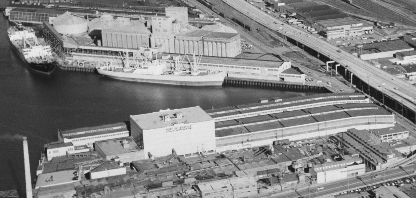
English: Hanford Street Dock (above) and Spokane Street Dock (below), Seattle, Washington, U.S., 1960. |
||||||||||||||||||||
| Date | Taken on 18 January 1960 | ||||||||||||||||||||
| Source |
Aerial of viaduct south of downtown, 1960 This image comes from the Seattle Municipal Archives, via Flickr.
|
||||||||||||||||||||
| Author | Seattle Municipal Archives from Seattle, WA | ||||||||||||||||||||
| Other versions | |||||||||||||||||||||
.jpg)
.jpg)
| Camera location | | View this and other nearby images on: OpenStreetMap |
|---|
Licensing[edit]
This file is licensed under the Creative Commons Attribution 2.0 Generic license.
- You are free:
- to share – to copy, distribute and transmit the work
- to remix – to adapt the work
- Under the following conditions:
- attribution – You must give appropriate credit, provide a link to the license, and indicate if changes were made. You may do so in any reasonable manner, but not in any way that suggests the licensor endorses you or your use.
File history
Click on a date/time to view the file as it appeared at that time.
| Date/Time | Thumbnail | Dimensions | User | Comment | |
|---|---|---|---|---|---|
| current | 22:31, 21 November 2022 | | 1,413 × 672 (446 KB) | Jmabel (talk | contribs) | File:Aerial of Alaskan Way Viaduct south of Downtown Seattle, 1960 (52474347222).jpg cropped 65 % horizontally, 79 % vertically using CropTool with precise mode. |
You cannot overwrite this file.
File usage on Commons
The following page uses this file:
File usage on other wikis
The following other wikis use this file:
- Usage on en.wikipedia.org