File:Aerial photograph of Mostar city in 1997.JPEG
跳至導覽
跳至搜尋

預覽大小:800 × 531 像素。 其他解析度:320 × 212 像素 | 640 × 425 像素 | 1,024 × 680 像素 | 1,524 × 1,012 像素。
原始檔案 (1,524 × 1,012 像素,檔案大小:588 KB,MIME 類型:image/jpeg)
說明
說明
添加單行說明來描述出檔案所代表的內容
摘要
[編輯]| 描述 |
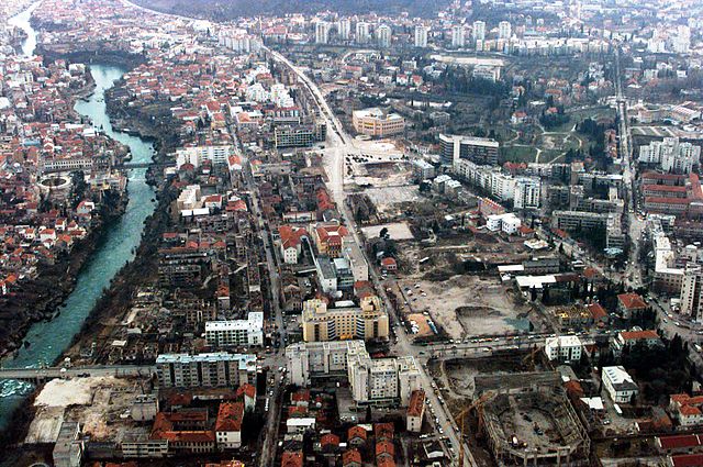
English: Aerial photograph of Mostar city in 1997. |
|||
| 日期 | ||||
| 來源 | http://www.defenseimagery.mil; VIRIN: 970225-F-2095R-032 | |||
| 作者 | Cesar Rodriquez, U.S. Air Force | |||
| 授權許可 (重用此檔案) |
|

檔案歷史
點選日期/時間以檢視該時間的檔案版本。
| 日期/時間 | 縮圖 | 尺寸 | 使用者 | 備註 | |
|---|---|---|---|---|---|
| 目前 | 2010年4月9日 (五) 22:00 | | 1,524 × 1,012(588 KB) | High Contrast(留言 | 貢獻) | == {{int:filedesc}} == {{Information |Description= {{en|Aerial photograph of Mostar city in 1997.}} |Source=http://www.defenseimagery.mil; [http://www.defenseimagery.mil/imagery.html#guid=3d5ab3c442b897366445cdd686f2bd6a393e6eff VIRIN: '''970225-F-2095R-0 |
無法覆蓋此檔案。
檔案用途
沒有使用此檔案的頁面。
全域檔案使用狀況
以下其他 wiki 使用了這個檔案:
- ar.wikipedia.org 的使用狀況
- bs.wikipedia.org 的使用狀況
- en.wikipedia.org 的使用狀況
- hr.wikipedia.org 的使用狀況
- ja.wikipedia.org 的使用狀況
- mt.wikipedia.org 的使用狀況
- pl.wikipedia.org 的使用狀況
- ru.wikipedia.org 的使用狀況
- zh.wikipedia.org 的使用狀況