File:Aerial view of Hópsnes, Húsafell and Hraunsvík.jpg
Jump to navigation
Jump to search
Size of this preview: 800 × 530 pixels. Other resolutions: 320 × 212 pixels | 640 × 424 pixels | 1,024 × 678 pixels | 1,280 × 848 pixels | 2,560 × 1,696 pixels | 4,928 × 3,264 pixels.
Original file (4,928 × 3,264 pixels, file size: 6.35 MB, MIME type: image/jpeg)
Captions
Captions
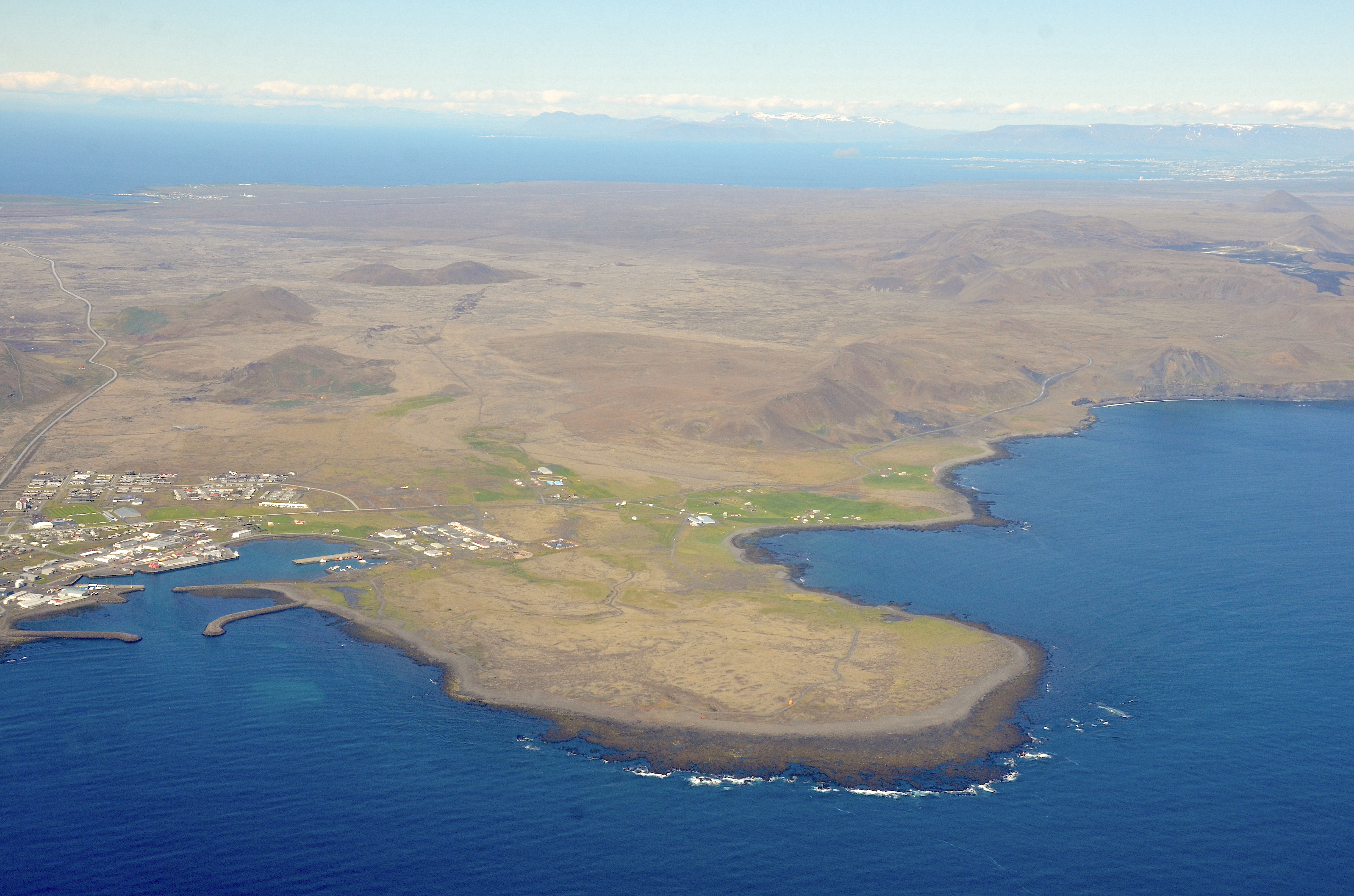
Aerial view of the small peninsual Hópsnes, Grindavík, Húsafjall and Hraunsvík Bay
Summary
[edit]
| Description |
Deutsch: Luftbild von der kleinen Halbinsel Hópsnes, Grindavík, den Bergen Húsafjall, Hagafell, Sýlingarfell und der Bucht Hraunsvík |
| Date | |
| Source | Own work |
| Author | Olga Ernst |
| Object location | | View this and other nearby images on: OpenStreetMap |
|---|
Licensing
[edit]
I, the copyright holder of this work, hereby publish it under the following license:
This file is licensed under the Creative Commons Attribution-Share Alike 4.0 International license.
- You are free:
- to share – to copy, distribute and transmit the work
- to remix – to adapt the work
- Under the following conditions:
- attribution – You must give appropriate credit, provide a link to the license, and indicate if changes were made. You may do so in any reasonable manner, but not in any way that suggests the licensor endorses you or your use.
- share alike – If you remix, transform, or build upon the material, you must distribute your contributions under the same or compatible license as the original.
| Annotations | This image is annotated: View the annotations at Commons |
File history
Click on a date/time to view the file as it appeared at that time.
| Date/Time | Thumbnail | Dimensions | User | Comment | |
|---|---|---|---|---|---|
| current | 11:30, 27 June 2022 | | 4,928 × 3,264 (6.35 MB) | Olga Ernst (talk | contribs) | Uploaded own work with UploadWizard |
You cannot overwrite this file.
File usage on Commons
There are no pages that use this file.
File usage on other wikis
The following other wikis use this file:
- Usage on en.wikipedia.org
Metadata
Categories:
- Hópsnes (Grindavík)
- Aerial photographs of Grindavík
- Hraunsvík
- Húsafell (Grindavík)
- June 2022 Iceland photographs
- Sýlingafell
- Aerial photographs of craters, eruption fissures and lava fields from 2021 Fagradalsfjall eruption
- 2022 aerial photographs of Iceland
- Sundhnúkagígaröðin
- Road 43 (Iceland)
- Hagafell (Grindavík)
- Stóra Skógfell (Reykjanes)
- Fiskidalsfjall (Reykjanes)
- Fagradalsfjall (Reykjanes)
- Grindavík in 2022