File:Aerial view of Vignes and Schuyler Creek in the town of Clay Banks, Door County, Wisconsin 2020 (cropped).png
Jump to navigation
Jump to search

Size of this preview: 600 × 600 pixels. Other resolutions: 240 × 240 pixels | 480 × 480 pixels | 768 × 768 pixels | 1,168 × 1,168 pixels.
Original file (1,168 × 1,168 pixels, file size: 2.16 MB, MIME type: image/png)
Captions
Captions
Add a one-line explanation of what this file represents
| Description |
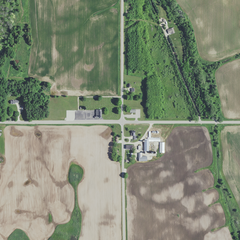
English: Aerial view of Vignes and Schuyler Creek in the town of Clay Banks, Door County, Wisconsin, taken June 27, 2020 |
|||
| Date | ||||
| Source | converted to .png by Epiphyllumlover from the original .tif available as item M_4408721_NE_16_060_20200627 on EarthExplorer | |||
| Author | Aerial Photography Field Office (APFO) for NAIP, USGS; in contract with the Surdex Corporation | |||
| Permission (Reusing this file) |
|
|||
| Other versions |

File history
Click on a date/time to view the file as it appeared at that time.
| Date/Time | Thumbnail | Dimensions | User | Comment | |
|---|---|---|---|---|---|
| current | 15:52, 3 March 2022 | | 1,168 × 1,168 (2.16 MB) | Epiphyllumlover (talk | contribs) | File:Aerial view of Carnot and Vignes in the towns of Forestville and Clay Banks in Door County, Wisconsin 2020.png cropped 87 % horizontally, 91 % vertically using CropTool with lossless mode. |
You cannot overwrite this file.
File usage on Commons
The following page uses this file:
File usage on other wikis
The following other wikis use this file:
- Usage on en.wikipedia.org
.png&oldid=782684995)