File:Africa satellite orthographic.jpg
Dhyworth Wikimedia Commons
Jump to navigation
Jump to search

Myns an ragwel ma: 534 × 600 piksel. Klerderyow erel: 214 × 240 piksel | 427 × 480 piksel | 684 × 768 piksel | 912 × 1,024 piksel | 1,624 × 1,824 piksel.
Restren wreydhek (1,624 × 1,824 piksel, myns an restren: 535 KB, eghen MIME: image/jpeg)
File information
Structured data
Captions
Captions
Add a one-line explanation of what this file represents
إفريقيا
taswirar yankunan Afirka
محمد
Berrskrif[golegi]
| DeskrifansAfrica satellite orthographic.jpg |
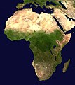
English: A composed satellite photograph of Africa in orthographic projection. This is NASA "Blue Marble" image applied as a texture on a sphere using Art of Illusion program. The observer is centered at (0° N, 15° E), at Moon distance above the Earth.
العربية: خريطة جغرافية لأفريقيا توضح الانقطاع البيئي الذي يحدد منطقة الصحراء |
| Dedhyans |
Unknown date Unknown date |
| Pennfenten | NASA |
| Awtour | NASA |
Leshyans[golegi]
| Public domainPublic domainfalsefalse |
| This file is in the public domain in the United States because it was solely created by NASA. NASA copyright policy states that "NASA material is not protected by copyright unless noted". (See Template:PD-USGov, NASA copyright policy page or JPL Image Use Policy.) |  | |
 |
Warnings:
|
Istori an restren
Klyckyewgh war dhedhyans/eur rag gweles an folen dell o an termyn na.
| Dedhyans/Eur | Skeusennik | Mynsow | Devnydhyer | Kampol | |
|---|---|---|---|---|---|
| a-lemmyn | 09:44, 19 Ebrel 2005 |  | 1,624 × 1,824 (535 KB) | Ghalas (keskows | kevrohow) | A composed satellite photograph of Africa in orthographic projection This is NASA [http://visibleearth.nasa.gov/view_rec.php?vev1id=11656 "Blue Marble"] image applied as a texture on a sphere u |
Ny yllowgh gorskrifa an restren ma.
Devnydh an restren
Yma an 6 folen a syw owth usya an restren ma:
Devnydh ollvysel an restren
Yma an wikis erel a syw ow tevnydhya an restren ma:
- Devnydh war af.wikipedia.org
- Devnydh war ang.wikipedia.org
- Devnydh war ar.wikipedia.org
- Devnydh war ar.wikinews.org
- Devnydh war ary.wikipedia.org
- Devnydh war arz.wikipedia.org
- Devnydh war ast.wikipedia.org
- Devnydh war as.wikipedia.org
- Devnydh war awa.wikipedia.org
- Devnydh war az.wikipedia.org
- Devnydh war bat-smg.wikipedia.org
- Devnydh war ba.wikipedia.org
- Devnydh war be-tarask.wikipedia.org
- Devnydh war be.wikipedia.org
- Devnydh war bg.wikipedia.org
Gweles devnydh ollvysel moy a'n restren ma.
Metadata
An restren ma a's teves kedhlow keworransel, dres lycklod keworrys dhyworth an kamera bysyel po an skanyer devnydhys rag hy gwruthyl po hy bysya. Mars yw chanjys an restren dhyworth hy studh gwredhek, possybyl yw na veu nebes manylyon nowedhys.
| _error | 0 |
|---|