File:Al-Idrisi's map of the Mediterranean.jpg
Jump to navigation
Jump to search
Size of this preview: 800 × 502 pixels. Other resolutions: 320 × 201 pixels | 640 × 402 pixels | 1,024 × 643 pixels | 1,280 × 803 pixels | 2,439 × 1,531 pixels.
Original file (2,439 × 1,531 pixels, file size: 2.72 MB, MIME type: image/jpeg)
Captions
Captions
Add a one-line explanation of what this file represents
Summary
[edit]
| Description |
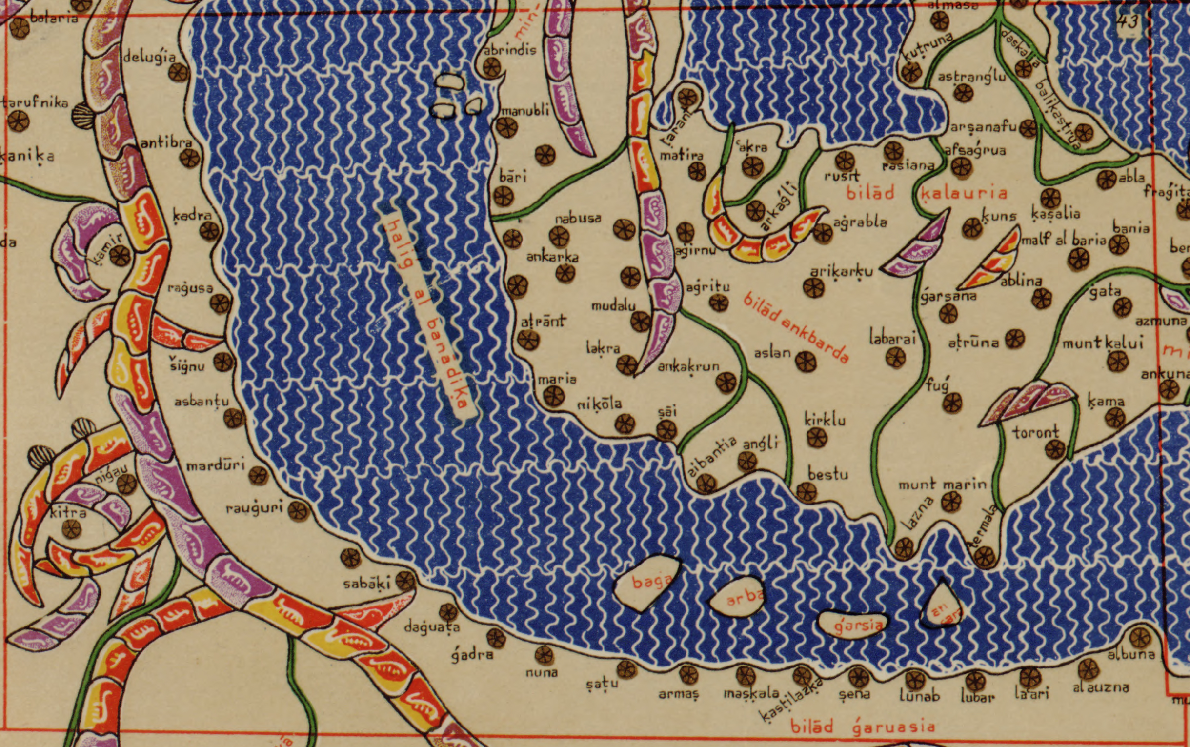
English: Map of the Mediterranean from Tabula Rogeriana created by Arab geographer Muhammad al-Idrisi in 1154 and copied by Konrad Miller in 1929 who translitterated names in the roman alphabet. The map shows Croatia ("bilad garuasia"), Lombardy ("bilad ankbarda") and Calabria ("bilad kalauria"). |
| Date | |
| Source | Tabula Rogeriana |
| Author | Muhammad al-Idrisi (original map), Konrad Miller (copy) |
Licensing
[edit]
This media file is in the public domain in the United States. This applies to U.S. works where the copyright has expired, often because its first publication occurred prior to January 1, 1929, and if not then due to lack of notice or renewal. See this page for further explanation.
|
 | |
 |
This image might not be in the public domain outside of the United States; this especially applies in the countries and areas that do not apply the rule of the shorter term for US works, such as Canada, Mainland China (not Hong Kong or Macao), Germany, Mexico, and Switzerland. The creator and year of publication are essential information and must be provided. See Wikipedia:Public domain and Wikipedia:Copyrights for more details.
|
File history
Click on a date/time to view the file as it appeared at that time.
| Date/Time | Thumbnail | Dimensions | User | Comment | |
|---|---|---|---|---|---|
| current | 19:30, 12 July 2014 | | 2,439 × 1,531 (2.72 MB) | Tezwoo (talk | contribs) | User created page with UploadWizard |
You cannot overwrite this file.
File usage on Commons
The following page uses this file:
File usage on other wikis
The following other wikis use this file:
- Usage on en.wikipedia.org
- Usage on es.wikipedia.org
- Usage on et.wikipedia.org
- Usage on ja.wikipedia.org
- Usage on mk.wikipedia.org